
 Italiano
 Français
 Deutsch
 Español

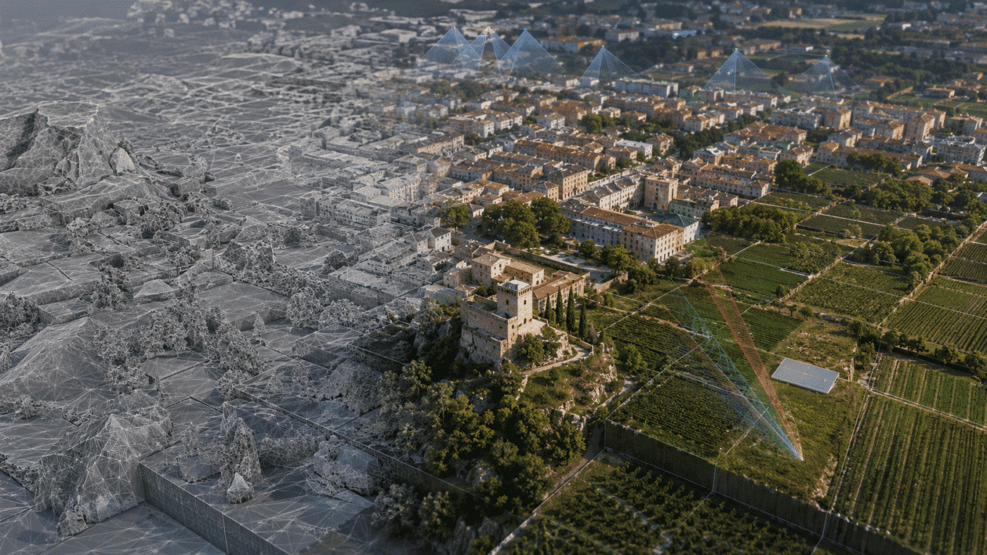
Agisoft Metashape 2.3.2 is now available as build 22956, released on August 25, 2026. This maintenance update focuses on faster Natural texturing, workflow improvements for large block models, expanded multispectral calibration support and better interoperability with recent Trimble Inpho projects. Compared with Metashape 2.3.1, the list of changes is concise, but several additions are particularly […]
Tag Archives: Agisoft Metashape
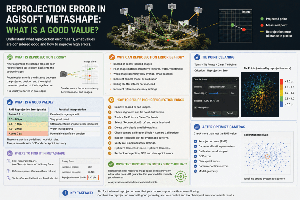
Reprojection error in Agisoft Metashape is one of the most commonly checked quality indicators after photo alignment, but it is also one of the most frequently misunderstood. You may open a Metashape processing report and see a reprojection error of 0.35 pixels, 0.8 pixels or even several pixels. The obvious question is: what is a […]
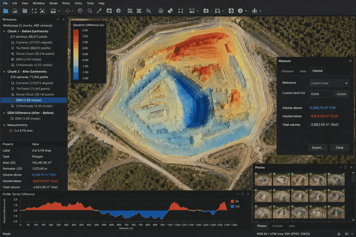
Calculating cut and fill volumes in Agisoft Metashape is a powerful workflow for construction, earthworks, road projects, mining, quarrying and site development. By surveying a site with a drone before and after earthmoving operations, Metashape Professional can generate accurate Digital Elevation Models (DEMs) that allow you to identify where material has been excavated, where material […]
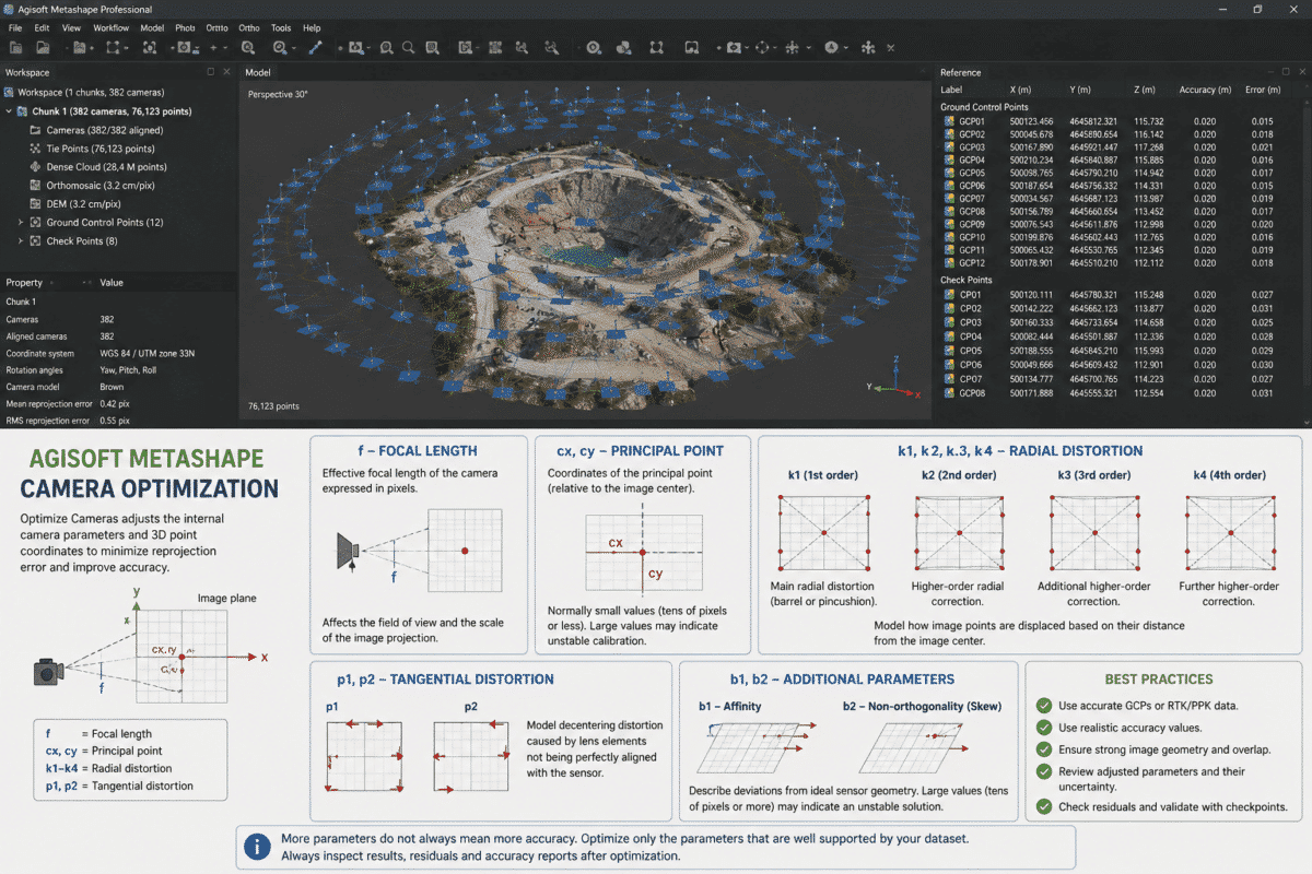
Agisoft Metashape camera optimization is one of the most important steps for improving the accuracy of a photogrammetric project, especially when processing drone surveys with Ground Control Points (GCPs), RTK or PPK camera coordinates. When you open the Optimize Cameras dialog in Metashape, you will see parameters such as f, cx, cy, k1, k2, k3, […]
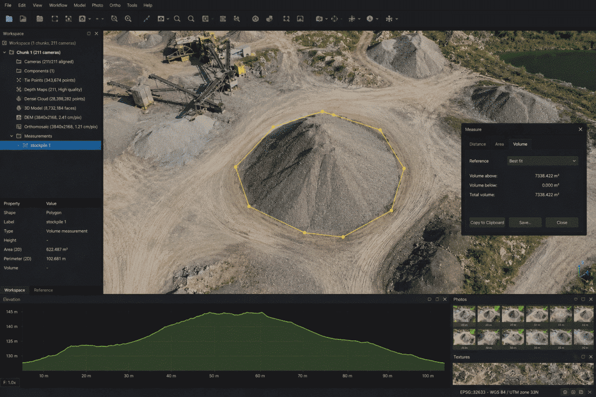
Calculating stockpile volumes in Agisoft Metashape is one of the most useful applications of drone photogrammetry for mining, construction, quarrying, aggregate management and earthworks. Instead of measuring a stockpile manually, a drone survey can capture hundreds or thousands of overlapping photographs that are processed in Metashape Professional to create an accurate Digital Elevation Model (DEM). […]
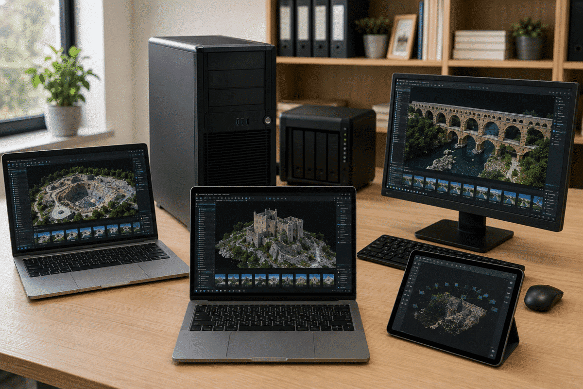
One of the most common questions from new Agisoft Metashape users is: Can I install Agisoft Metashape on multiple computers? The answer depends on the type of license you own. With a node-locked license, one license can be activated on only one computer at a time. However, the license is rehostable, which means you can […]
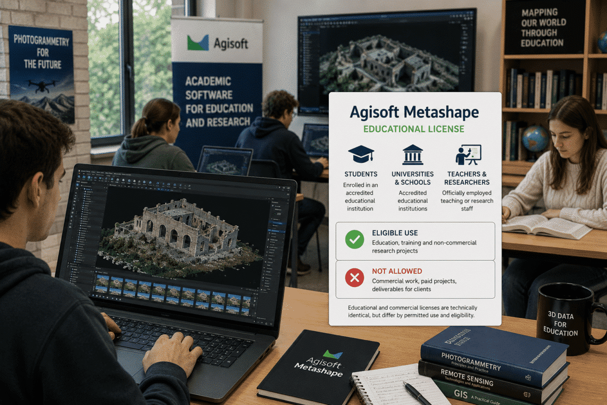
The Agisoft Metashape Educational License provides students, universities, schools and academic researchers with access to Metashape at a significantly reduced price. However, educational pricing is not simply a discounted license available to every non-commercial organization. Agisoft defines specific eligibility requirements, and the license can only be used for educational and research purposes. This distinction is […]
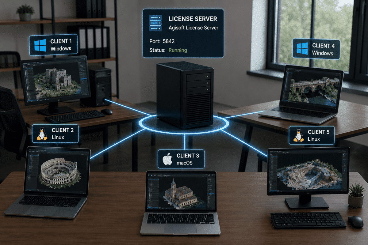
Setting up an Agisoft Metashape Floating License Server is the recommended solution for companies, universities, laboratories and organizations that need to use Metashape Professional across multiple computers. Unlike a node-locked license, which is activated on one workstation at a time, a floating license is managed centrally by a license server. Metashape Professional can be installed […]
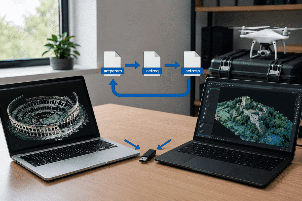
If your workstation cannot connect to the Internet, you can still activate Agisoft Metashape Professional offline. This is particularly useful for secure workstations, air-gapped computers, government environments, research laboratories, remote processing systems and organizations with strict network policies. Agisoft provides an official offline activation procedure that allows a Metashape node-locked license to be activated without […]
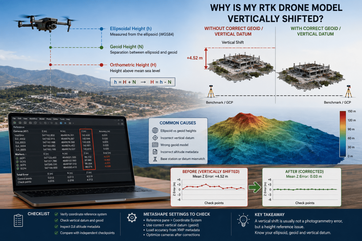
You process a survey captured with an RTK drone, the cameras align correctly, the point cloud looks excellent and the model appears internally consistent. Then you compare the result with surveyed checkpoints and discover that the entire project is several meters vertically shifted. This is one of the most confusing problems in professional drone photogrammetry. […]