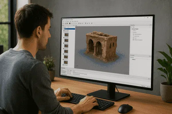
News
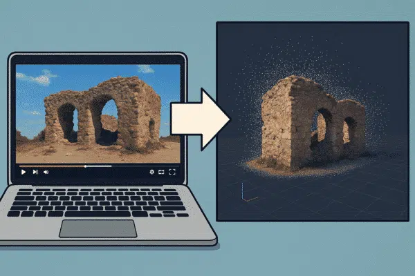
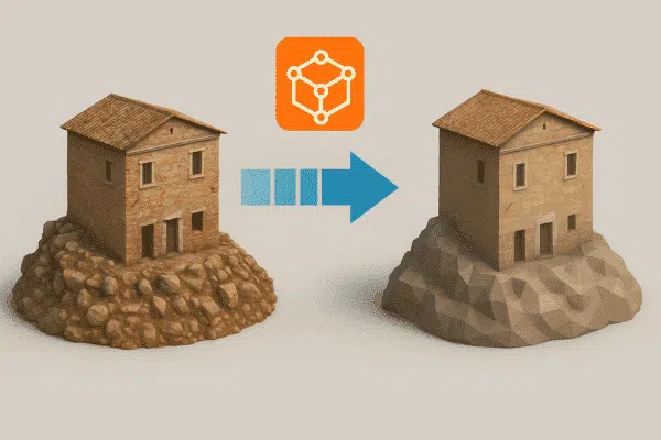
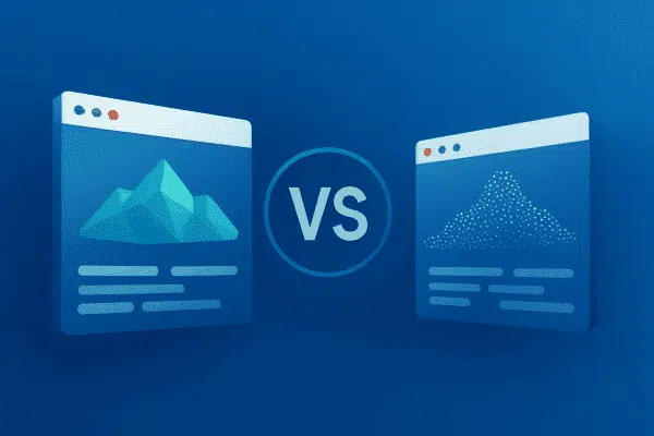
Agisoft Metashape vs Gaussian Splatting: The Future of 3D Reconstruction
3D reconstruction technologies are evolving rapidly. For more than a decade, photogrammetry software such as Agisoft Metashape has been widely used to generate accurate 3D models from photographs captured by drones, cameras, and mobile devices. However, [...]

News
How to Process Smartphone LiDAR and Photogrammetry Together in Agisoft Metashape
In recent years, modern smartphones have evolved from simple photography devices into powerful 3D scanning tools. Several high-end mobile devices, including Apple’s iPhone Pro models and some advanced tablets, now include built-in LiDAR sensors capable of [...]

News
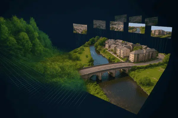
How to Create 3D Models from 360° Cameras in Agisoft Metashape: Complete Photogrammetry Workflow
Photogrammetry workflows traditionally rely on DSLR cameras, mirrorless cameras, or drone imagery captured with nadir and oblique angles. However, a new approach is gaining attention among professionals working in digital documentation, indoor mapping, and digital twin [...]
News
Agisoft Metashape 2.3 in Practice: How Professional Workflows Are Really Changing
When a new version of Agisoft Metashape is released, most discussions focus on the list of new features. While this is useful, professional users are usually more interested in a different question: how does this update [...]
News
Satellite Imagery Processing in Agisoft Metashape: Complete Workflow Guide
Satellite imagery has become an essential data source for large-scale mapping, environmental monitoring, urban planning, and geospatial analysis. While photogrammetry is traditionally associated with drone or aerial photography, modern photogrammetric software is increasingly capable of handling [...]

News
How to Use the Texture Editing Tool (Assign Image) in Agisoft Metashape 2.3
Agisoft Metashape 2.3 introduces a powerful new utility for texture refinement: the Texture Editing Tool, also known as Assign Image. This addition expands the flexibility of texture workflows by allowing users to manually select specific images [...]
News
New Features in Agisoft Metashape 2.3
Agisoft Metashape 2.3 is a meaningful update for anyone building maps, orthomosaics, or high-detail 3D models from photos and laser scans. While earlier versions already delivered robust photogrammetry, this release focuses on three practical themes: higher-quality [...]
News
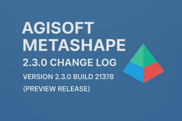
Agisoft Metashape 2.3.0 Change Log: What’s New in the Latest Preview Release
Agisoft Metashape 2.3.0 build 21378 (preview release, 4 October 2025) introduces a focused set of improvements that target three main areas: more natural and detailed textures, better support for complex camera and fisheye setups, and advanced [...]
News
Agisoft Metashape 2.2.3: All the Latest Features in the New Release
Agisoft Metashape 2.2.3 is the newest stable release of the well-known photogrammetry software, available in both Standard and Professional editions and downloadable directly from the official Agisoft website. This version represents the most recent update in [...]
News
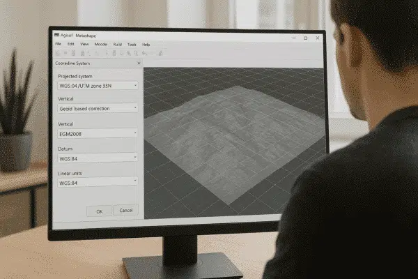
How to Convert Between Coordinate Systems in Agisoft Metashape: Complete Guide
Agisoft Metashape Professional is widely used for photogrammetry, 3D modeling, topographic mapping, and geospatial analysis. One of the most important steps in processing georeferenced data is choosing and correctly converting between coordinate systems. Whether you work [...]
News
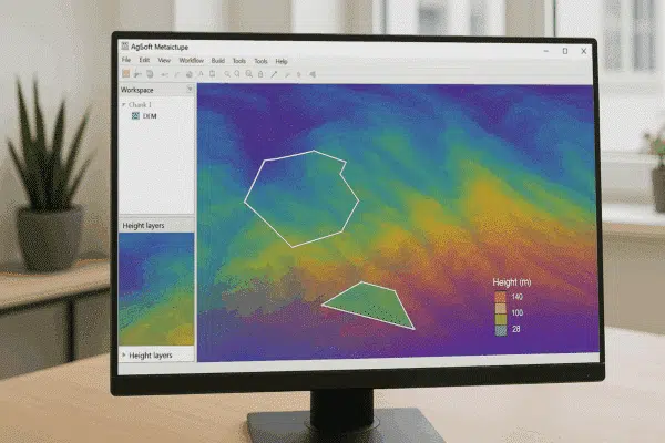
How to Perform DEM-Based Measurements in Agisoft Metashape
Agisoft Metashape Professional is a leading photogrammetry software used by surveyors, GIS specialists, and drone mapping professionals worldwide. One of its most powerful analytical features is the ability to perform DEM-based measurements — enabling users to [...]
News
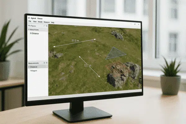
How to Use Measure and Drawing Tools in Agisoft Viewer: A Complete Guide
Agisoft Viewer is a lightweight, free application developed by Agisoft that allows users to view, explore, and analyze 3D models, orthomosaics, and digital elevation data created in Agisoft Metashape Professional. Among its most valuable features are [...]
News
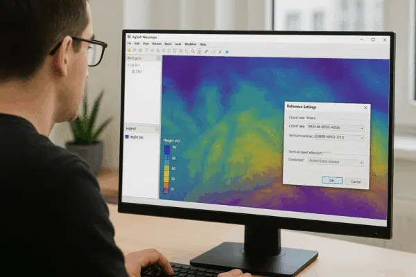
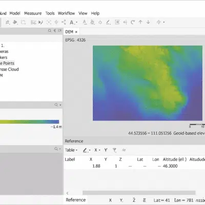
How to Use Height Above Geoid for the Coordinate System in Agisoft Metashape
Agisoft Metashape Professional is one of the most advanced photogrammetry software solutions for processing aerial and terrestrial imagery into georeferenced 3D models, orthomosaics, and elevation maps. A key step in achieving accurate elevation results is understanding [...]
News
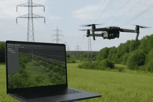
How to Detect Powerlines in Agisoft Metashape: A Complete Workflow Guide
Agisoft Metashape Professional is one of the most versatile photogrammetry platforms for turning aerial imagery into accurate 3D data models. Beyond terrain mapping and orthomosaic creation, Metashape can also be used for specialized infrastructure applications — [...]
News
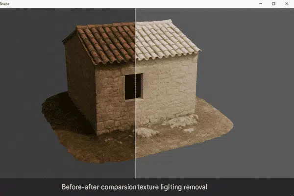
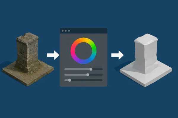
How to Remove Lighting from Texture in Agisoft Metashape Professional
Agisoft Metashape Professional is a leading photogrammetry software used for creating high-quality 3D models and orthomosaics from images. One of the most common challenges in photogrammetry is dealing with uneven lighting or shadows baked into texture [...]

News
Agisoft Texture De-Lighter: General Workflow and Best Practices
Agisoft Texture De-Lighter is a powerful post-processing tool designed to improve the visual quality of textured 3D models created with Agisoft Metashape. It allows users to remove shadows, highlights, and uneven illumination from texture maps, producing [...]
News
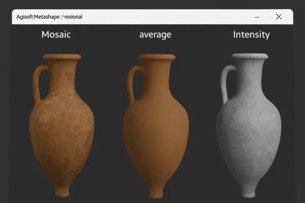
Understanding Texture Map Types in Agisoft Metashape: A Complete Guide
Agisoft Metashape is one of the most advanced photogrammetry platforms for turning aerial or terrestrial images into detailed 3D models. Beyond geometry and point clouds, what truly brings these models to life is their texture mapping [...]

News
MicaSense Altum Processing Workflow in Agisoft Metashape Professional: Complete Guide with Reflectance Calibration
Agisoft Metashape Professional is one of the most powerful photogrammetry tools for processing aerial imagery, allowing users to create accurate 3D models, orthomosaics, and reflectance maps. When paired with advanced sensors like the MicaSense Altum, Metashape [...]

News
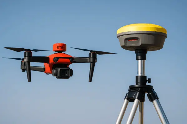
How to Process DJI RTK Coordinate Data in Agisoft Metashape: Complete Workflow Guide
Agisoft Metashape has become the go-to software for professionals who want to transform drone imagery into accurate 3D models, orthomosaics, and geospatial datasets. When combined with drones equipped with Real-Time Kinematic (RTK) positioning systems — such [...]
News
How to Use Batch Processing for Multiple Chunks in One Agisoft Metashape Project
Agisoft Metashape is an industry-standard software for photogrammetry, allowing users to turn aerial and terrestrial imagery into accurate 3D models, orthomosaics, and digital elevation models (DEMs). When working on large projects with multiple datasets — such [...]

News
Agisoft Metashape Aerial Survey Tips: How to Capture and Process High-Quality Data
Agisoft Metashape is one of the most powerful photogrammetry platforms available today, capable of turning aerial imagery into detailed 3D models, orthomosaics, and geospatial data products. Its versatility and precision make it the go-to choice for [...]

News
How to Solve Import Video Issues in Agisoft Metashape: Complete Troubleshooting Guide
Agisoft Metashape is a leading photogrammetry software used to transform images into accurate 3D models, orthomosaics, and geospatial datasets. While most workflows rely on still photographs captured by drones or cameras, many professionals also use video [...]

News
How to Fix Loss of Detail and Ripple Artifacts in Exported Models from Agisoft Metashape
Agisoft Metashape is one of the most powerful photogrammetry tools available for transforming 2D images into accurate 3D models. From archaeology and architecture to mining and film production, professionals rely on Metashape for precise, detailed reconstructions. [...]

News
How to Adjust Brightness and Contrast in Agisoft Metashape for Perfect Orthomosaic Exports
Agisoft Metashape is one of the most widely used photogrammetry software tools for creating orthomosaics, 3D models, and geospatial data products from aerial imagery. While most users focus on camera alignment, dense cloud generation, and orthomosaic [...]

News
How to Fix Orthomosaic Export Failures in Agisoft Metashape: Complete Troubleshooting Guide
Agisoft Metashape is one of the most powerful photogrammetry tools available today, used by professionals worldwide for drone mapping, 3D modeling, and geospatial analysis. However, even experienced users sometimes face a frustrating obstacle during the final [...]

News
Volumetric Masking in Agisoft Metashape: How to Improve Depth Map-Based Mesh Generation
Agisoft Metashape is a powerful photogrammetry software used by professionals in surveying, archaeology, film production, and 3D modeling. One of its most advanced and effective tools for enhancing model quality is volumetric masking. When applied during [...]

News
Full Body and Head Scanning Tips in Agisoft Metashape: A Complete Photogrammetry Guide
Agisoft Metashape is one of the most powerful photogrammetry tools available for generating highly detailed 3D models from photographs. While it’s widely used in fields like surveying, archaeology, and mapping, Metashape also excels in full-body and [...]

News
How to Align Photos in Agisoft Metashape with Background Suppression Using a Single Mask
Agisoft Metashape is one of the most advanced photogrammetry software platforms available, enabling users to create accurate 3D models from ordinary photos. One of its most powerful yet underused capabilities is the ability to align photos [...]
News
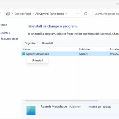
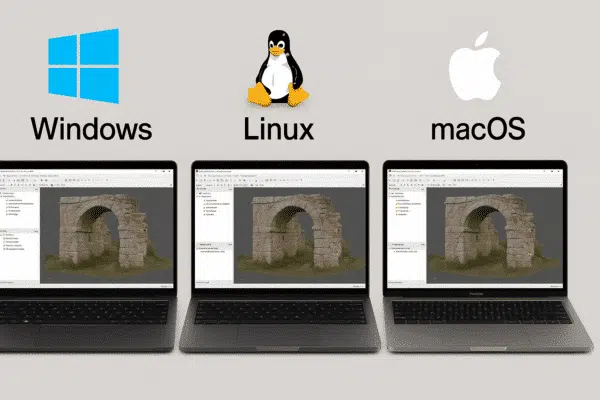
How to Uninstall Agisoft Metashape: Complete Guide for Windows, macOS, and Linux
Agisoft Metashape is one of the most powerful photogrammetry software solutions used by professionals and researchers to create detailed 3D models from photographs. However, there are times when you might need to uninstall Metashape — whether [...]
News
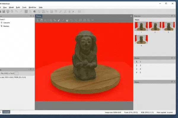
How to Create Masks from Background Photos in Agisoft Metashape: A Complete Workflow Guide
Agisoft Metashape is one of the leading photogrammetry software tools used worldwide for creating highly detailed 3D models from photographs. One of its most powerful yet often underutilized features is the ability to create masks from [...]
News
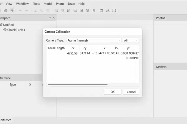
What Camera Calibration Results Mean in Agisoft Metashape: A Complete Guide
Agisoft Metashape is one of the most advanced photogrammetry software solutions available today, used by professionals worldwide to generate highly accurate 3D models from photographs. One of the most critical steps in the photogrammetry workflow is [...]
News
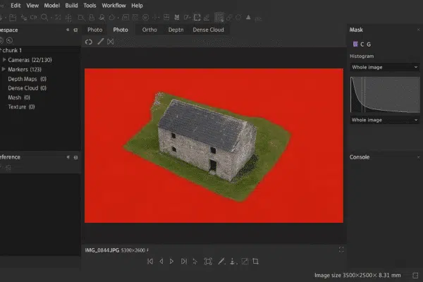
How to Work with Masks in Agisoft Metashape: Complete Guide for Photogrammetry Projects
Agisoft Metashape is one of the most powerful photogrammetry software solutions available today, widely used for 3D modeling, mapping, cultural heritage documentation, and industrial applications. Among its advanced features, working with masks is a crucial technique [...]
News
Troubleshooting Agisoft Metashape on Linux: A Complete Guide
Agisoft Metashape is a leading photogrammetry and 3D reconstruction software used by professionals worldwide. While Windows and macOS are common environments, many advanced users prefer Linux for its flexibility, scalability, and performance advantages. However, running Metashape [...]
News
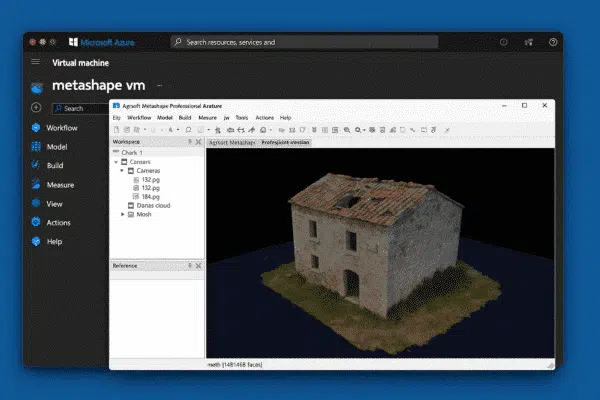
Deploying Agisoft Metashape on Microsoft Azure: A Complete Cloud Setup Guide
Agisoft Metashape is one of the most advanced photogrammetry software platforms used for creating high-precision 3D models, orthophotos, and digital twins from photographs. While it runs smoothly on local workstations, large-scale projects — such as drone [...]
News
How to Purchase an Agisoft Metashape License: Complete Step-by-Step Guide
Agisoft Metashape is one of the most powerful and widely used photogrammetry software solutions in the world, enabling users to transform ordinary photos into high-quality 3D models, orthophotos, and digital elevation models. Whether you work in [...]
News
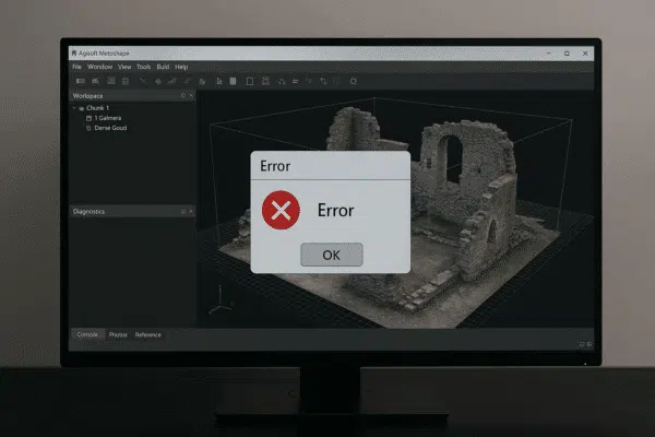
What to Do if Agisoft Metashape Crashes? A Complete Troubleshooting Guide
Agisoft Metashape is one of the most powerful photogrammetry software solutions available today, widely used for 3D modeling, surveying, mapping, and cultural heritage documentation. However, like any complex software, it can occasionally crash, especially when working [...]
News
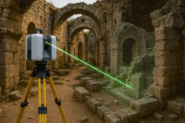
Terrestrial Laser Scans Processing in Metashape 2.2: A Complete Guide
The release of Agisoft Metashape 2.2 has brought significant improvements in handling terrestrial laser scans (TLS). These datasets, captured by ground-based LiDAR systems, are crucial for industries such as construction, cultural heritage preservation, mining, and engineering. [...]
News
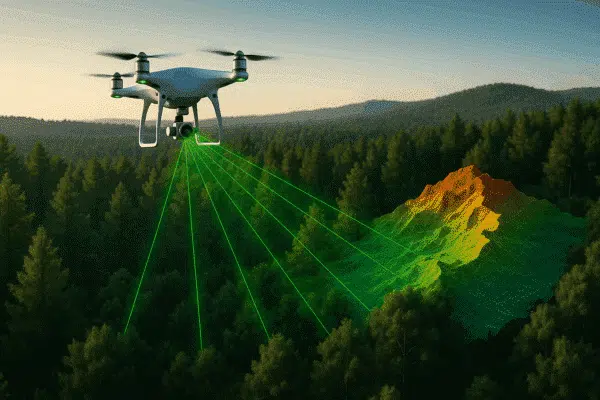
Aerial Laser Scans Data Processing with Agisoft Metashape
The integration of aerial laser scans with advanced photogrammetry software has transformed the way we capture and analyze our world. Among the leading tools for this purpose, Agisoft Metashape stands out for its ability to process [...]
News
Agisoft Metashape Manual: The Complete Guide for Beginners and Professionals
If you are exploring the world of photogrammetry, 3D modeling, or drone mapping, one of the most valuable resources you can rely on is the manuale Agisoft Metashape. This comprehensive document, published directly by Agisoft, provides [...]
News
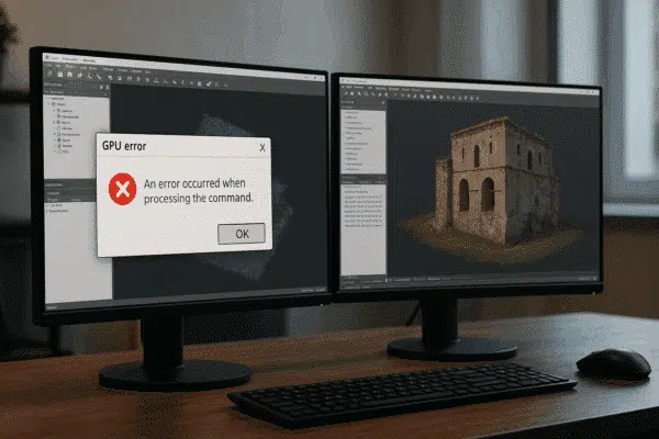
GPU Error Messages in Agisoft Metashape – Possible Solutions
Agisoft Metashape is widely regarded as one of the most efficient tools for photogrammetry and 3D reconstruction. By leveraging GPU acceleration, the software can handle demanding tasks such as dense cloud generation, mesh building, and texture [...]
News
How to Set the Scale in Agisoft Metashape: Complete Guide
Agisoft Metashape is one of the most popular photogrammetry software solutions, used in surveying, archaeology, construction, mining, and many other fields. While the software can generate highly detailed 3D models from images, the results are often [...]
News
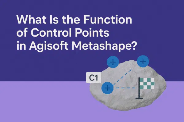
What Is the Function of Control Points in Agisoft Metashape?
Agisoft Metashape is a powerful photogrammetry software that transforms images into accurate 3D models, orthophotos, and digital elevation models. One of the key elements that ensures accuracy in these outputs is the use of control points. [...]
News
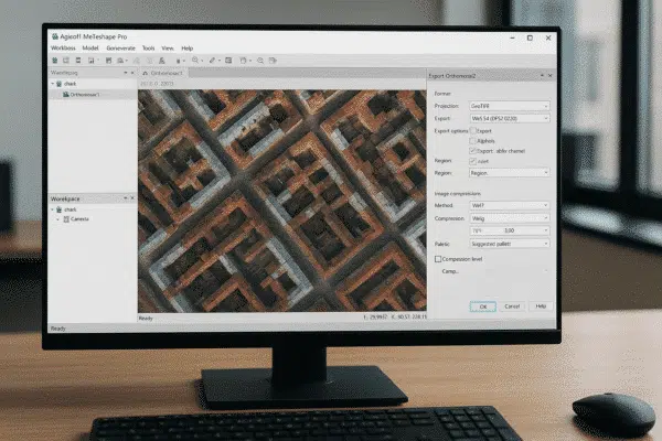
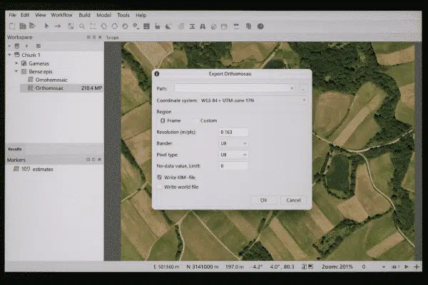
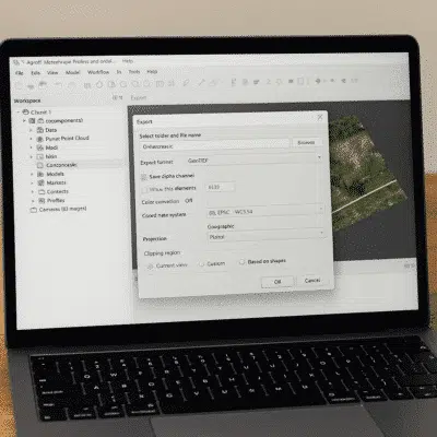
How to Export an Image from Agisoft Metashape: Complete Guide
Agisoft Metashape is a powerful photogrammetry software that allows users to create 3D models, orthophotos, and digital elevation models from aerial and terrestrial imagery. Once your project is processed, one of the most important tasks is [...]
News
How to Add a Scale Bar in Agisoft Metashape: Step-by-Step Guide
Agisoft Metashape is a leading photogrammetry software used by professionals in surveying, archaeology, construction, and many other industries. One of the most important steps in ensuring the accuracy of your 3D models is adding a scale [...]
News
How to Measure in Agisoft Metashape: A Complete Step-by-Step Guide
Agisoft Metashape is one of the most advanced photogrammetry tools available today, widely used for surveying, mapping, archaeology, mining, and construction. Beyond generating 3D models, orthophotos, and DEMs, Metashape provides powerful tools for measuring distances, areas, [...]
News
What Is the Key Point Limit in Agisoft Metashape? Complete Guide
When working with Agisoft Metashape, one of the most important settings you will encounter during the photo alignment stage is the Key Point Limit. Many new users ask: What is the key point limit, and how [...]
News
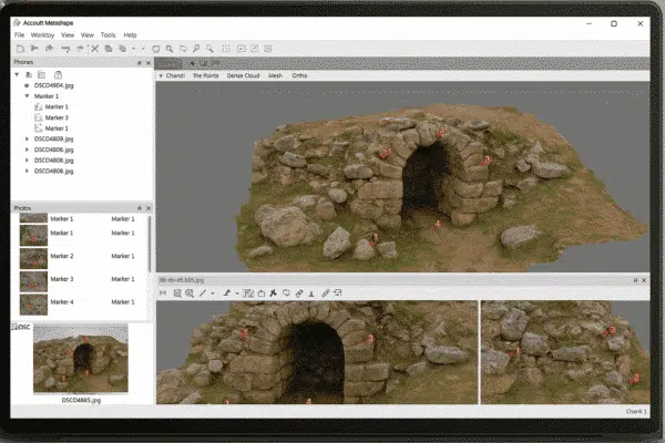
How to Place Markers in Agisoft Metashape: A Step-by-Step Guide
Agisoft Metashape is one of the most widely used photogrammetry tools for creating 3D models, orthophotos, and digital elevation models from images. One of the key elements in achieving accurate results is the use of markers. [...]
News
What File Formats Does Agisoft Metashape Support? A Complete Guide
Agisoft Metashape is one of the most powerful photogrammetry tools available today, widely used for 3D modeling, mapping, and surveying. A frequent question among new users is: what file formats does Agisoft Metashape support? Understanding supported [...]
News
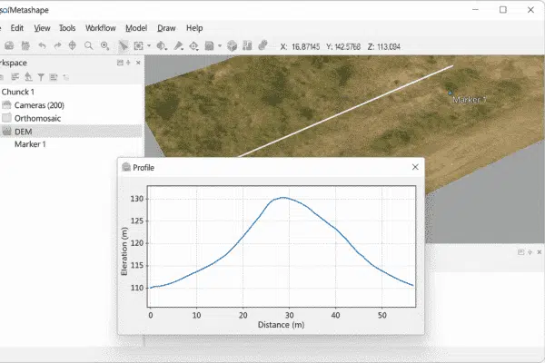
How to Generate Profiles and Cross-Sections in Agisoft Metashape: A Step-by-Step Guide
One of the most powerful features of Agisoft Metashape is the ability to generate profiles and cross-sections from your 3D data. Whether you are working with a digital elevation model (DEM), a dense point cloud, or [...]
News
How to Work with Local Coordinates in Agisoft Metashape: A Step-by-Step Guide
Working with local coordinates in Agisoft Metashape can be extremely useful for projects that do not require a global reference system. While many photogrammetry workflows use standardized coordinate reference systems (CRS) such as WGS84 or UTM, [...]
News
Does the Trial Agisoft Metashape Transfer from Windows to Linux or Mac?
When testing professional photogrammetry software such as Agisoft Metashape, many users begin their 30-day free trial on one operating system, often Windows. Later, some realize they would prefer to run the software on Linux or Mac, [...]
News
Metashape + GNSS/RTK Workflows for Surveying: How Accurate Is It?
Agisoft Metashape is one of the most powerful photogrammetry tools used in surveying, and when paired with GNSS and RTK workflows, it becomes a precision-grade solution. This article explains how GNSS and RTK work with Metashape, [...]
News
How to Use Geoids in Agisoft Metashape: A Step-by-Step Guide
Working with geoids in Agisoft Metashape is essential for anyone who needs accurate elevation data in their photogrammetry projects. By default, drone data often provides altitudes in relation to an ellipsoid model, which can lead to [...]
News
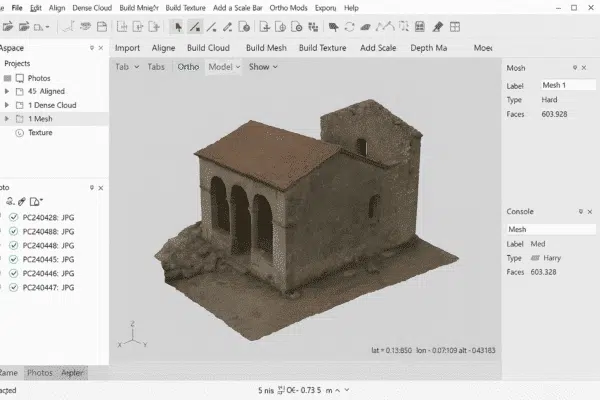
How to Create a Mesh in Agisoft Metashape: A Step-by-Step Guide
Creating a 3D mesh in Agisoft Metashape is one of the most important steps in any photogrammetry workflow. A mesh transforms your aligned images and dense point cloud into a surface that can be textured, measured, [...]
News
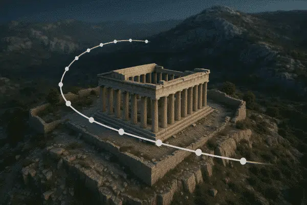
How to Create Animated Flythroughs of 3D Models in Agisoft Metashape
Agisoft Metashape is widely known for its photogrammetry capabilities, but many users don’t realize it also includes basic animation tools. With the camera track feature, you can create professional-looking flythrough animations directly within Metashape, ideal for [...]
News
Agisoft Metashape 2.2.2 – All New Features & Enhancements
Agisoft Metashape 2.2.2 has officially been released by Agisoft, delivering numerous enhancements in LiDAR data handling, orthomosaic processing, precision display, batch operations, the Agisoft Viewer, and enhanced cloud-based team control. Below is a comprehensive overview of [...]
News
How to Optimize Texture Quality in Agisoft Metashape for 3D Web and VR Projects
High-quality textures are essential for 3D models intended for WebGL, VR, and real-time rendering. In Agisoft Metashape, optimizing texture quality involves a careful combination of capture strategy, mesh preparation, and export settings. This guide will show [...]
News
How to Clean Noisy Point Clouds in Metashape (Step-by-Step Guide)
When working with Agisoft Metashape, one of the most common issues after generating a dense point cloud is the presence of noise — unwanted points that can degrade model accuracy and appearance. Whether you’re mapping urban [...]
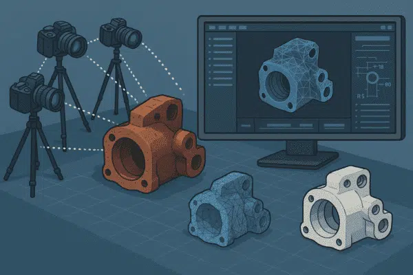
News
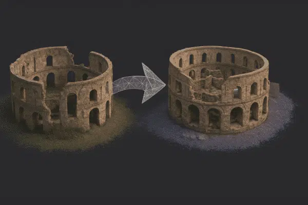
Reverse Engineering Objects with Metashape: From Scan to CAD
Reverse engineering physical objects into editable CAD models is invaluable in manufacturing, product design, and quality control. By combining photogrammetry with Agisoft Metashape’s powerful processing engine, you can generate accurate meshes from photographs and convert them [...]
News
Using Agisoft Metashape for Environmental Monitoring and Land Deformation
Agisoft Metashape has become a trusted tool for environmental scientists and geospatial professionals working in monitoring ecosystems, assessing land deformation, and detecting changes in terrain over time. Thanks to its high-precision photogrammetric engine, Metashape allows for [...]
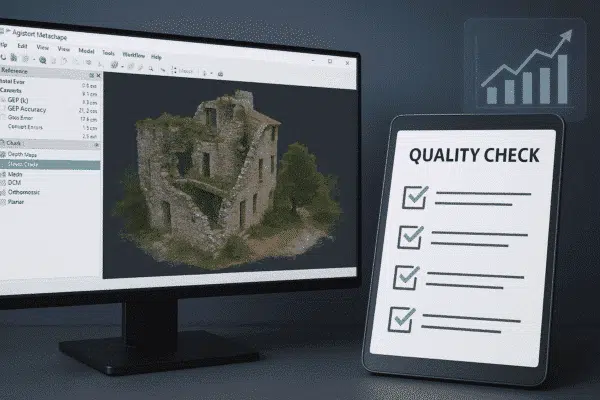
News
How to Perform Quality Checks on Photogrammetry Projects in Metashape
Agisoft Metashape is a powerful tool for generating accurate 3D models, orthophotos, and point clouds from images. But even the best photogrammetry workflow can yield poor results if quality control is ignored. In this guide, you’ll [...]
News
Agisoft Viewer: How to Explore and Share 3D Models with Ease
In the world of photogrammetry and 3D modeling, professionals often need not only to process data but also to present and share it in an accessible way. That’s where Agisoft Viewer comes in. This lightweight and [...]
News
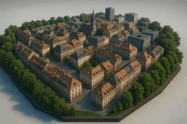
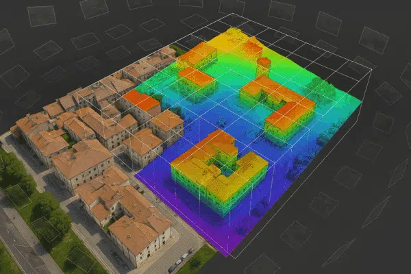
How to Build Accurate 3D City Models with Drones and Agisoft Metashape
Creating realistic and accurate 3D city models has become more accessible thanks to advancements in drone photogrammetry and software like Agisoft Metashape. Whether you’re working in urban planning, architecture, or smart city development, a 3D reconstruction [...]
News
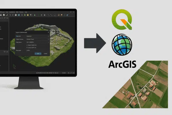
How to Export Orthophotos and Georeferenced Maps from Metashape for QGIS and ArcGIS
Agisoft Metashape is a powerful tool for photogrammetry, but its true value often emerges when exporting data to GIS platforms like QGIS and ArcGIS. Whether you’re working on land surveys, environmental analysis, or urban planning, exporting [...]

News
How to Create Digital Twins with Agisoft Metashape and IoT Sensors
Digital twins are virtual representations of real-world assets that mirror their physical counterparts in real-time using data from sensors, cameras, and other inputs. With Agisoft Metashape, you can create highly accurate 3D models from drone or [...]
News
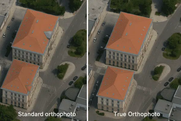
How to Create True Orthophotos with Metashape: Building Lean Correction Explained
Agisoft Metashape is a powerful photogrammetry software used to generate high-resolution orthophotos, but standard orthophotos often suffer from one common issue in urban areas: building lean. This distortion occurs when tall structures appear tilted in the [...]
News
How to Use Agisoft Metashape with DJI Drones: Setup and Best Practices
Combining DJI drones with Agisoft Metashape is one of the most efficient ways to perform accurate photogrammetry for 3D mapping, surveying, and inspections. Whether you’re capturing construction sites, cultural heritage, or agricultural fields, this guide provides [...]
News
What File Formats Does Agisoft Metashape Support?
Agisoft Metashape is one of the leading photogrammetry software solutions used worldwide in fields such as surveying, archaeology, mining, cultural heritage, and visual effects. One of the key reasons for its popularity is its compatibility with [...]
News
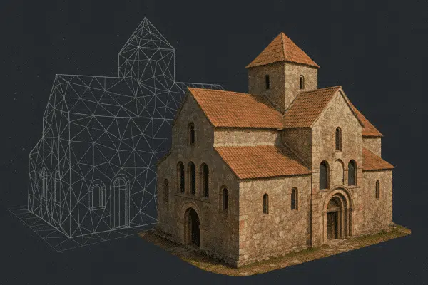
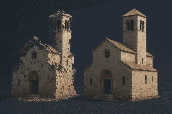
How to Document Historical Buildings with Agisoft Metashape: Field to Archive
Agisoft Metashape is a powerful photogrammetry tool that has become essential for the preservation and documentation of historical buildings. Whether you are working in archaeology, architecture, or cultural heritage, Metashape offers a complete pipeline to turn [...]
News
Best Collection Method for 3D Building Models Using Agisoft Metashape
Creating high-quality 3D models of buildings using Agisoft Metashape depends heavily on your data collection method. Whether you’re modeling for architecture, cultural heritage, construction, or real estate, the way you capture your images determines the accuracy, [...]
News
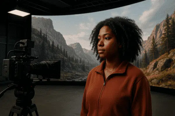
Using Agisoft Metashape for Volumetric Filmmaking and Virtual Production
Volumetric filmmaking is reshaping the film and game industry by blending real-world scenes with virtual production. Agisoft Metashape, known for its precision in photogrammetry, is increasingly used to scan environments, props, and actors in 3D. When [...]
News
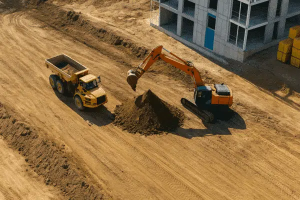
Metashape for Construction Sites: 3D Progress Monitoring and Volume Calculations
In modern construction projects, real-time site updates and precise volume measurements are key for efficient decision-making. Agisoft Metashape offers a powerful photogrammetry solution to transform drone images into 3D models, orthophotos, and digital terrain models (DTMs). [...]

News
How Museums Use Agisoft Metashape to Create 3D Archives and Virtual Exhibits
Museums around the globe are embracing digital technologies to preserve artifacts, engage visitors, and broaden access to cultural heritage. Agisoft Metashape has emerged as a leading photogrammetry solution, enabling institutions to generate high‑resolution 3D models of [...]
News
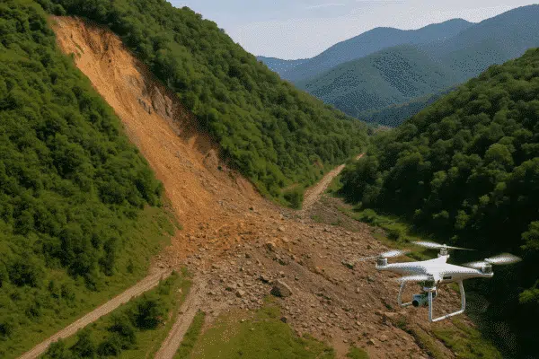
Using Agisoft Metashape for Landslide Mapping and Disaster Assessment
In the face of increasing climate risks, landslides and terrain collapses are becoming more frequent and dangerous. Rapid mapping and accurate terrain analysis are critical for effective response. Agisoft Metashape provides a powerful solution for landslide [...]
News
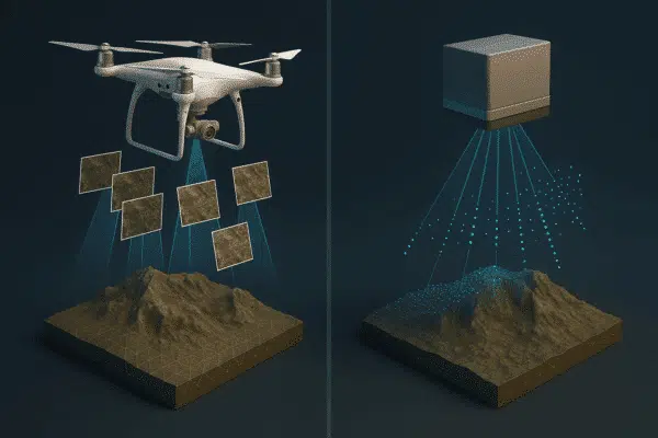
Photogrammetry vs Laser Scanning: When to Use Agisoft Metashape Instead of LiDAR
Photogrammetry and LiDAR are two leading technologies for 3D mapping, modeling, and spatial analysis. While both have their strengths, they are suited for different applications. In this article, we compare photogrammetry with laser scanning and explain [...]
News
How to Make Orthophotos from Oblique Images in Agisoft Metashape
While nadir images are commonly used in photogrammetry, oblique images—taken at an angle—offer valuable context for 3D modeling and orthophoto generation. With Agisoft Metashape, it’s entirely possible to generate orthophotos from oblique images, though the workflow [...]
News
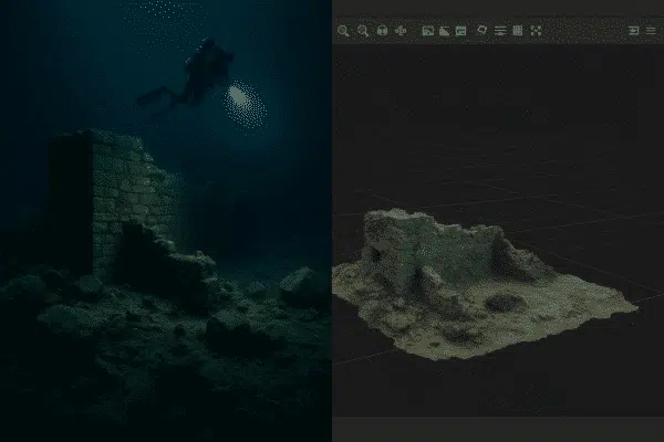
How to Process Underwater or Low-Light Images in Agisoft Metashape
Photogrammetry in underwater or low-light environments presents unique challenges—from motion blur to color distortion and poor contrast. However, with the right techniques, Agisoft Metashape can still generate high-quality 3D models from images captured in these conditions. [...]
News
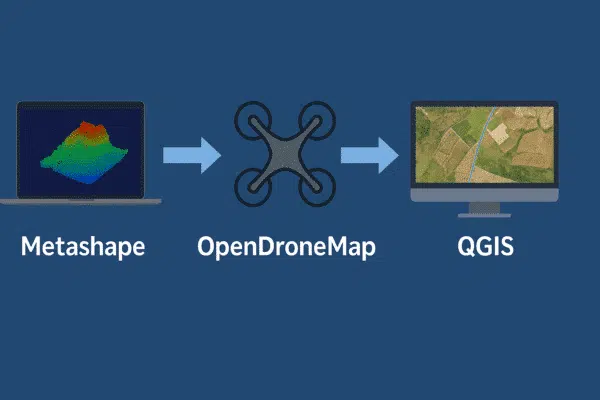
Metashape + OpenDroneMap + QGIS: Free GIS Workflow for Surveying and Mapping Professionals
Combining Agisoft Metashape, OpenDroneMap, and QGIS offers professionals a powerful, cost-effective pipeline for drone-based GIS mapping and analysis. Whether you’re in surveying, agriculture, or environmental research, this hybrid workflow enables the creation of georeferenced 3D models, [...]
News
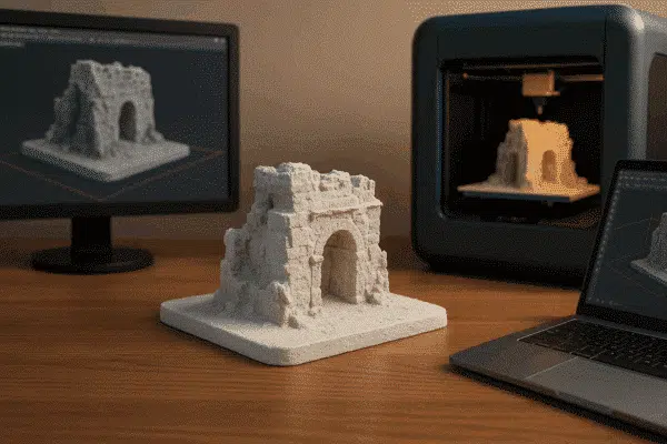
How to Turn Metashape Outputs into 3D Printable Models
Agisoft Metashape is widely known for its ability to produce high-resolution 3D models from drone or DSLR photos. But did you know you can also turn these outputs into 3D printable models? Whether you’re creating architectural [...]
News
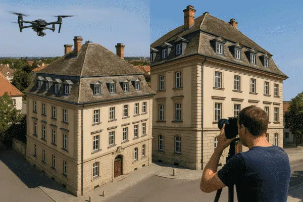
How to Combine Terrestrial and Aerial Photos in One Project in Agisoft Metashape
Agisoft Metashape allows users to create highly detailed 3D models by combining both aerial and terrestrial (ground-level) photos. This hybrid approach is especially useful when modeling buildings, archaeological sites, industrial areas, or any structure where drone [...]
News
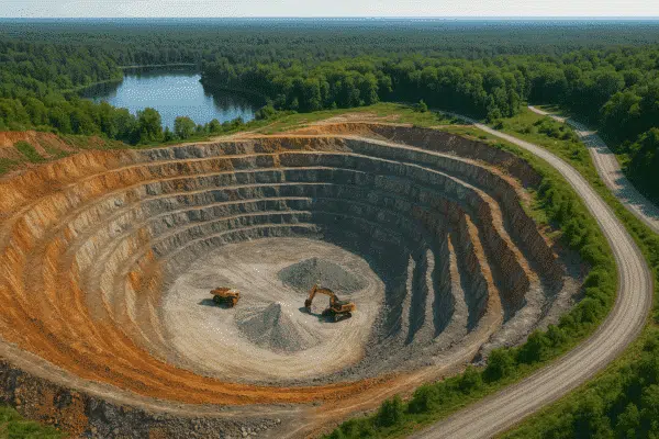
Metashape for Mining and Quarry Monitoring: Volume Reports and Change Detection
Agisoft Metashape has emerged as a powerful tool in the mining and quarrying industry, thanks to its ability to turn drone images into precise 3D models and geospatial data. From calculating extraction volumes to monitoring topographic [...]
News
Troubleshooting Dense Cloud Issues in Metashape: Holes, Noise & Misalignment Fixes
The dense cloud is a critical step in Agisoft Metashape’s photogrammetry pipeline. But when things go wrong—such as holes, noise, or poor alignment—the quality of your final 3D model or orthomosaic suffers. In this guide, we’ll [...]

News
Automating Forest Inventory and Tree Counting with Metashape and AI: A Smarter Way to Monitor Forests
Efficient and accurate forest inventory is essential for sustainable forestry, biodiversity monitoring, and combating deforestation. Traditionally, it required field crews to manually count and measure trees—a time-consuming and labor-intensive task. But today, thanks to drone photogrammetry [...]
News
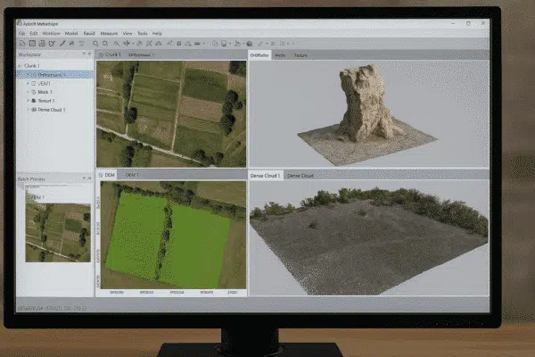
How to Build Orthomosaics in Agisoft Metashape: Step-by-Step Guide for Beginners
Creating orthomosaics is one of the most powerful features of Agisoft Metashape. An orthomosaic is a geometrically corrected image composed from multiple aerial photos, where distortions from camera angle and terrain have been removed. This tutorial [...]

News
Agisoft Metashape for Film Location Scouting & Previz | 3D Scanning
In 2025, film professionals are under increasing pressure to streamline pre‑production workflows, reduce on‑site logistics, and improve visual accuracy. Agisoft Metashape—an industry‑leading photogrammetry software—has emerged as a powerful tool for film location scouting and previz (previsualization). [...]
News
Metashape + RTK/PPK Drones: How to Maximize Accuracy with Geotagged Photos
Agisoft Metashape is a powerful photogrammetry tool, and when combined with RTK (Real-Time Kinematic) or PPK (Post-Processed Kinematic) drones, it delivers centimeter-level accuracy in 3D models and orthomosaics. Whether you’re mapping for surveying, agriculture, or construction, [...]
News
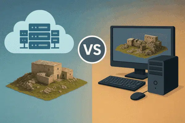
Cloud Processing vs Local Workstation: What’s Faster for Agisoft Metashape Projects?
Agisoft Metashape is widely used for photogrammetry, 3D modeling, and drone mapping. But as datasets grow larger and processing times stretch into hours—or even days—many users ask: should I upgrade my local workstation or move to [...]
News
How to Create Custom DEMs and Contour Lines in Metashape
Agisoft Metashape offers a complete set of tools to generate Digital Elevation Models (DEMs) and extract contour lines from drone imagery or terrestrial photogrammetry. These outputs are essential for topographic mapping, land surveys, construction planning, and [...]
News
How to Georeference a Model Without GPS in Agisoft Metashape
Working without GPS data doesn’t mean your 3D reconstruction has to be inaccurate. With Agisoft Metashape, you can manually georeference a model by using known distances, scale bars, and Ground Control Points (GCPs). Whether you’re digitizing [...]
News
How to Combine Multiple Chunks in Agisoft Metashape: Alignment and Merging Guide
In complex photogrammetry projects, splitting a project into multiple chunks in Agisoft Metashape is often necessary—for example, when working with large datasets, separate flight missions, or different parts of a building. But to produce a seamless [...]
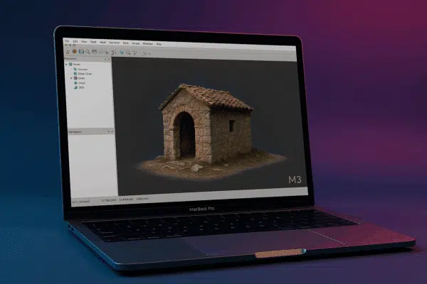
News
Agisoft Metashape on Apple M3 Chips: Performance and Compatibility in 2025
With Apple’s transition to ARM-based silicon well underway, users of Agisoft Metashape are increasingly asking whether the software runs efficiently on the new Mac M3 chips in 2025. This article explores performance benchmarks, compatibility insights, and [...]

News
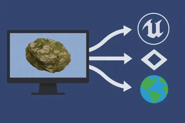
How to Export 3D Models from Metashape for WebAR, GLB, USDZ, and Cesium
Sharing 3D models online has never been easier thanks to modern formats like GLB, USDZ, and Cesium. Whether you want to publish models for WebAR (Web-based Augmented Reality), mobile viewing, or immersive web maps, Agisoft Metashape [...]
News
How to Reconstruct 3D Models from Video in Agisoft Metashape (Frame Extraction Tutorial)
Did you know that you can use video footage to create 3D models in Agisoft Metashape? Even without a DSLR or drone, videos from smartphones or action cameras can be used for photogrammetry by extracting still [...]

News
Troubleshooting Agisoft Metashape: Top 10 Common Errors and How to Fix Them
Agisoft Metashape is a powerful photogrammetry tool—but even the most experienced users sometimes run into issues. From alignment failures to texture errors, knowing how to troubleshoot common problems can save you hours of frustration. In this [...]

News
Metashape on Mac, Windows, or Linux: Which Platform Performs Best
Agisoft Metashape is a professional-grade photogrammetry software used for 3D modeling, mapping, and reconstruction. But which operating system—Mac, Windows, or Linux—offers the best performance in 2025? Whether you’re processing drone imagery or building high-resolution 3D models, [...]
News
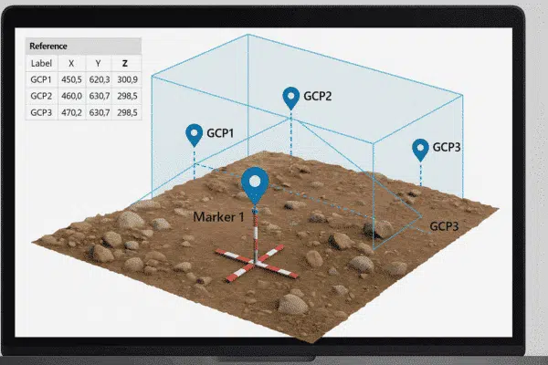
How to Use GCPs in Agisoft Metashape: Step-by-Step Guide for Accurate Georeferencing
Georeferencing is essential for producing accurate, real-world scaled 3D models and maps. Ground Control Points (GCPs) play a vital role in this process by anchoring your photogrammetry data to known Earth coordinates. In this guide, we’ll [...]
News
Best Export Settings in Metashape for Unity, Unreal Engine, and Cesium
Agisoft Metashape is widely used to generate high-resolution 3D models from drone imagery or photogrammetric scans. But exporting those models into real-time engines like Unity, Unreal Engine, or web-based platforms like CesiumJS requires specific settings and [...]
News
How to Reduce Model Size in Agisoft Metashape Without Losing Detail
Agisoft Metashape produces highly detailed 3D models from drone imagery or close-range photos. However, these models can quickly become massive in size—making them hard to share, view, or use in real-time environments. In this guide, you’ll [...]
News
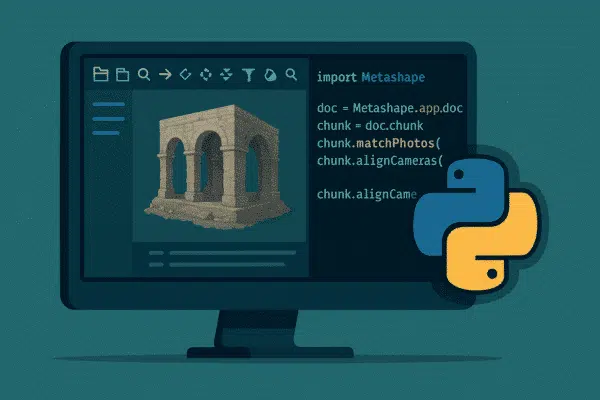
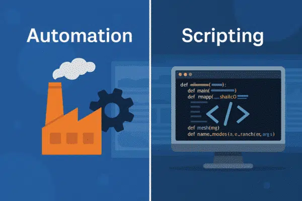
Agisoft Metashape Python Scripting: 5 Ready-to-Use Automation Scripts to Speed Up Your Workflow
Agisoft Metashape includes a powerful Python API that enables users to automate complex photogrammetry tasks. Whether you’re working on drone mapping, architecture, or archaeological documentation, scripting in Metashape can save hours of manual clicking. In this [...]
News
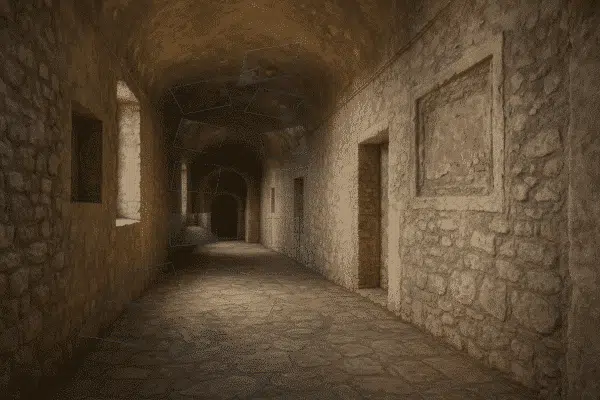
How to Process Indoor Scans and Enclosed Spaces in Agisoft Metashape
Agisoft Metashape is well-known for its ability to process aerial and outdoor datasets, but it also offers powerful tools for generating 3D models of indoor and enclosed spaces. Whether you’re capturing architectural interiors, tunnels, industrial rooms, [...]
News
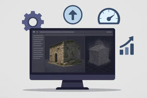
How to Speed Up Processing in Agisoft Metashape: Best Settings for Faster Results
Agisoft Metashape is one of the most powerful photogrammetry tools available—but high-resolution processing can take hours or even days. Fortunately, you can dramatically improve performance with the right settings and workflow. In this guide, we’ll explain [...]
News
Can You Use LiDAR in Agisoft Metashape? Hybrid Photogrammetry Workflows Explained
LiDAR technology is transforming 3D mapping with laser-based precision, but what happens when you combine it with Agisoft Metashape’s photogrammetry capabilities? Many professionals are exploring hybrid workflows to maximize accuracy and model detail. In this article, [...]

News
How to Automatically Mask Backgrounds in Agisoft Metashape
One of the most effective ways to improve model quality and reduce noise in Agisoft Metashape is by removing unwanted backgrounds from images. While manual masking is tedious, Metashape offers powerful options for automatic background masking. [...]
News
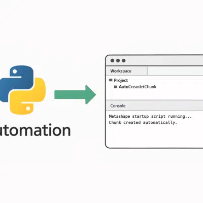
How to Auto-Run Python Scripts at Startup in Agisoft Metashape
Automating your photogrammetry workflow can dramatically increase efficiency—especially in repetitive or enterprise tasks. Agisoft Metashape supports Python scripting, and you can even configure it to auto-run scripts at startup. This guide shows you how to set [...]
News
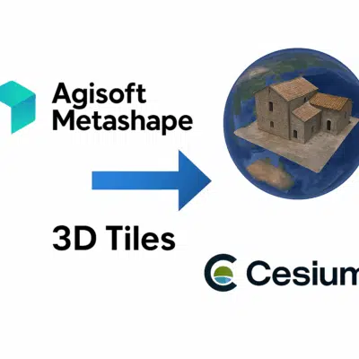
How to Export 3D Tiles from Agisoft Metashape for Cesium Visualization
Agisoft Metashape offers advanced tools for 3D reconstruction, dense cloud generation, and textured mesh creation. But once your model is complete, how do you export it in a format compatible with modern 3D geospatial platforms like [...]
News
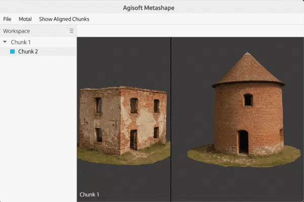
Can You View Multiple Chunks or Models at Once in Agisoft Metashape?
Agisoft Metashape is a powerful photogrammetry tool that allows users to work with complex datasets by organizing them into “chunks.” A common question among users is: Can I view multiple chunks or models at the same [...]
News
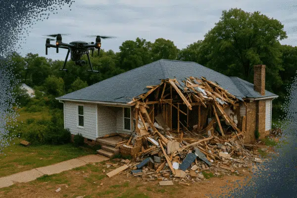
Photogrammetry for Insurance and Damage Assessment: A Metashape Workflow
Photogrammetry is rapidly becoming a critical tool in the insurance industry for documenting damage and accelerating claims. Agisoft Metashape offers a precise, scalable way to generate 3D models and measurements from aerial and ground images, making [...]
News
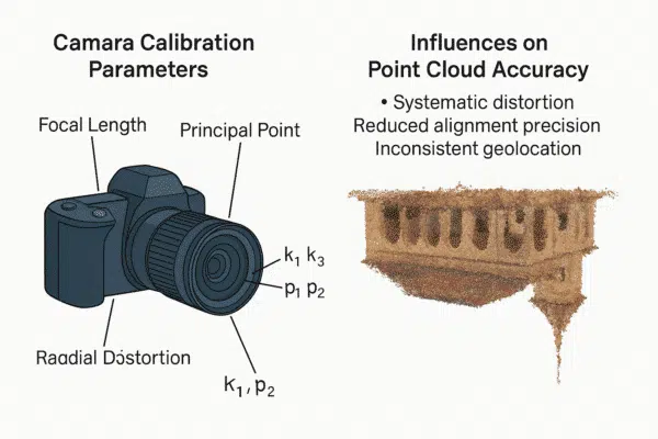
How Camera Calibration Affects Point Cloud Accuracy in Agisoft Metashape
Agisoft Metashape delivers high-precision photogrammetry results, but the quality of your final point cloud heavily depends on one crucial factor: camera calibration. Inaccurate calibration parameters can lead to distorted models, poor alignment, and unreliable measurements. This [...]
News
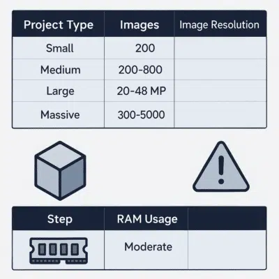
How Much RAM Do You Need for Large Metashape Projects and 3D PDF Exports?
When working with photogrammetry software like Agisoft Metashape, hardware performance—especially RAM—plays a crucial role. This is even more true when handling large-scale projects or exporting complex deliverables like 3D PDFs. In this guide, we’ll help you [...]
News
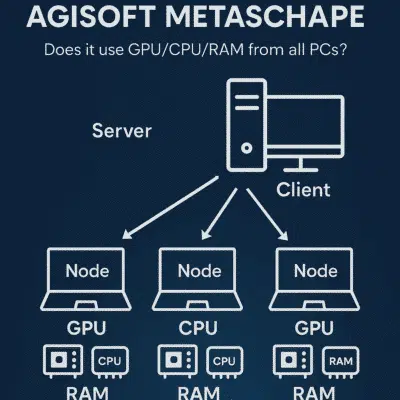
Agisoft Metashape Network Processing: How It Uses GPU, CPU, and RAM Across All Machines
Agisoft Metashape is widely used in professional photogrammetry for processing large datasets and generating 3D models, orthomosaics, DEMs, and dense point clouds. As project sizes grow, many users ask: how does network processing work in Metashape? [...]
News
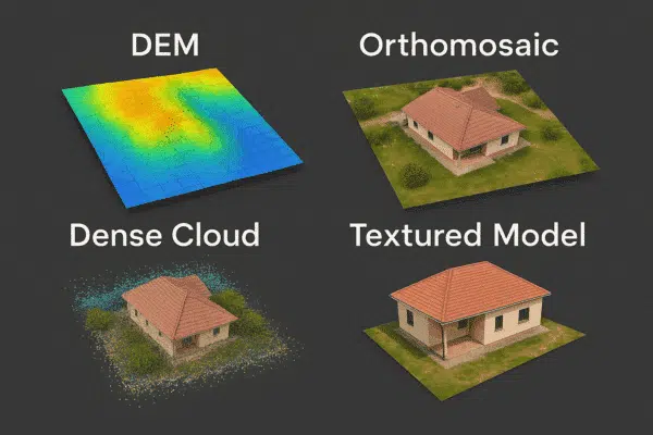
Top Features of Agisoft Metashape: DEM, Dense Cloud, Orthomosaic, and More Explained
Agisoft Metashape is one of the most powerful and widely used photogrammetry tools in the world. From drone mapping to architectural 3D modeling, its features support a wide range of industries. In this guide, we’ll explore [...]

News
How to Run Agisoft Metashape in Headless Mode with Python Scripting
Agisoft Metashape isn’t just a graphical interface for 3D model creation—it’s also a powerful automation engine. With Python scripting, users can run Metashape in headless mode (i.e., without a GUI), ideal for server-based processing, batch workflows, [...]
News
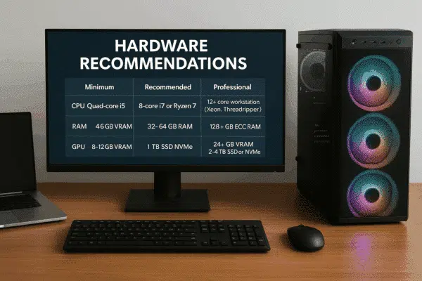
Agisoft Metashape Hardware Recommendations and Memory Requirements
Whether you’re new to photogrammetry or looking to upgrade your workstation, knowing the right hardware specifications for Agisoft Metashape is essential. RAM, CPU, GPU, and storage all play important roles in the speed, quality, and stability [...]
News
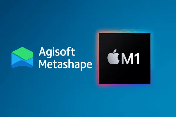
Does Agisoft Metashape Work on Apple M1 and M2 Macs? Compatibility Guide
With Apple’s transition from Intel to its own ARM-based silicon chips like the M1, M1 Pro/Max, and M2, many users have wondered: Does Agisoft Metashape work on Apple Silicon Macs? The answer is yes—with some important [...]
News
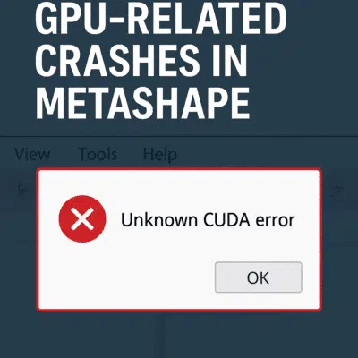
How to Fix GPU-Related Crashes in Agisoft Metashape: Troubleshooting Guide
Agisoft Metashape is a powerful photogrammetry tool, but when it crashes during GPU-intensive tasks like dense cloud generation or mesh building, it can be incredibly frustrating. Many users encounter GPU-related crashes—particularly on machines with dedicated graphics [...]
News
Agisoft Metashape 2.2.x: Advanced LiDAR Calibration, AI Masking & High‑Resolution Orthomosaics
With release 2.2.x, Agisoft Metashape raises the bar in professional photogrammetry by integrating aerial LiDAR processing, AI‑driven workflows, and enhanced orthomosaic quality. From seamless boresight calibration to intelligent background removal and geoid embedding, Metashape 2.2.x empowers [...]
News
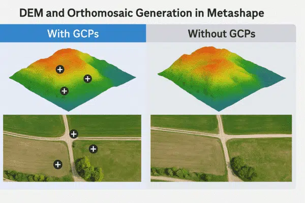
DEM and Orthomosaic Generation in Agisoft Metashape: With vs Without GCPs
Agisoft Metashape is a powerful tool for generating high-resolution Digital Elevation Models (DEMs) and orthomosaics from drone or terrestrial imagery. A common question users face is: Can I generate accurate results without Ground Control Points (GCPs)? [...]
News
The Best Agisoft Metashape Plugins and Python Scripts (2025 Edition)
Agisoft Metashape is one of the most powerful photogrammetry tools available today. While its GUI offers rich features, many users unlock its true potential by extending it with Python scripts and plugins. Whether you need automation, [...]
News
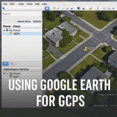
Using Google Earth for GCPs in Agisoft Metashape: A Step-by-Step Guide
Ground Control Points (GCPs) are essential for georeferencing and improving the accuracy of 3D models in Agisoft Metashape. But what if you don’t have access to high-precision GNSS data? You can use Google Earth as a [...]
News
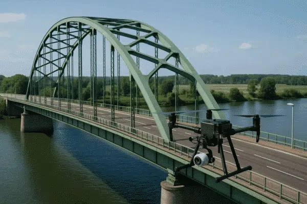
Using Agisoft Metashape for Drone Inspection and Infrastructure Modeling
Drone inspection is revolutionizing infrastructure management, enabling fast, safe, and cost-effective surveys of complex assets such as bridges, buildings, powerlines, and roads. One of the most powerful tools in this workflow is Agisoft Metashape, a photogrammetry [...]

News
Fixing SSL Errors When Uploading from Agisoft Metashape to Sketchfab
Trying to upload your 3D model from Agisoft Metashape to Sketchfab but running into an “SSL error”? You’re not alone. Many users experience issues when publishing directly to Sketchfab due to outdated SSL certificates or system [...]
News
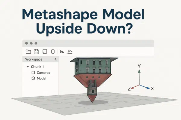
Agisoft Metashape Model Appears Upside Down? Here’s How to Fix It
One of the most common frustrations among new users of Agisoft Metashape is discovering that their 3D model appears upside down after processing. Whether you’re generating a dense cloud, mesh, or textured model, this issue can [...]

News
Agisoft Metashape Educational License After Graduation: What Happens Next?
If you’re a student or educator using Agisoft Metashape under an educational license, you may be wondering: what happens after graduation? Can you keep using the software commercially? Do you need to upgrade? In this guide, [...]
News
Post-Processing in Metashape: Color Correction, Mesh Cleaning, and Retopology
After you’ve completed the core photogrammetry workflow in Agisoft Metashape—aligning photos, generating dense clouds, and building a 3D mesh—post-processing becomes essential. Proper post-processing significantly improves the final output quality, making your models cleaner, lighter, and more [...]
News
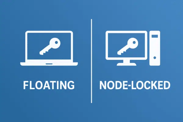
Agisoft Metashape License Activation Explained: Floating vs Node-Locked – Which Is Better?
Agisoft Metashape offers two main types of software licenses: Node-Locked and Floating. Choosing the right one can significantly impact your workflow, collaboration model, and overall software investment. In this article, we break down how each license [...]
News
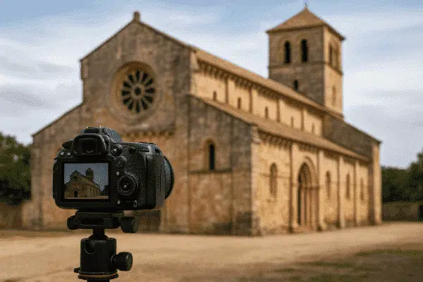
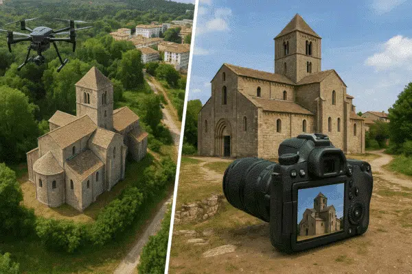
How to Capture the Best Photos for Photogrammetry: Drone and DSLR Tips
Photogrammetry relies entirely on the quality of your photos. Whether you’re using a drone or DSLR, capturing sharp, well-lit, and properly overlapped images is essential for producing accurate 3D models, orthophotos, and point clouds. In this [...]

News
Running Agisoft Metashape in the Cloud: EC2, GPU Acceleration and NAS
Agisoft Metashape is a powerful photogrammetry tool—but when working with thousands of high-resolution images, local hardware can quickly become a bottleneck. Running Metashape in the cloud offers scalable performance, remote access, and faster processing thanks to [...]
News
Best GPU and Hardware Setup for Agisoft Metashape
Agisoft Metashape is a demanding photogrammetry tool that thrives on powerful hardware. If you’re planning to process high-resolution drone imagery or generate dense 3D models, your system setup will make a major difference. In this article, [...]

News
How to Make Agisoft Metashape Faster: 10 Tips to Speed Up Processing
Agisoft Metashape is a powerful photogrammetry tool, but it can be demanding—especially when processing large datasets. Whether you’re reconstructing a small object or an entire city block, speeding up Metashape can save you hours of time. [...]
News
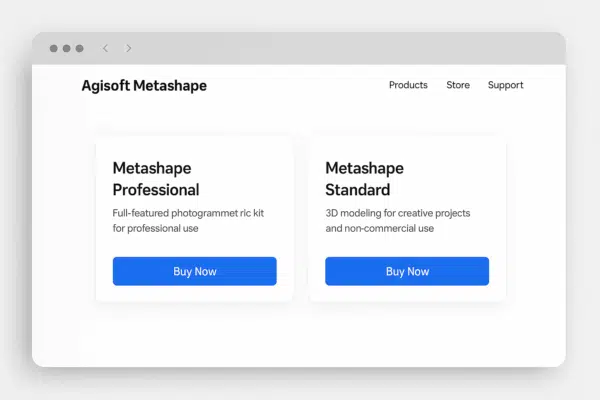
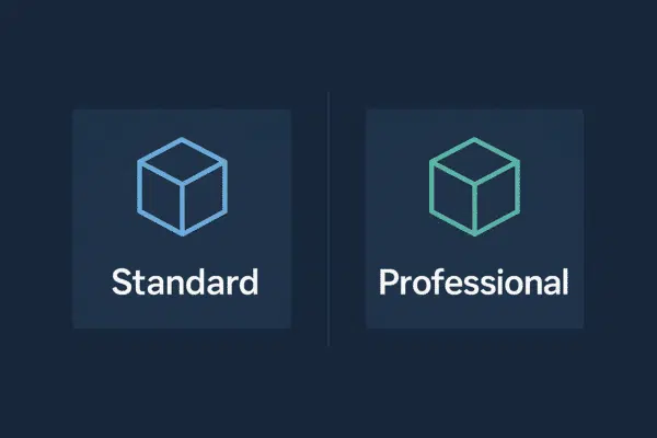
Agisoft Metashape Standard vs Professional: Key Differences Explained
Agisoft Metashape is a leading photogrammetry software used for creating 3D models, point clouds, and orthophotos from images. It comes in two editions: Standard and Professional. While both share the same powerful core engine, their capabilities [...]
News
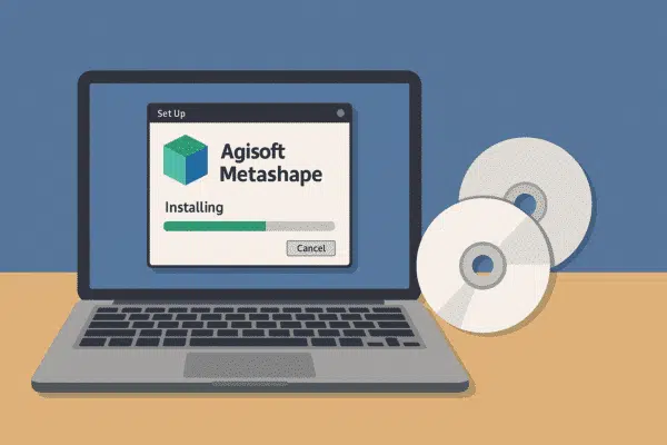
How to Install and Activate Agisoft Metashape on Windows, Mac and Linux
Agisoft Metashape is a leading photogrammetry software used by professionals in surveying, archaeology, construction, and 3D modeling. Whether you’re using Windows, macOS, or Linux, the installation and activation process is straightforward—but there are key steps and [...]
News
Is Metashape Free to Use? Everything You Need to Know About Pricing and Trial Options
Agisoft Metashape is a powerful photogrammetry software used by professionals in surveying, drone mapping, archaeology, and 3D modeling. But one of the most frequently searched questions online is: “Is Metashape free to use?” In this article, [...]

News
AI and Photogrammetry: Smart Features Now in Agisoft Metashape
In the evolving world of photogrammetry, artificial intelligence (AI) is now playing a central role. While traditional photogrammetry relies heavily on geometry and pixel comparison, the integration of AI has added automation, accuracy, and intelligent feature [...]

News
Is Metashape a One-Time Purchase? Understanding Agisoft’s Licensing Model
Agisoft Metashape is one of the most trusted photogrammetry tools on the market, used by professionals in surveying, drone mapping, archaeology, and 3D reconstruction. But many users ask the same question before buying: Is Metashape a [...]
News
What Is Agisoft Metashape Used For? Top Applications in Mapping, Surveying, and 3D Modeling
Agisoft Metashape is a powerful photogrammetry software that transforms ordinary images into precise 3D models and geospatial data. But what is it really used for, and who uses it? In this article, we explore the most [...]
News
3D Mapping with Agisoft Metashape: The Complete Guide to Professional Photogrammetry
Photogrammetry has become an essential technology for creating detailed 3D models of real-world environments and objects. Whether for surveying, archaeology, engineering, or visual effects, converting photographs into accurate 3D data has never been more accessible. This [...]
News
Using Metashape for BIM and Architectural 3D Modeling
Building Information Modeling (BIM) has become the industry standard for managing the entire lifecycle of a structure—from design to construction and maintenance. But what if you’re starting from existing architecture or heritage buildings? This is where [...]
News
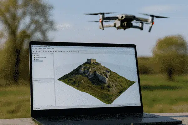
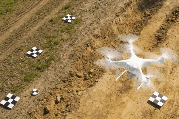
Drone Surveying with Metashape: Complete Guide + Real Applications
Drone surveying has become one of the most efficient ways to collect geospatial data, and when combined with Agisoft Metashape, it becomes a powerful workflow for producing accurate 3D maps, digital elevation models (DEMs), orthophotos, and [...]

News
Best Metashape Settings for High-Precision 3D Reconstructions
Agisoft Metashape is a powerful photogrammetry software trusted by professionals across industries like surveying, construction, archaeology, and visual effects. But to unlock its full potential, it’s crucial to understand which settings deliver the best results for [...]

News
How to Create 3D Models from Photos with Agisoft Metashape: Step-by-Step Tutorial
Agisoft Metashape is one of the most powerful tools for generating 3D models from photographs, widely used in surveying, archaeology, architecture, and research. This tutorial will guide you through the entire process—from capturing images to exporting [...]
News
Metashape + Blender: Turn Reality into 3D Animations with This Workflow
Agisoft Metashape is widely used for photogrammetry—turning real-world images into detailed 3D models. Blender is one of the most powerful free 3D animation and rendering tools. Together, they form a powerful pipeline to create realistic 3D [...]
News
7 Mistakes in Agisoft Metashape That Are Ruining Your 3D Models
Agisoft Metashape is a powerful tool for creating accurate 3D models and maps from aerial images. But even experienced users make small mistakes that can lead to poor results, long processing times, or unusable outputs. In [...]

News
Agisoft Metashape vs RealityCapture: Best Photogrammetry Software for 2025?
Agisoft Metashape and RealityCapture are two of the most popular photogrammetry platforms in 2025. Whether you’re building 3D maps from drone imagery or digitizing objects for cultural heritage, choosing the right tool can impact your speed, [...]

News
10 Pro Tips to Get Better 3D Models with Agisoft Metashape
Agisoft Metashape is a powerful photogrammetry platform—but are you using it to its full potential? Whether you’re working on drone mapping, archaeology, architecture, or 3D scanning, these 10 expert tips and tricks will help you improve [...]
News
5 Powerful Agisoft Metashape Features You Probably Aren’t Using (Yet)
Agisoft Metashape is known for its powerful photogrammetry engine and professional-grade outputs. But beyond its standard workflows—like photo alignment, dense cloud generation, and mesh building—there are several hidden or underused features that can significantly improve your [...]
News
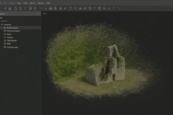
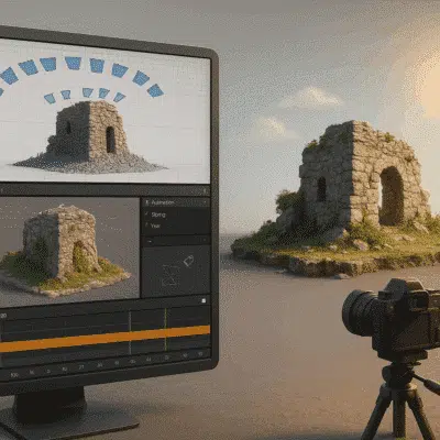
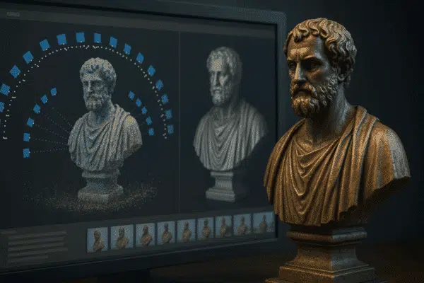
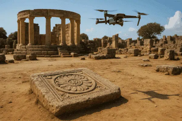
Agisoft Metashape in Archaeology and Cultural Heritage: Real-World Use Cases
Agisoft Metashape is not just a photogrammetry tool for drones and surveys—it’s a game-changer in archaeology and cultural heritage preservation. With its ability to turn photographs into highly detailed 3D models, researchers are using it to [...]
News
Using Agisoft Metashape with Thermal, Multispectral, and LiDAR Data
Agisoft Metashape is widely known for its photogrammetry capabilities using RGB drone imagery—but its power extends much further. With the right sensors and processing techniques, Metashape can handle thermal, multispectral, and even LiDAR data. These advanced [...]
News
Agisoft Metashape vs Pix4D: Which Photogrammetry Software Is Best
Agisoft Metashape and Pix4D are two of the most widely used photogrammetry platforms for drone mapping and 3D modeling. Whether you’re working in surveying, agriculture, construction, or cultural heritage, choosing the right software can significantly impact [...]
News
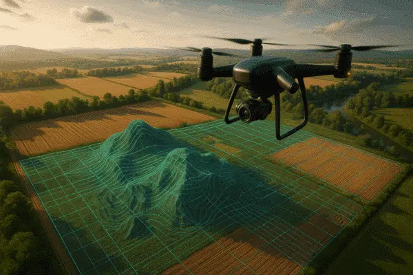
How to Turn Drone Images into 3D Models with Agisoft Metashape (2025 Guide)
Agisoft Metashape is one of the most powerful photogrammetry tools on the market, used by drone professionals, engineers, archaeologists, and 3D artists alike. In this step-by-step guide, you’ll learn how to turn simple drone photos into [...]
News
Agisoft Metashape: The Ultimate Guide to Photogrammetry and 3D Mapping Software
Agisoft Metashape is one of the most powerful photogrammetry tools on the market, trusted by professionals in surveying, archaeology, construction, agriculture, and more. This article explores what Metashape can do, who it’s for, and how to [...]