

 Italiano
 Français
 Deutsch
 Español
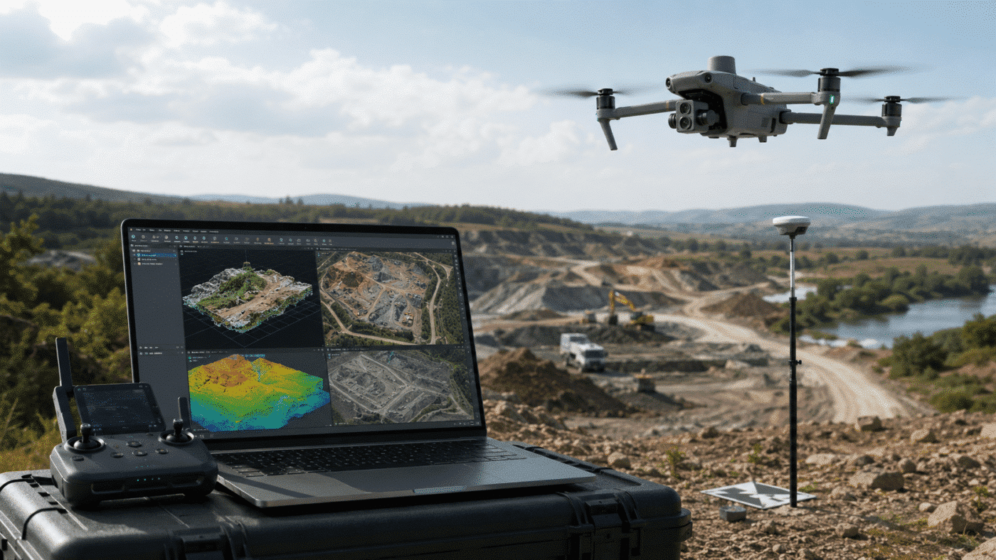
The DJI Matrice 4E and Agisoft Metashape Professional combination provides a powerful workflow for surveyors, engineers, construction companies and drone mapping professionals who need to generate accurate orthomosaics, point clouds, digital elevation models and 3D data.
The Matrice 4E is specifically designed for professional geospatial applications and combines an integrated RTK system with a 20 MP 4/3-inch wide-angle camera. When its RTK positioning information is correctly imported into Agisoft Metashape Professional, highly accurate georeferenced projects can be created even without using Ground Control Points in every survey.
However, obtaining good results requires more than simply importing the photographs and clicking Align Photos. Camera accuracy, coordinate systems, RTK metadata and camera optimization all need to be handled correctly.
This guide explains a recommended DJI Matrice 4E Agisoft Metashape workflow from image import to the final orthomosaic and DEM.
Why DJI Matrice 4E Is Well Suited to Photogrammetry
DJI designed the Matrice 4E as the mapping-oriented model of the Matrice 4 Series.
Its main wide-angle camera uses a 4/3-inch CMOS sensor with 20 megapixels and a 24 mm equivalent lens. More importantly for aerial photogrammetry, the wide camera includes a mechanical shutter.
A mechanical shutter is particularly valuable during mapping missions because the entire image is captured simultaneously, helping to reduce distortions that can occur when photographing the ground while the aircraft is moving.
The Matrice 4E can also capture photographs at short intervals, allowing efficient coverage of relatively large areas while maintaining the image overlap required for photogrammetric reconstruction.
Combined with its integrated RTK positioning system, this makes the Matrice 4E particularly suitable for:
- Topographic surveys
- Construction site mapping
- Earthworks monitoring
- Stockpile measurements
- Mining and quarry surveys
- Road and infrastructure mapping
- Orthomosaic production
- DSM and DTM generation
- 3D reconstruction
Can DJI Matrice 4E Data Be Processed in Agisoft Metashape?
Yes. Agisoft Metashape Professional can process geotagged images captured with DJI RTK drones and use their camera positions during photogrammetric reconstruction.
The RTK information recorded during the flight can provide precise initial camera coordinates. Metashape can use this information during alignment and optimization to improve georeferencing accuracy.
This means you are not limited to DJI Terra when processing data captured with a DJI Matrice 4E.
Metashape also provides advanced tools for Ground Control Points, checkpoints, coordinate reference systems, camera calibration, point cloud generation, DEM creation and orthomosaic export.
Step 1: Capture the Mapping Dataset
Good photogrammetry always starts with good image acquisition.
Plan the Matrice 4E mapping mission with sufficient forward and side overlap. The exact overlap required depends on terrain, vegetation, building density and the type of deliverable, but aerial mapping projects generally benefit from consistent and redundant image coverage.
For normal nadir mapping, use the Matrice 4E wide-angle camera rather than the telephoto cameras.
The wide camera is the primary mapping camera and combines the larger 4/3-inch sensor with the mechanical shutter required for efficient aerial surveying.
Before starting the mission, also confirm that the aircraft has obtained the expected RTK solution and that the positioning service or RTK base station is operating correctly.
Step 2: Import Matrice 4E Images into Metashape
Create a new project in Agisoft Metashape Professional and add the photographs using:
Workflow > Add Photos
Before importing RTK DJI imagery, there is one particularly important setting to check.
Go to:
Tools > Preferences > Advanced
and enable:
Load camera location accuracy from XMP meta data
This allows Metashape to read the positioning accuracy stored in the DJI image metadata rather than assigning the same generic accuracy value to every photograph.
This step is important because the RTK camera coordinates should be appropriately weighted during bundle adjustment. If inaccurate default values are used instead, much of the benefit provided by RTK positioning can be lost.
Step 3: Check Camera Coordinates and Coordinate System
After loading the photographs, open the Reference pane and inspect the camera positions and accuracy values.
Do not assume that the imported information is correct simply because the images contain GPS coordinates.
Check:
- Latitude and longitude values
- Camera altitude
- Camera coordinate accuracy
- Selected coordinate reference system
- RTK status of the original mission
If your deliverables need to use a projected coordinate system or a local vertical datum, configure the appropriate reference system before producing the final results.
Step 4: Align the Matrice 4E Photos
Once the reference information has been verified, select:
Workflow > Align Photos
Metashape identifies common features across overlapping images and calculates the relative position and orientation of each camera.
When precise RTK camera coordinates are available, reference-based image information can help Metashape identify likely overlapping image pairs efficiently.
After alignment, inspect the project rather than immediately moving to the next stage.
Check that:
- Almost all expected cameras are aligned
- The camera trajectory appears correct
- The tie point cloud covers the complete survey
- No isolated or incorrectly positioned camera groups are present
- Reference errors are reasonable
Step 5: Use GCPs and Checkpoints Correctly
A major advantage of RTK drones is that accurate camera coordinates can reduce the number of Ground Control Points required for many projects.
However, RTK does not eliminate the need to verify accuracy.
Independent surveyed checkpoints are extremely useful because they provide an external measurement of the accuracy of the photogrammetric model.
A checkpoint should not influence the adjustment of the model. Instead, it is used to compare its known surveyed coordinates with the coordinates calculated by Metashape.
For professional surveying, this provides a much stronger indication of real-world accuracy than relying exclusively on the estimated camera errors displayed by the software.
Step 6: Optimize Cameras — Important Setting for Matrice 4E
Camera optimization is one of the most important steps in an accurate DJI Matrice 4E Metashape workflow.
Open the Reference pane and select Optimize Cameras after alignment and after placing any Ground Control Points that will be used.
Optimization refines camera parameters and can improve the overall bundle adjustment.
For DJI Matrice 4E datasets, Agisoft specifically recommends excluding the k4 camera calibration parameter from the parameters selected for optimization.
In some RTK projects, enabling Fit additional corrections can also help improve alignment accuracy.
After optimization, review the camera and checkpoint errors again before generating the final products.
Step 7: Build the Point Cloud
Once alignment and optimization are satisfactory, select:
Workflow > Build Point Cloud
The resulting dense point cloud represents the reconstructed surface of the survey area and can be used for measurements, classification, visualization and subsequent elevation model generation.
The appropriate quality settings depend on dataset size, required output resolution and available CPU, GPU and RAM resources.
Step 8: Build a DSM or DTM
Select:
Workflow > Build DEM
A Digital Surface Model (DSM) represents the visible surface, including buildings, vegetation and other objects.
If you need a bare-earth Digital Terrain Model (DTM), the point cloud should first be classified so that ground points can be separated from buildings, trees and other above-ground features.
This distinction is especially important for topographic, earthworks, hydrological and construction applications.
Step 9: Build the Orthomosaic
After creating the elevation model, select:
Workflow > Build Orthomosaic
Metashape uses the reconstructed geometry and camera calibration to remove perspective distortion and create a georeferenced aerial image with a consistent scale.
The resulting orthomosaic can be exported as a GeoTIFF and used in GIS applications such as QGIS or ArcGIS.
Common Matrice 4E RTK Altitude Problems
One issue that deserves particular attention with DJI imagery is altitude.
DJI image metadata can contain both absolute and relative altitude information. If the wrong height reference is interpreted, or if the project uses a different vertical datum, the entire model can appear vertically shifted even though the relative geometry is correct.
For example, a project may show good internal precision but still differ significantly from surveyed checkpoints because the drone coordinates and ground reference data use different height definitions.
If you observe a significant vertical offset, check the altitude metadata, ellipsoidal versus orthometric heights, geoid model and coordinate system before changing processing parameters.
Can You Map with Matrice 4E Without GCPs?
Yes. The Matrice 4E wide-angle camera and RTK positioning system are designed to support mapping workflows without Ground Control Points.
Metashape can use the RTK camera coordinates directly during processing.
However, for projects where absolute accuracy must be demonstrated, using several independently surveyed checkpoints remains strongly recommended.
This provides objective evidence of the final horizontal and vertical accuracy of the survey.
DJI Matrice 4E + Agisoft Metashape: Final Recommendations
The DJI Matrice 4E and Agisoft Metashape Professional combination is a highly capable solution for professional drone mapping.
For the best results:
- Use the Matrice 4E wide-angle mapping camera.
- Verify that RTK positioning is working correctly during the mission.
- Enable XMP camera accuracy loading before importing images into Metashape.
- Check the camera coordinate system and altitude information.
- Inspect alignment before continuing processing.
- Use independent checkpoints whenever survey accuracy is important.
- Optimize cameras after alignment and exclude k4 for Matrice 4E projects.
- Verify vertical datums if unexplained altitude offsets appear.
- Generate the point cloud, DEM and orthomosaic only after checking reference errors.
When these steps are followed, Metashape Professional provides a flexible workflow for transforming DJI Matrice 4E RTK imagery into accurate point clouds, terrain data, orthomosaics and other professional geospatial deliverables.
Frequently Asked Questions
Does Agisoft Metashape support DJI Matrice 4E?
Yes. Agisoft Metashape Professional can process images and RTK camera coordinates generated by DJI mapping drones, including Matrice 4E datasets.
Do I need GCPs with DJI Matrice 4E?
Not necessarily. RTK camera coordinates can be used to georeference a Metashape project without Ground Control Points. However, independently surveyed checkpoints are strongly recommended when the final accuracy needs to be verified.
Which Matrice 4E camera should I use for mapping?
For conventional photogrammetric mapping, use the Matrice 4E wide-angle camera. It features a 20 MP 4/3-inch sensor and a mechanical shutter specifically suited to mapping operations.
Why is my Matrice 4E model vertically shifted?
A vertical shift can be caused by incorrect altitude metadata, differences between ellipsoidal and orthometric heights, an incorrect vertical datum or an inappropriate coordinate reference configuration.
Can Metashape create an orthomosaic from Matrice 4E images?
Yes. Metashape Professional can generate georeferenced orthomosaics, point clouds, DSMs, DTMs and other GIS-ready products from properly captured Matrice 4E imagery.
