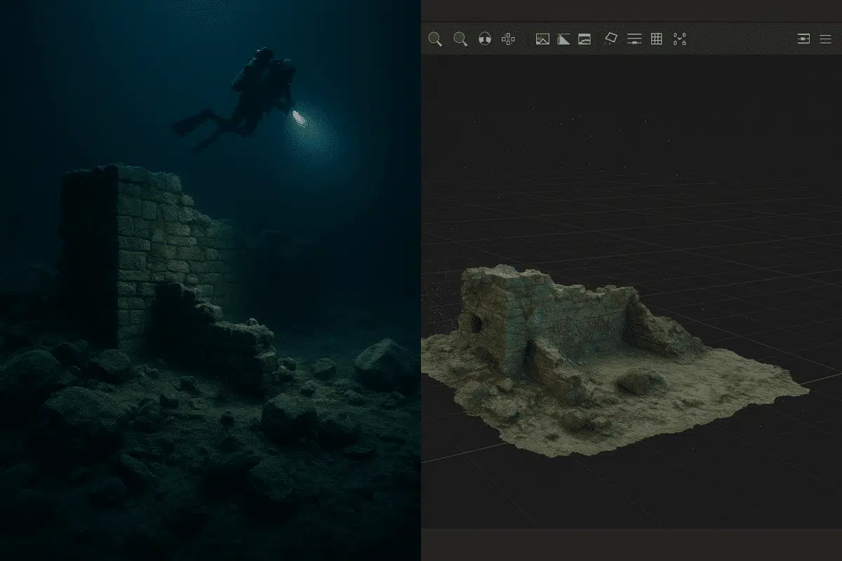
Photogrammetry in underwater or low-light environments presents unique challenges—from motion blur to color distortion and poor contrast. However, with the right techniques, Agisoft Metashape can still generate high-quality 3D models from images captured in these conditions. This article offers a practical guide to optimizing your workflow for underwater and low-light image processing using Metashape. Challenges […]
Author Archives: admin
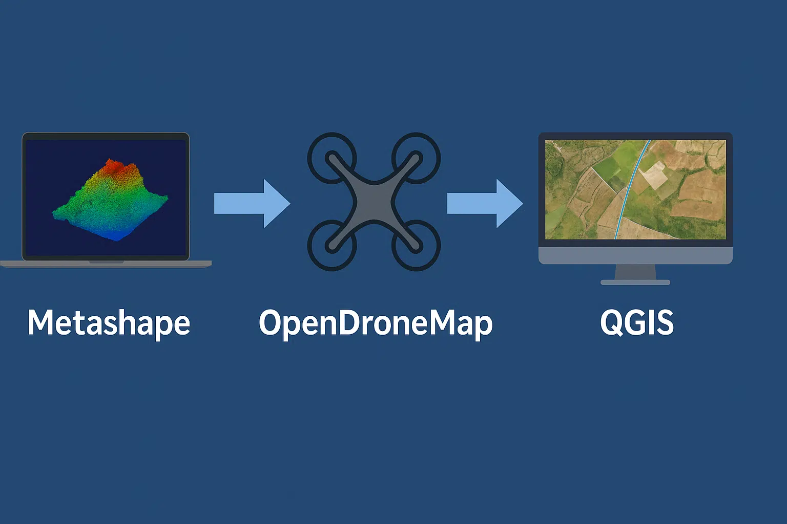
Combining Agisoft Metashape, OpenDroneMap, and QGIS offers professionals a powerful, cost-effective pipeline for drone-based GIS mapping and analysis. Whether you’re in surveying, agriculture, or environmental research, this hybrid workflow enables the creation of georeferenced 3D models, orthomosaics, and vector maps—all with free or low-cost tools. Here’s how to set up a full GIS workflow using […]

Agisoft Metashape is widely known for its ability to produce high-resolution 3D models from drone or DSLR photos. But did you know you can also turn these outputs into 3D printable models? Whether you’re creating architectural miniatures, archaeological replicas, or just fun terrain prints, Metashape can be a key part of your workflow. In this […]

Agisoft Metashape allows users to create highly detailed 3D models by combining both aerial and terrestrial (ground-level) photos. This hybrid approach is especially useful when modeling buildings, archaeological sites, industrial areas, or any structure where drone and DSLR images offer complementary perspectives. In this article, you’ll learn how to integrate both types of imagery into […]

Agisoft Metashape has emerged as a powerful tool in the mining and quarrying industry, thanks to its ability to turn drone images into precise 3D models and geospatial data. From calculating extraction volumes to monitoring topographic changes, Metashape helps professionals increase accuracy and efficiency across operations. In this article, we explore how to use Metashape […]

The dense cloud is a critical step in Agisoft Metashape’s photogrammetry pipeline. But when things go wrong—such as holes, noise, or poor alignment—the quality of your final 3D model or orthomosaic suffers. In this guide, we’ll walk through common dense cloud issues in Metashape and show you how to troubleshoot and fix them for better […]

Efficient and accurate forest inventory is essential for sustainable forestry, biodiversity monitoring, and combating deforestation. Traditionally, it required field crews to manually count and measure trees—a time-consuming and labor-intensive task. But today, thanks to drone photogrammetry and artificial intelligence (AI), forest monitoring can be dramatically streamlined. In this article, we explore how Agisoft Metashape, combined […]

Creating orthomosaics is one of the most powerful features of Agisoft Metashape. An orthomosaic is a geometrically corrected image composed from multiple aerial photos, where distortions from camera angle and terrain have been removed. This tutorial walks beginners through the full workflow—from importing images to exporting the final orthophoto. What is an Orthomosaic? An orthomosaic […]
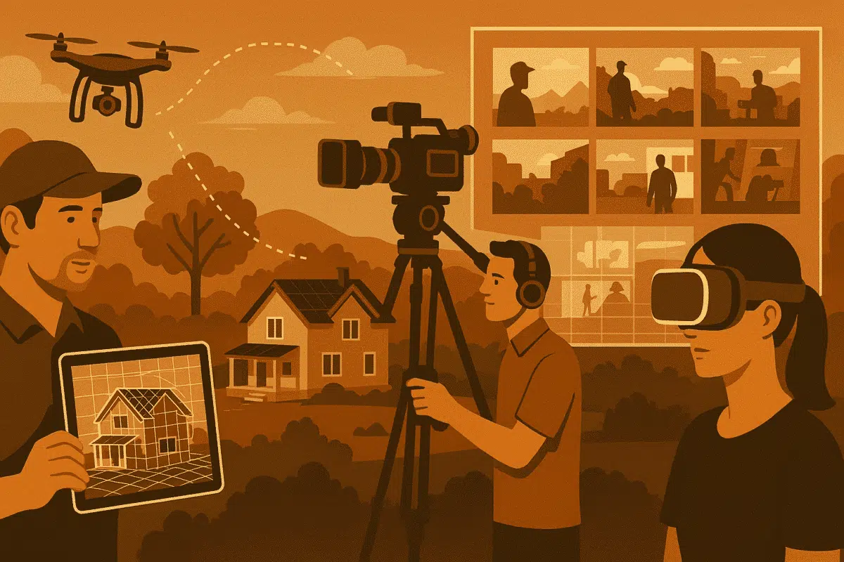
In 2025, film professionals are under increasing pressure to streamline pre‑production workflows, reduce on‑site logistics, and improve visual accuracy. Agisoft Metashape—an industry‑leading photogrammetry software—has emerged as a powerful tool for film location scouting and previz (previsualization). By converting an array of photographs into high‑fidelity 3D models, Metashape enables directors, production designers, and location managers to […]
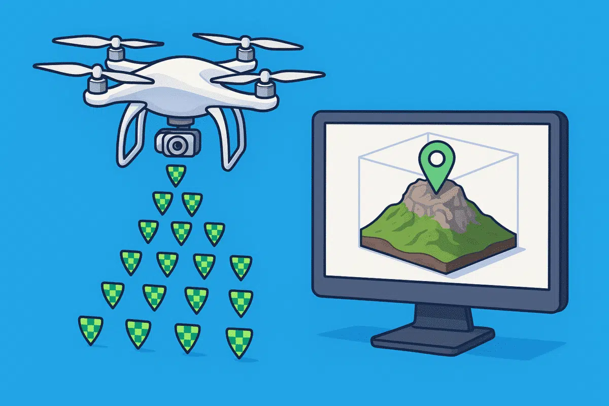
Agisoft Metashape is a powerful photogrammetry tool, and when combined with RTK (Real-Time Kinematic) or PPK (Post-Processed Kinematic) drones, it delivers centimeter-level accuracy in 3D models and orthomosaics. Whether you’re mapping for surveying, agriculture, or construction, integrating geotagged imagery properly is key. In this guide, you’ll learn how to import RTK/PPK photos into Metashape, fine-tune […]