Photogrammetry software such as Agisoft Metashape allows professionals to generate highly detailed 3D models from photographs captured by drones, cameras, or smartphones. These models are widely used in fields such as surveying, cultural heritage documentation, construction monitoring, and digital twin creation. However, many projects require more than just generating a 3D model. Often the goal […]
Author Archives: admin
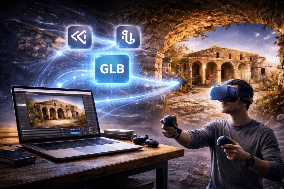
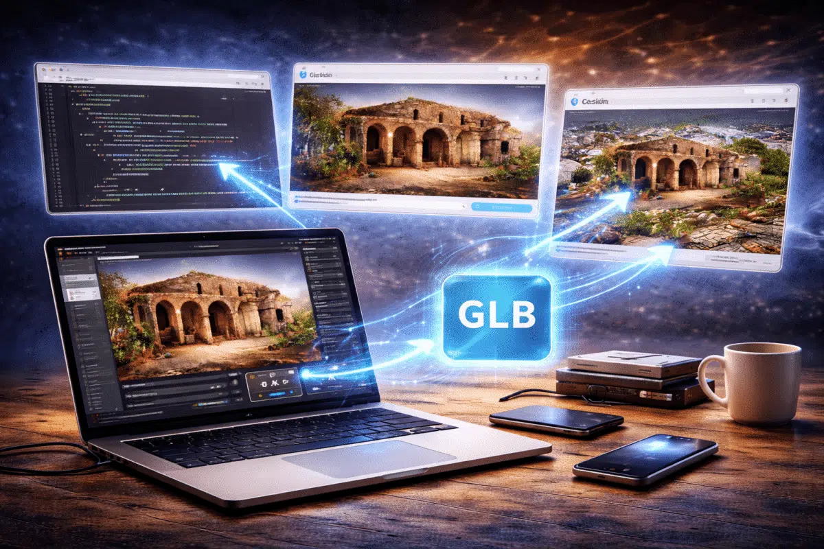
Photogrammetry has revolutionized the way we capture and reconstruct real-world environments. Using software such as Agisoft Metashape, professionals can generate highly detailed 3D models from photographs taken by drones, cameras, or smartphones. While these models are often used for surveying, documentation, and research, they can also be transformed into immersive virtual reality (VR) experiences. VR […]
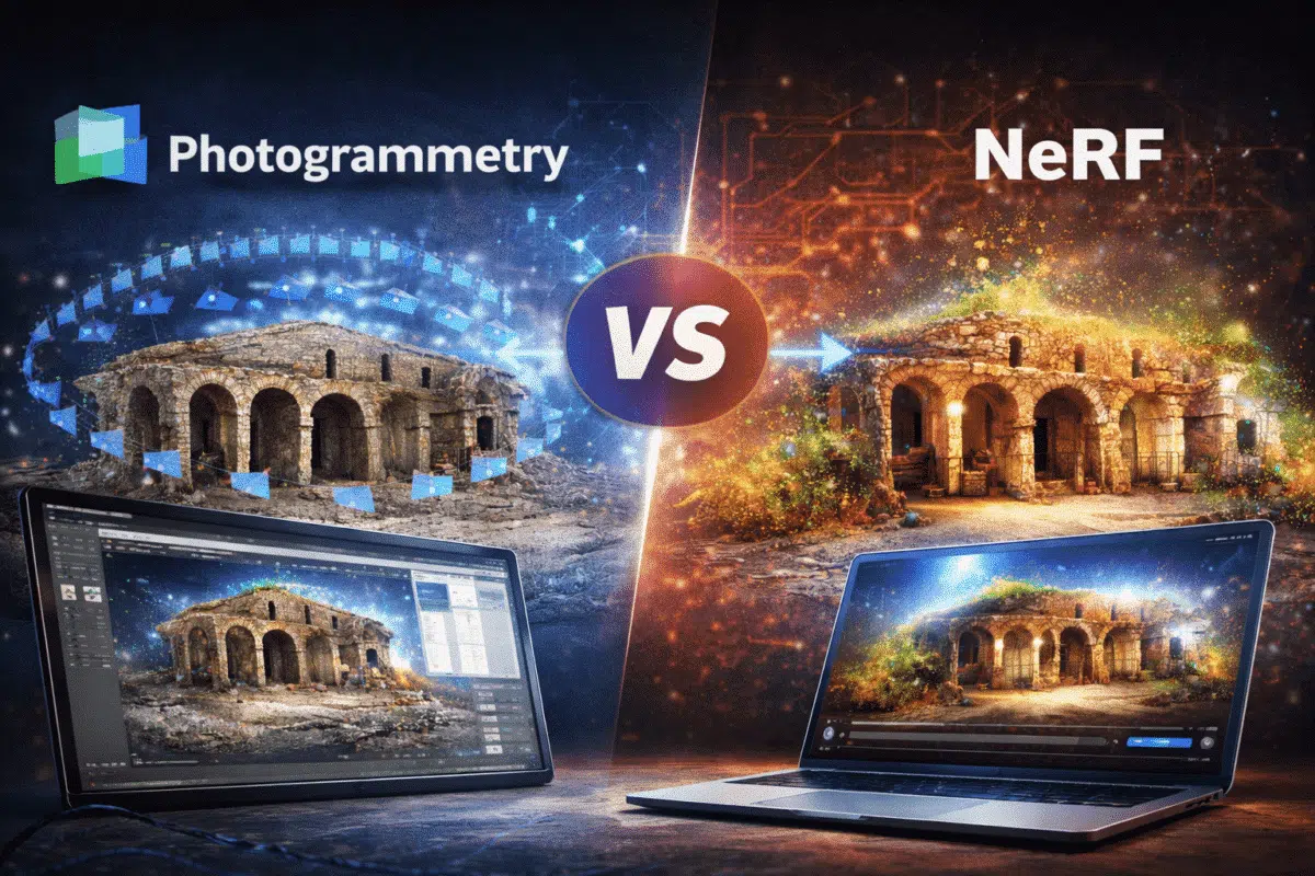
3D reconstruction technologies have evolved significantly over the past decade. Traditional photogrammetry software such as Agisoft Metashape has become a standard tool for generating accurate 3D models from photographs captured by drones, cameras, or smartphones. Recently, a new technology called Neural Radiance Fields (NeRF) has gained attention within the computer vision and artificial intelligence communities. […]

Photogrammetry has become one of the most powerful technologies for generating 3D models from images. Software such as Agisoft Metashape allows users to reconstruct detailed point clouds, meshes, and textured models from photographs captured by drones, cameras, or smartphones. However, one common challenge in photogrammetry workflows is the presence of noise and unwanted artifacts within […]
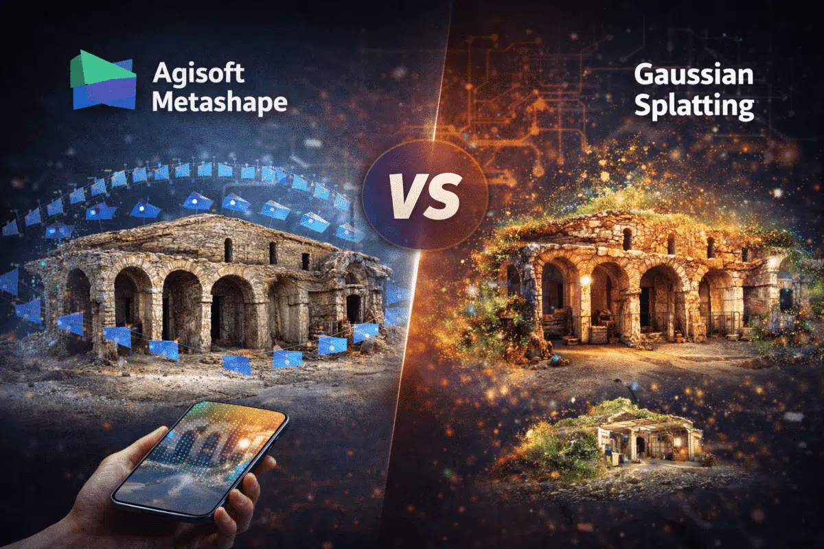
3D reconstruction technologies are evolving rapidly. For more than a decade, photogrammetry software such as Agisoft Metashape has been widely used to generate accurate 3D models from photographs captured by drones, cameras, and mobile devices. However, a new technology has recently emerged in the computer vision community: Gaussian Splatting. This innovative technique promises real-time rendering […]
In recent years, modern smartphones have evolved from simple photography devices into powerful 3D scanning tools. Several high-end mobile devices, including Apple’s iPhone Pro models and some advanced tablets, now include built-in LiDAR sensors capable of capturing depth information in real time. While smartphone LiDAR scans alone can generate quick 3D models, their geometric accuracy […]
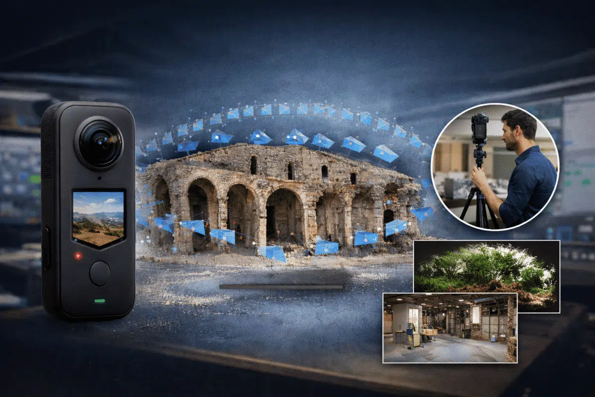
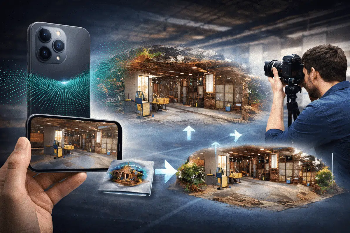
Photogrammetry workflows traditionally rely on DSLR cameras, mirrorless cameras, or drone imagery captured with nadir and oblique angles. However, a new approach is gaining attention among professionals working in digital documentation, indoor mapping, and digital twin creation: the use of 360° cameras for photogrammetry. Modern spherical cameras such as the Insta360 series, GoPro Max, or […]
When a new version of Agisoft Metashape is released, most discussions focus on the list of new features. While this is useful, professional users are usually more interested in a different question: how does this update change daily work in real projects? Agisoft Metashape 2.3 is not just an incremental update, but a version that […]

Satellite imagery has become an essential data source for large-scale mapping, environmental monitoring, urban planning, and geospatial analysis. While photogrammetry is traditionally associated with drone or aerial photography, modern photogrammetric software is increasingly capable of handling satellite images with impressive results. includes dedicated tools and workflows that allow users to process satellite imagery and generate orthomosaics, […]
Agisoft Metashape 2.3 introduces a powerful new utility for texture refinement: the Texture Editing Tool, also known as Assign Image. This addition expands the flexibility of texture workflows by allowing users to manually select specific images to influence defined portions of a texture map. Whether you’re fixing problem areas or improving visual consistency, this tool […]