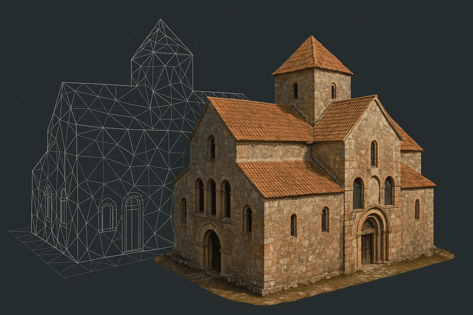
High-quality textures are essential for 3D models intended for WebGL, VR, and real-time rendering. In Agisoft Metashape, optimizing texture quality involves a careful combination of capture strategy, mesh preparation, and export settings. This guide will show you how to get the most photorealistic textures from your photogrammetry workflows. Why Texture Quality Matters in 3D Visualization […]
Author Archives: admin
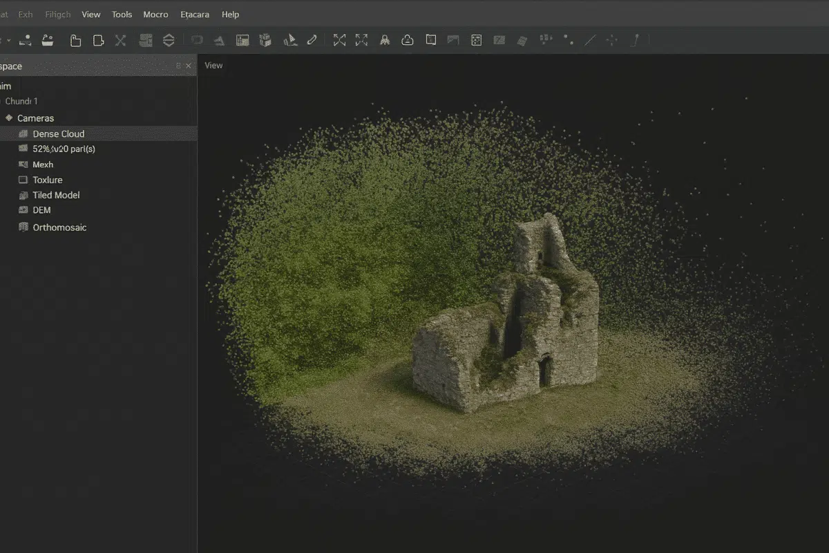
When working with Agisoft Metashape, one of the most common issues after generating a dense point cloud is the presence of noise — unwanted points that can degrade model accuracy and appearance. Whether you’re mapping urban environments or natural terrain, learning to clean noisy point clouds in Metashape is essential for creating high-quality outputs. What […]

Reverse engineering physical objects into editable CAD models is invaluable in manufacturing, product design, and quality control. By combining photogrammetry with Agisoft Metashape’s powerful processing engine, you can generate accurate meshes from photographs and convert them into parametric CAD geometry. This guide walks you through the end-to-end workflow: from capture to Metashape processing, mesh cleanup, […]
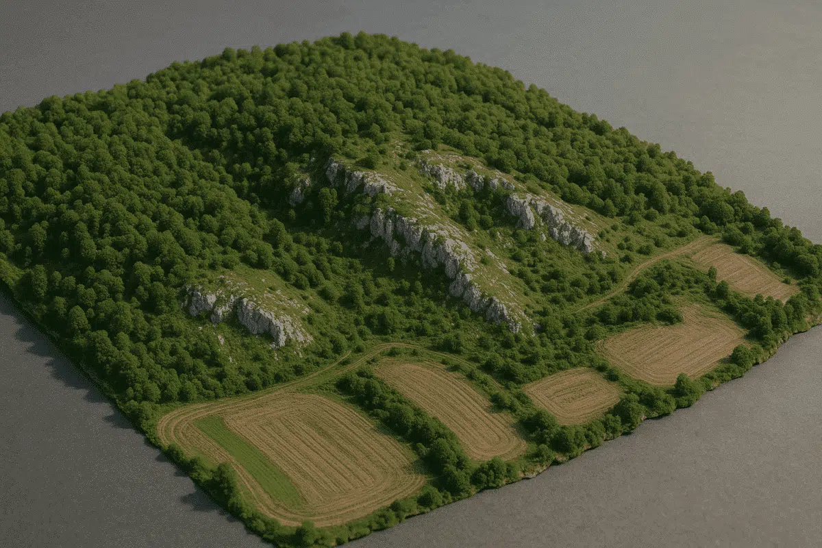
Agisoft Metashape has become a trusted tool for environmental scientists and geospatial professionals working in monitoring ecosystems, assessing land deformation, and detecting changes in terrain over time. Thanks to its high-precision photogrammetric engine, Metashape allows for the generation of accurate 3D models, orthophotos, and elevation data that can be compared across time to reveal subtle […]
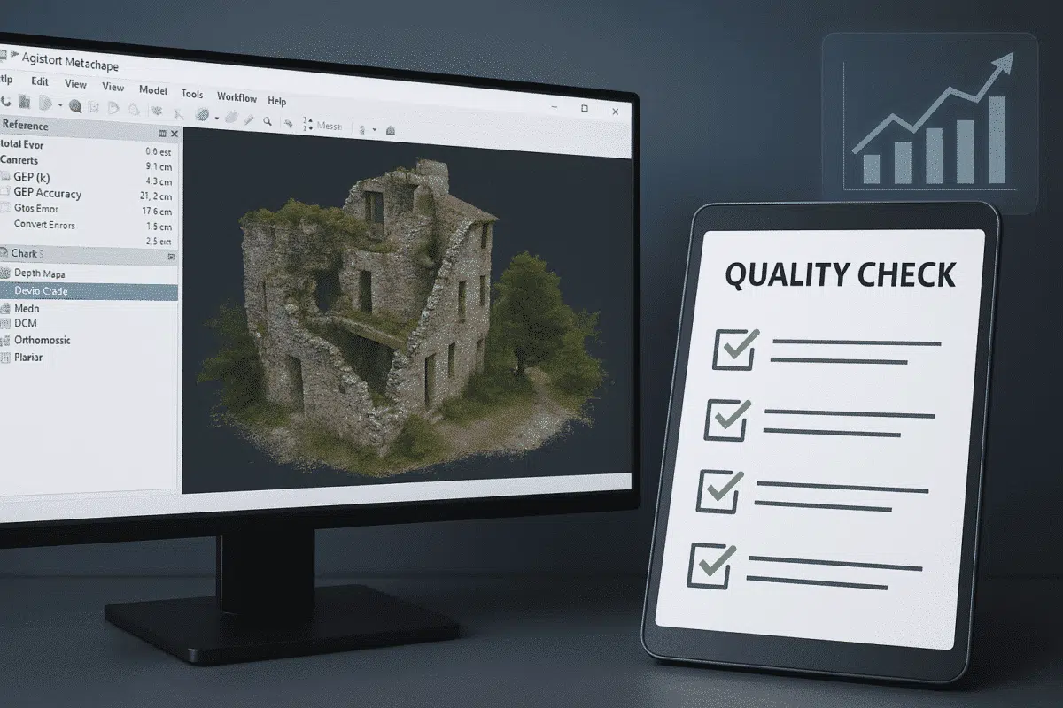
Agisoft Metashape is a powerful tool for generating accurate 3D models, orthophotos, and point clouds from images. But even the best photogrammetry workflow can yield poor results if quality control is ignored. In this guide, you’ll learn how to perform essential quality checks in Metashape to ensure your projects meet professional standards. Why Quality Checks […]
In the world of photogrammetry and 3D modeling, professionals often need not only to process data but also to present and share it in an accessible way. That’s where Agisoft Viewer comes in. This lightweight and free application developed by Agisoft allows users to open, navigate, and inspect 3D models, orthophotos, DEMs, and point clouds […]
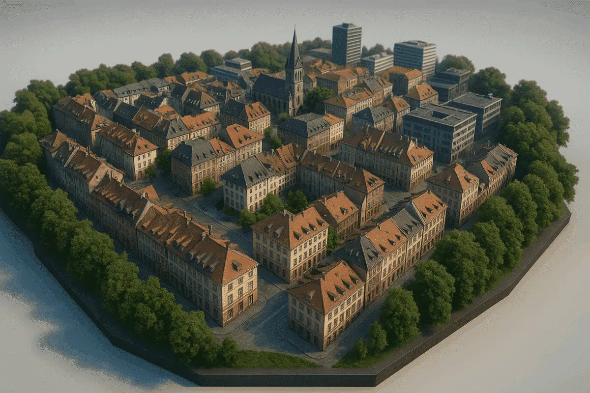
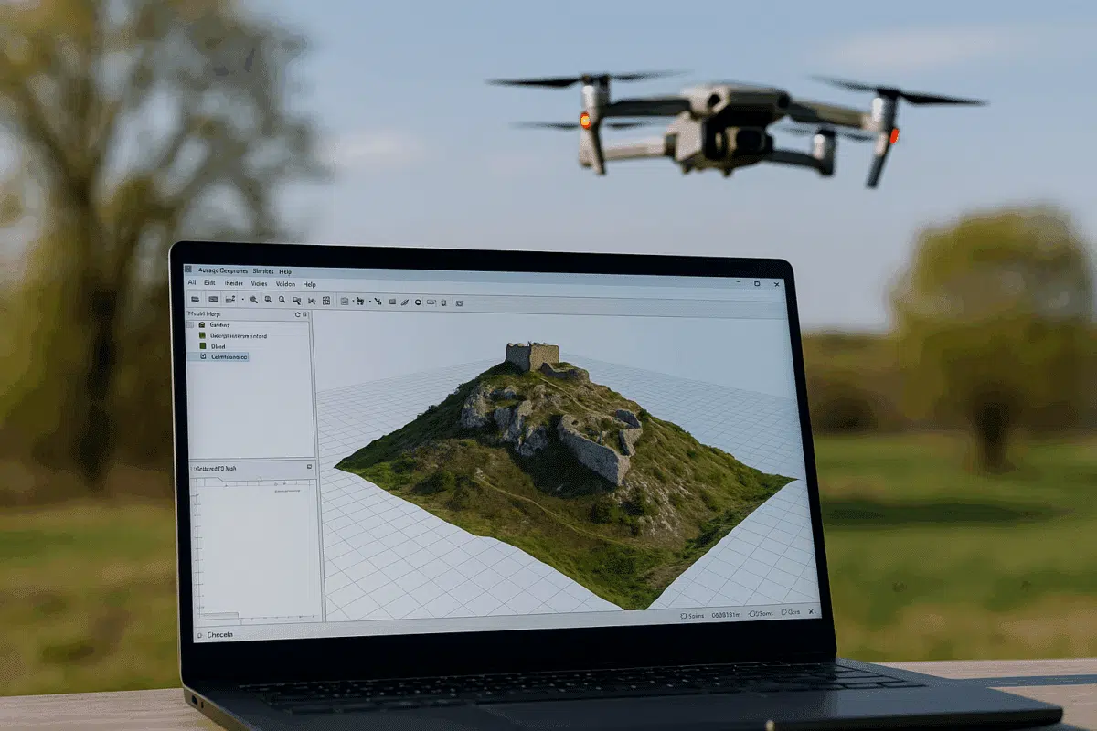
Creating realistic and accurate 3D city models has become more accessible thanks to advancements in drone photogrammetry and software like Agisoft Metashape. Whether you’re working in urban planning, architecture, or smart city development, a 3D reconstruction of cityscapes can provide invaluable spatial data. This article will guide you through the key steps and best practices […]
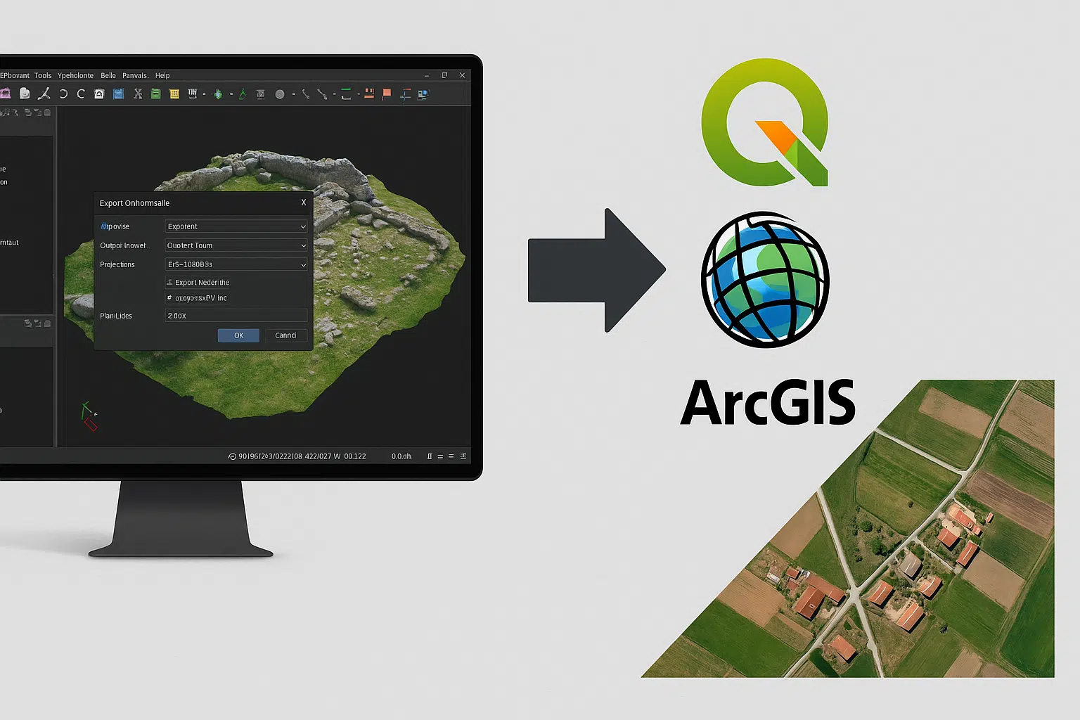
Agisoft Metashape is a powerful tool for photogrammetry, but its true value often emerges when exporting data to GIS platforms like QGIS and ArcGIS. Whether you’re working on land surveys, environmental analysis, or urban planning, exporting orthophotos and georeferenced maps properly ensures your data is usable in professional GIS workflows. In this article, we’ll walk […]

Digital twins are virtual representations of real-world assets that mirror their physical counterparts in real-time using data from sensors, cameras, and other inputs. With Agisoft Metashape, you can create highly accurate 3D models from drone or terrestrial imagery, forming the visual foundation of a digital twin. When combined with IoT (Internet of Things) sensors, these […]
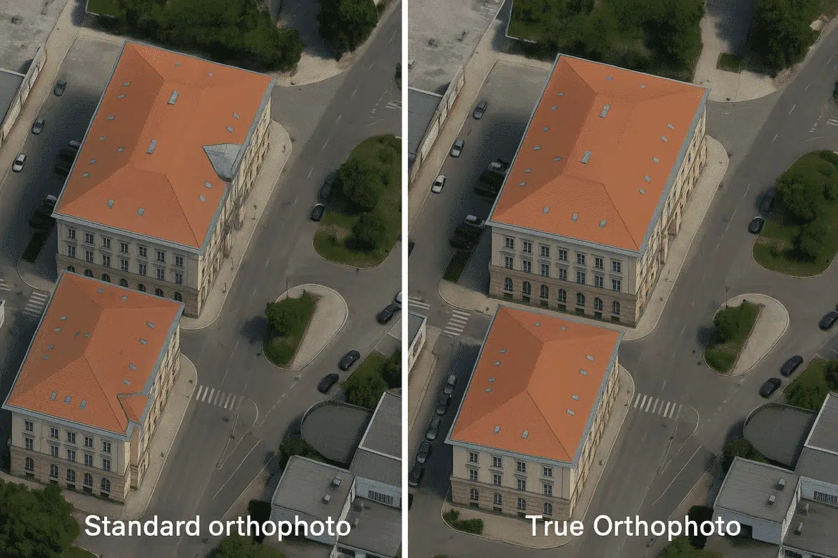
Agisoft Metashape is a powerful photogrammetry software used to generate high-resolution orthophotos, but standard orthophotos often suffer from one common issue in urban areas: building lean. This distortion occurs when tall structures appear tilted in the image due to off-nadir perspectives. In this guide, you’ll learn how to produce true orthophotos in Metashape by correcting […]