

 Italiano
 Français
 Deutsch
 Español
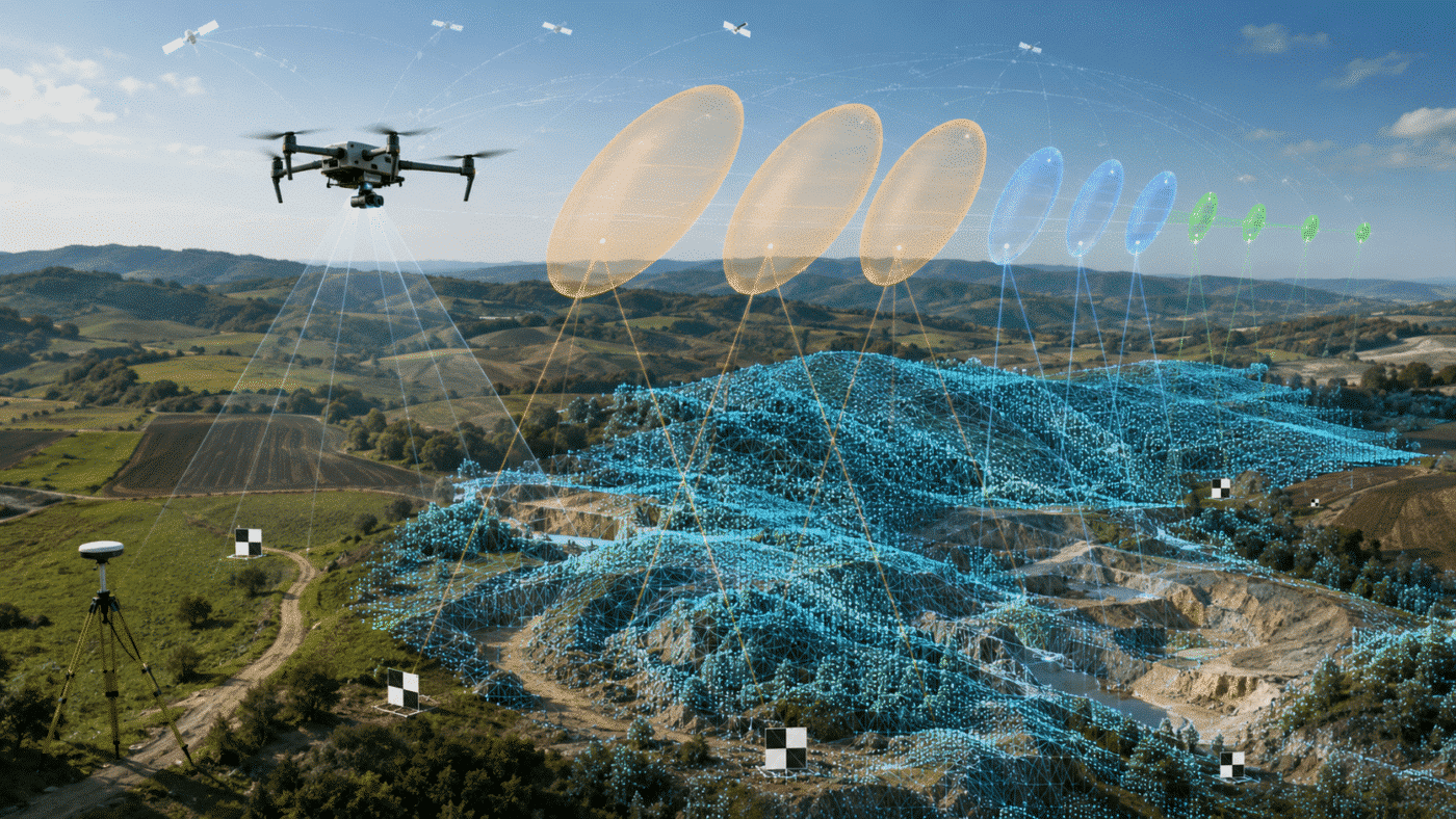
Camera accuracy settings in Agisoft Metashape determine how strongly the software should trust the reference coordinates assigned to each image. They are not a requested output accuracy and they do not magically convert ordinary GPS coordinates into centimetre-level data. They describe the expected uncertainty of the measurements used during bundle adjustment.
Choosing values that are too optimistic can force the model toward inaccurate coordinates and distort the adjustment. Values that are too loose may prevent good RTK, PPK or Ground Control Point data from contributing effectively. This guide explains how to configure camera and marker accuracy for consumer GPS, RTK, PPK and GCP workflows in Agisoft Metashape Professional.
Contents
Metashape Camera Accuracy Settings: Quick Answer
Use the actual uncertainty supplied by the GNSS processing report, drone metadata or survey method whenever it is available. For supported DJI RTK imagery, enable loading of camera-location accuracy from XMP metadata before adding the photos. Do not replace per-image values with a generic centimetre value unless you have verified that every image has an equivalent solution quality.
| Reference source | Practical starting accuracy | Important qualification |
|---|---|---|
| Ordinary drone or camera GPS | Approximately 5–10 m XY and 10–20 m Z | Use documented device performance when available; do not claim survey accuracy |
| Verified RTK FIX camera coordinates | Often around 0.01–0.03 m XY and 0.02–0.05 m Z | Prefer the accuracy recorded for each image in XMP or the manufacturer’s processing output |
| RTK FLOAT camera coordinates | Often 0.10–0.50 m or worse | Do not assign FIX accuracy; inspect solution status and baseline conditions |
| Quality-controlled PPK camera coordinates | Often around 0.02–0.05 m XY and 0.03–0.10 m Z | Use the PPK report’s estimated standard deviations or covariance information |
| Surveyed GCP with RTK rover | Often around 0.01–0.03 m XY and 0.02–0.05 m Z | Use field quality-control results, occupation method and datum configuration |
| Total-station control | Use the documented network and observation uncertainty | Millimetre-level input is appropriate only when the complete survey network supports it |
These are initial planning ranges, not universal presets. GNSS quality changes with satellite geometry, corrections, baseline length, multipath, antenna calibration, flight dynamics and processing method. A drone showing “RTK” in its name does not prove that every exposure has a FIX solution.
What Does Camera Accuracy Mean in Agisoft Metashape?
After alignment, Metashape estimates the position and orientation of every camera from image matches and available reference observations. The coordinates imported from EXIF, XMP or CSV are measured values. The estimated camera centres are the positions produced by the photogrammetric adjustment.
The camera accuracy setting expresses the expected uncertainty of the measured reference coordinates, normally in metres. Metashape uses the measurements together with their assigned accuracies when optimizing the photogrammetric block. A smaller accuracy value gives that observation more influence; a larger value gives it less influence.
Agisoft’s official aerial workflow explains that coordinate and orientation accuracy must reflect how precisely those values were measured. The general default is intentionally loose for ordinary positioning data. See Aerial Data Processing with GCPs.
Accuracy Is Not the Same as Residual Error
The value entered in the Accuracy column is an input assumption. The Error columns display output residuals: the difference between the adjusted position and the reference observation. Entering 0.02 m does not instruct Metashape to produce a 2 cm map. It tells the adjustment that the coordinate is expected to have approximately that level of uncertainty.
Similarly, a 2 cm camera residual does not prove that every point on the ground is accurate to 2 cm. Ground accuracy must be evaluated with independent check points, suitable distribution and a defined acceptance method. Read Agisoft Metashape Processing Report Explained for a detailed interpretation of camera, GCP and checkpoint RMSE.
XY and Z Accuracy Should Often Be Different
GNSS height is frequently less accurate than horizontal positioning. Metashape allows separate horizontal and vertical values, commonly entered in an XY/Z format or supplied in individual accuracy columns. If the processing report gives 0.02 m horizontal and 0.05 m vertical uncertainty, retain that distinction rather than applying 0.02 m to all three axes.
Camera Rotation Accuracy Is a Separate Setting
Yaw, pitch and roll from a consumer drone are not equivalent to a survey-grade inertial solution. Keep rotation accuracy reasonably loose unless the orientation data comes from a calibrated GNSS/INS system with documented uncertainty. Over-weighted angles can damage a solution that would otherwise be supported well by image geometry.
Recommended Starting Values by Data Source
Standard GPS or Consumer Geotags
Ordinary drone and camera geotags are useful for locating the project, reference preselection and approximate georeferencing, but their errors may reach several metres. Heights can be particularly unreliable. A cautious starting assumption is approximately 5–10 m horizontally and 10–20 m vertically unless the device documentation or field testing supports something better.
Do not set consumer GPS to 0.02 m because the images appear to align correctly. Image alignment can be internally strong while absolute positioning remains inaccurate. If centimetre accuracy is required, add surveyed control or use verified RTK/PPK data and independent check points.
RTK FIX Coordinates
Centimetre-level starting values may be reasonable when each exposure has a valid RTK FIX solution, corrections are reliable and antenna offsets and timestamps are handled correctly. Typical values often fall around 0.01–0.03 m XY and 0.02–0.05 m Z, but the correct choice is the per-image estimate stored by the platform.
For compatible DJI datasets, Agisoft specifically recommends enabling Load camera location accuracy from XMP metadata in Tools → Preferences → Advanced before loading images. This allows Metashape to apply the recorded measurement accuracy rather than one global value. Follow the official DJI RTK coordinates processing workflow.
RTK FLOAT and Mixed-Quality Flights
FLOAT observations must not be weighted like FIX observations. Their uncertainty may be decimetres or greater and can vary substantially throughout the flight. If a project contains FIX, FLOAT and standalone GNSS images:
- load or import per-image accuracy values;
- group or filter images by solution status;
- assign appropriately larger uncertainty to FLOAT and standalone positions;
- disable clearly invalid reference coordinates when necessary;
- retain check points to detect systematic bias.
A single global 0.02 m value applied to a mixed-quality dataset overstates the reliability of many observations and can deform the block.
PPK Coordinates
PPK quality depends on the base data, ephemerides, antenna model, timing, baseline and processing configuration. A well-processed solution may support values around 0.02–0.05 m XY and 0.03–0.10 m Z, but use the uncertainty estimates produced by the PPK software whenever possible.
Do not confuse repeatable results with correct datum configuration. A PPK solution can be internally precise and still have a vertical offset if camera positions, control points and deliverables use different height systems.
Ground Control Points
Marker accuracy should represent the uncertainty of the surveyed coordinates, including the control network and measurement method. RTK-rover control may justify approximately 0.01–0.03 m XY and 0.02–0.05 m Z under good conditions, while total-station control can be tighter when the complete survey network supports it.
Do not assign 0.001 m merely because Metashape accepts the value. A one-millimetre accuracy assumption is inappropriate for a point measured with centimetre-level GNSS. It gives the marker excessive weight and may encourage camera calibration or model geometry to absorb field-survey errors.
For point roles, quantity and distribution, see GCP vs Check Points in Agisoft Metashape.
How to Set Camera Accuracy in Metashape
Method 1: Load Accuracy from XMP Metadata
- Open Tools → Preferences → Advanced.
- Enable Load camera location accuracy from XMP metadata.
- Add the RTK images to the project.
- Open the Reference pane and display the accuracy columns.
- Check that the imported values vary plausibly and match the flight’s solution quality.
Enable the option before importing the photographs. If the images were already added without accuracy metadata, reload the reference data or re-add them in a controlled duplicate project and verify the result.
Method 2: Import Per-Image Accuracy from CSV
If the GNSS or PPK processor exports position and uncertainty columns, import them using the Reference pane. Map the filename, X, Y, Z and accuracy fields carefully. Confirm the delimiter, coordinate order, units and coordinate reference system.
Per-image values are preferable when solution quality changes during the flight. They prevent a few weaker observations from receiving the same weight as high-quality FIX positions.
Method 3: Apply a Global Accuracy Value
- Open the Reference pane.
- Click Settings.
- Confirm the camera coordinate system.
- Enter horizontal and vertical camera accuracy values supported by the data source.
- Click Update after changing reference information.
A global value is appropriate only when the coordinates have reasonably uniform quality. Document the source of the assumption in the processing report or project notes.
Method 4: Modify Selected Cameras
Select a group of images in the Reference pane and use Modify to update their accuracy. This is useful when the flight contains identifiable FIX, FLOAT and uncorrected sections. Preserve the original project or duplicate the chunk before making major weighting changes.
Reference Preselection and Camera Accuracy Are Not the Same Thing
Reference preselection uses camera coordinates to identify likely overlapping image pairs during matching. Camera accuracy controls the weight of those coordinates during adjustment. Enabling Source preselection does not automatically set RTK accuracy, and changing camera accuracy does not repair incorrect coordinates used for pair selection.
If coordinates are only approximate, Generic preselection may be safer than relying exclusively on their positions. Agisoft’s official aerial processing workflow without GCPs notes that Source preselection is not recommended when image coordinates are not measured with centimetre accuracy.
Practical Workflows for Different Survey Types
| Workflow | Camera weighting | Control and validation | Main risk |
|---|---|---|---|
| Consumer GPS only | Loose, normally metres | Add GCPs and check points for accurate mapping | False assumption of absolute accuracy |
| RTK/PPK without GCPs | Per-image XMP or processed uncertainty | Independent check points strongly recommended | GNSS bias, height datum or mixed solution status |
| Consumer GPS plus GCPs | Keep camera coordinates loose or disable them during marker-led optimization when appropriate | Use well-distributed GCPs and reserve check points | Over-weighting poor camera positions against accurate control |
| RTK/PPK plus limited GCPs | Retain verified camera uncertainty | Use control to detect or correct bias; preserve independent checks | Conflicting datums, offsets or unrealistic accuracy assumptions |
Consumer GPS Plus Surveyed GCPs
When marker coordinates are much more accurate than camera geotags, allow the control to lead the adjustment. Keep consumer camera positions loose or, in a duplicated test chunk, disable their coordinate checkboxes during final marker-based optimization. Agisoft notes that optimizing from precise markers alone can be reasonable when GCP coordinates are significantly more accurate than the camera GPS.
RTK or PPK Without GCPs
Load per-image accuracies, align the photographs, inspect camera residuals and optimize the calibration deliberately. Agisoft notes that Fit additional corrections may help some RTK/PPK datasets without GCPs when the standard Brown camera model does not describe remaining effects adequately. It should be tested and validated, not enabled blindly.
Use independent check points to verify the output. If the camera residuals are small but checkpoint errors are large, investigate the reference system, antenna offset, GNSS bias, timing and calibration instead of simply tightening the accuracy setting.
RTK or PPK with GCPs
This workflow provides useful redundancy. Camera coordinates stabilize the block, while limited GCPs can reveal or correct systematic bias. Preserve separate check points so the final result is still independently validated. Our RTK/PPK workflow for Metashape and DJI RTK coordinate processing guide provide detailed processing steps.
What Happens When Accuracy Values Are Wrong?
| Symptom | Likely cause | Recommended action |
|---|---|---|
| Model bends to fit camera positions | Camera accuracy is too optimistic or coordinates contain bias | Verify metadata and offsets; increase uncertainty to a defensible value |
| Large camera residuals despite RTK FIX | Datum, geoid, lever-arm, timestamp, bias or calibration problem | Diagnose the systematic cause before changing weights |
| Good camera residuals but poor check points | Reference observations agree internally but the product is biased or deformed | Audit check points, CRS, block geometry and calibration |
| GCPs appear to have little influence | Marker accuracy is too loose or camera positions are excessively tight | Use measurement-supported accuracies for both observation groups |
| Some cameras show much larger errors | Mixed FIX/FLOAT status, bad metadata or weak flight segment | Inspect and modify individual camera accuracies |
| Nearly constant vertical offset | Ellipsoidal versus orthometric height mismatch or GNSS bias | Correct the height reference; do not hide it with looser accuracy |
Accuracy Settings Cannot Repair a Wrong Coordinate System
If the cameras, markers and output use incompatible coordinate or height systems, increasing the accuracy value only reduces the influence of the bad data; it does not correct the reference problem. Agisoft explains that Metashape reads DJI altitude metadata without automatically repairing invalid height information. See Possible Causes of Large Altitude Errors with DJI Images.
For a constant Z displacement, read Why Is My RTK Drone Model Vertically Shifted? and our Metashape geoid workflow.
A Reliable Adjustment and Validation Procedure
- Preserve the original data. Duplicate the chunk before major reference or optimization experiments.
- Verify the coordinate systems. Confirm camera, marker, chunk and vertical references.
- Inspect solution status. Separate FIX, FLOAT and uncorrected images.
- Load measurement-based accuracies. Prefer per-image XMP or CSV values over global assumptions.
- Align and review coverage. Check unaligned images, components and tie-point distribution.
- Inspect camera residuals spatially. Look for clusters, flight-line patterns and systematic X, Y or Z bias.
- Configure GCPs and check points. Use realistic marker uncertainty and exclude validation points from optimization.
- Optimize camera parameters deliberately. Follow our guide to camera optimization parameters in Metashape.
- Compare test chunks. Evaluate different justified weighting strategies without overwriting the original solution.
- Validate independently. Report checkpoint XY and Z RMSE, maximum residual, point count and distribution.
Use the complete Metashape photogrammetry quality-control checklist before exporting final deliverables.
Frequently Asked Questions
What is the default camera accuracy in Metashape?
Agisoft’s current aerial workflow states that the general defaults for camera reference observations are 10 m for coordinates and 10 degrees for orientation. Replace them only with values supported by the actual measurement method or imported metadata.
Should I set every RTK image to 0.02 m?
No. Use per-image XMP or processed accuracy whenever available. A global 0.02 m value is defensible only if the complete dataset has verified, reasonably uniform FIX quality at that level.
What accuracy should I use for RTK FLOAT images?
Use the uncertainty estimated for those observations, often decimetres or worse. Never apply FIX-level weighting. If reliable estimates are unavailable, use a conservative value or disable clearly unreliable reference positions and validate the consequences.
Does reducing camera accuracy improve the final accuracy?
Not automatically. A smaller number gives the reference coordinates more weight. If those coordinates contain bias, the adjusted model may become worse even though it fits the camera references more closely.
Should marker accuracy equal camera accuracy?
No. Each accuracy should represent its own measurement source. Surveyed GCPs can be much more accurate than consumer GPS camera positions, while verified RTK/PPK camera coordinates may approach the quality of some ground-control measurements.
Why is Z accuracy worse than XY?
GNSS vertical positioning is commonly weaker than horizontal positioning, and height-datum errors add another risk. Use separate XY and Z uncertainty and verify ellipsoidal versus orthometric heights.
Can low camera residuals replace check points?
No. Camera coordinates participate in the adjustment when enabled. Independent check points provide a stronger test of final ground accuracy because their coordinates are excluded from optimization.
Conclusion
The best Metashape camera accuracy setting is not the smallest value you can enter. It is the value that honestly represents the uncertainty of the source observation. Use per-image accuracy for variable RTK/PPK solutions, keep consumer GPS loose, distinguish horizontal and vertical uncertainty, and assign GCP accuracy from the real survey method.
Finally, validate the result rather than trusting the input labels. A FIX status, a 2 cm setting or a low camera residual does not independently prove product accuracy. Check points, a correct coordinate reference system and a documented processing report turn the adjustment into a defensible professional workflow.
To process RTK, PPK and GCP-controlled surveys with advanced reference tools, explore Agisoft Metashape Professional Edition or visit the downloads page.
