

 Italiano
 Français
 Deutsch
 Español
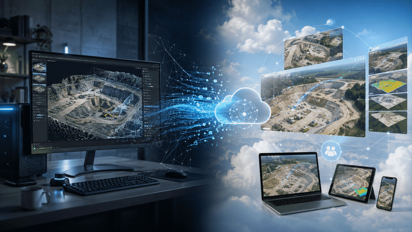
Choosing between Agisoft Metashape and DroneDeploy is not simply a question of which software can create the best drone map.
Both platforms can transform aerial imagery into professional geospatial products such as orthomosaics, elevation models, point clouds and 3D models, but they approach the workflow from very different directions.
Agisoft Metashape Professional is primarily a desktop photogrammetry platform that gives users extensive control over image processing, camera calibration, Ground Control Points, coordinate systems, point clouds, DEMs, multispectral imagery and automation.
DroneDeploy is primarily a cloud-based reality capture platform designed to connect drone flight planning, cloud processing, site visualization, measurements, collaboration and project management.
So when comparing Agisoft Metashape vs DroneDeploy, the best choice depends heavily on whether your priority is advanced photogrammetric control or a streamlined cloud workflow for teams.
Agisoft Metashape vs DroneDeploy: Quick Comparison
| Feature | Agisoft Metashape Professional | DroneDeploy |
|---|---|---|
| Photogrammetry processing | Yes | Yes |
| Primary processing model | Desktop / local / Cloud | Cloud |
| Orthomosaic generation | Yes | Yes |
| Point clouds | Yes | Yes |
| 3D models | Yes | Yes |
| DEM / elevation models | Yes | Yes |
| GCP support | Yes | Yes |
| RTK / PPK workflows | Yes | Yes |
| Advanced camera calibration control | Extensive | More automated |
| Point cloud editing / classification | Extensive | More workflow-oriented |
| Multispectral processing | Advanced | Available for supported workflows |
| Python API | Yes | Different cloud/API approach |
| Team collaboration | Limited compared with cloud platforms | Major strength |
| Flight planning | Specialized mission-planning tools | Integrated drone capture workflow |
| Internet required for processing | No for local processing | Cloud workflow requires connectivity for upload/processing |
| License model | Perpetual options | Subscription-based platform |
The Fundamental Difference: Desktop Photogrammetry vs Cloud Reality Capture
The biggest difference between Metashape and DroneDeploy is not the final orthomosaic. It is where processing happens and how much control the user has over it.
Agisoft Metashape is installed directly on a Windows, macOS or Linux workstation. The photographs can remain on your own computer, storage server or local network, and processing is performed using your own CPU, GPU and RAM.
This gives experienced photogrammetrists direct control over nearly every stage of the reconstruction.
DroneDeploy takes a different approach. Images are uploaded to its cloud platform, where processing is largely automated. The resulting map can then be viewed, measured, annotated and shared through a web-based environment.
For project managers and distributed teams, this can significantly simplify access to drone data.
Photogrammetry Processing Control
This is one of the areas where Agisoft Metashape Professional stands out.
Metashape provides detailed control over:
- Photo alignment
- Tie points
- Camera calibration
- Camera optimization
- Depth maps
- Point cloud generation
- Point cloud classification
- Mesh generation
- DEM and DTM generation
- Orthomosaic generation
- Coordinate systems
- Vertical datums
- Raster calculations
This level of control is particularly valuable when processing unusual datasets, troubleshooting accuracy problems or developing workflows that cannot be handled effectively by a highly automated processing pipeline.
DroneDeploy intentionally automates more of the photogrammetric process.
This can make the workflow faster and easier for users who want to upload a drone survey and receive usable site maps without manually configuring numerous photogrammetric parameters.
Ground Control Points, RTK and PPK
Both platforms support professional georeferencing workflows.
Metashape Professional provides extensive tools for:
- Ground Control Points
- Checkpoints
- RTK camera coordinates
- PPK coordinates
- Camera accuracy values
- Marker accuracy
- EPSG coordinate systems
- Geoid and vertical datum configuration
This makes Metashape particularly attractive when precise control of the coordinate system or adjustment process is required.
DroneDeploy also supports GCPs, checkpoints and RTK/PPK processing and provides dedicated high-accuracy mapping workflows.
For users who prefer a guided cloud workflow rather than manually managing photogrammetric adjustment parameters, DroneDeploy can therefore provide a simpler experience.
Point Clouds, DSMs and DTMs
Metashape Professional provides extensive point cloud editing and classification tools.
Users can classify ground points, manually edit classifications and generate either:
- Digital Surface Models (DSM)
- Digital Terrain Models (DTM)
This is especially useful for surveying, mining, forestry, construction and earthworks.
DroneDeploy also creates elevation models and point cloud products and includes tools for site measurements and volumetric analysis.
The key difference is again workflow philosophy: Metashape provides more direct access to the photogrammetric reconstruction, while DroneDeploy focuses more heavily on making the processed result immediately usable across a project team.
Stockpile and Earthworks Measurements
Both platforms can support volume calculations.
In Metashape, the user can create a DEM, draw a polygon and calculate volume relative to a Best Fit, Mean Level or Custom reference surface.
Multiple DEMs can also be compared to calculate terrain changes between surveys, making Metashape useful for cut-and-fill analysis and recurring earthworks monitoring.
DroneDeploy provides cloud-based volumetric and earthworks tools, allowing measurements to be performed directly on processed maps.
For construction teams that want project managers and field personnel to access volume information through a browser rather than opening photogrammetry software, this can be a significant advantage.
Team Collaboration: DroneDeploy’s Major Strength
DroneDeploy has a clear advantage when the objective is to make reality-capture information available across an organization.
Processed maps and site data can be accessed through the cloud platform rather than remaining primarily on a photogrammetrist’s workstation.
This makes it easier for:
- Project managers
- Engineers
- Site supervisors
- Owners
- Remote stakeholders
- Construction teams
to review current site conditions without learning professional photogrammetry software.
DroneDeploy also integrates with construction and project-management ecosystems such as Autodesk Construction Cloud and Procore.
For organizations where drone mapping is part of a larger site-documentation workflow, collaboration can therefore be more important than detailed control over every photogrammetric parameter.
Offline Processing and Data Control
For organizations working with sensitive datasets, remote locations or restricted networks, local processing can be an important requirement.
Metashape can process photographs directly on the user’s workstation without uploading the project imagery to a third-party cloud processing platform.
This can be useful for:
- Government projects
- Restricted infrastructure
- Air-gapped environments
- Research laboratories
- Remote field operations
- Organizations with strict data policies
Metashape also supports optional network and cloud processing, so desktop processing is not its only deployment model.
DroneDeploy’s core advantage, however, comes specifically from its cloud architecture. Uploading imagery and making the results available online is central to the platform’s collaborative workflow.
Hardware: Buy Processing Power or Use the Cloud?
Metashape performance depends heavily on your own hardware.
Large projects can require significant:
- CPU resources
- GPU performance
- RAM
- SSD storage
This means a company using Metashape intensively may need to invest in high-performance workstations or a network-processing environment.
DroneDeploy moves much of that processing workload into the cloud.
The local computer therefore does not need to perform the full photogrammetric reconstruction.
This can be attractive for teams that prefer predictable cloud workflows instead of purchasing and maintaining specialized photogrammetry workstations.
Automation and APIs
Metashape Professional includes a comprehensive Python API and Java bindings.
This allows technically advanced users to automate workflows such as:
- Importing datasets
- Aligning images
- Processing point clouds
- Building DEMs
- Generating orthomosaics
- Batch processing
- Network processing
- Custom quality-control procedures
This makes Metashape particularly attractive for companies developing their own automated photogrammetry pipelines.
DroneDeploy also provides developer APIs, including GraphQL and JavaScript interfaces, particularly for Enterprise integrations.
The emphasis is different: Metashape’s API automates the photogrammetric processing engine itself, while DroneDeploy’s APIs are strongly oriented toward integrating cloud-based reality-capture data and workflows with other systems.
Construction: Which Platform Is Better?
For construction companies, the answer depends heavily on who needs to use the data.
Metashape may be preferable when:
- A dedicated survey or geomatics team processes the imagery.
- Custom coordinate systems are important.
- Detailed point cloud editing is required.
- DTM generation and terrain analysis are important.
- Processing needs to remain local.
- Advanced photogrammetric control is required.
DroneDeploy may be preferable when:
- Many project stakeholders need easy access to current site maps.
- Frequent recurring surveys are performed.
- Cloud collaboration is a priority.
- Construction-management integrations are important.
- The team wants a highly automated processing workflow.
- Reality capture includes more than traditional photogrammetry.
Can You Use Metashape and DroneDeploy Together?
Yes, and this is an important point often overlooked in software comparisons.
The two platforms do not necessarily need to be mutually exclusive.
A company can perform detailed photogrammetric processing in Metashape and then use selected outputs inside a broader cloud workflow.
DroneDeploy supports uploading preprocessed GeoTIFF orthomosaics and elevation models from third-party photogrammetry applications, including Metashape.
This creates an interesting hybrid workflow:
- Process the survey locally in Metashape.
- Apply detailed calibration, GCP and coordinate-system control.
- Export the orthomosaic and DEM.
- Upload the processed GeoTIFFs to DroneDeploy.
- Use DroneDeploy for visualization, collaboration and site measurements.
For some organizations, this provides the best combination of detailed photogrammetric control and cloud-based project access.
Licensing: Perpetual vs Subscription
Licensing philosophy is another major difference.
Agisoft Metashape offers perpetual licensing options.
Metashape Professional is available as:
- Node-Locked License
- Floating License
The license itself is not time-limited.
DroneDeploy operates primarily as a subscription-based cloud platform with different plans for individual users, teams and enterprise organizations.
This means the long-term cost structure is different.
With Metashape, the organization purchases the photogrammetry software license and provides the processing hardware.
With DroneDeploy, the subscription includes access to the cloud platform and associated services according to the selected plan.
Agisoft Metashape vs DroneDeploy: Which Should You Choose?
Choose Agisoft Metashape Professional if:
- You want detailed control over photogrammetric processing.
- You need advanced camera calibration tools.
- You work with complex coordinate systems or vertical datums.
- You need point cloud classification and DTM workflows.
- You process unusual cameras or sensors.
- You require multispectral processing.
- You want Python-based automation.
- You need local or offline processing.
- You prefer perpetual licensing.
Choose DroneDeploy if:
- You want a streamlined cloud-based drone mapping workflow.
- You need maps to be easily accessible across a project team.
- You perform frequent recurring site surveys.
- You need cloud-based measurements and progress tracking.
- You use construction-management integrations.
- You prefer automated processing over manual photogrammetric configuration.
- You want reality capture data centralized in an online platform.
Final Verdict
When comparing Agisoft Metashape vs DroneDeploy, there is no universal winner because the two products solve different parts of the reality-capture workflow.
Metashape is generally the stronger choice when photogrammetric processing itself is the priority. It provides extensive control over camera calibration, tie points, GCPs, coordinate systems, point clouds, DEMs, multispectral imagery and automation.
DroneDeploy is generally stronger when accessibility, automation and cloud collaboration are the priority. It turns drone maps and other reality-capture data into an online environment that can be accessed by a much wider project team.
For surveyors, researchers, geomatics professionals and organizations that want maximum processing flexibility, Agisoft Metashape Professional provides a powerful long-term photogrammetry platform.
For construction and enterprise teams that need frequent site capture and simple distribution of results across many stakeholders, DroneDeploy’s cloud model can be particularly attractive.
And for organizations that need both capabilities, processing technically demanding projects in Metashape and publishing selected outputs into a cloud platform can provide an effective hybrid workflow.
Frequently Asked Questions
Is Agisoft Metashape better than DroneDeploy?
It depends on the workflow. Metashape provides deeper photogrammetric processing control, while DroneDeploy focuses more strongly on automated cloud processing, collaboration and reality-capture management.
Does DroneDeploy use photogrammetry?
Yes. DroneDeploy processes overlapping drone imagery to create products including orthomosaics, elevation models, point clouds and 3D models.
Can DroneDeploy process RTK drone data?
Yes. DroneDeploy supports RTK and PPK workflows as well as Ground Control Points and checkpoints for high-accuracy mapping.
Can Metashape process drone data offline?
Yes. Metashape is a standalone application and photogrammetric processing can be performed locally without uploading the project imagery to a cloud processing platform.
Does Metashape require a subscription?
No. Agisoft offers perpetual node-locked and floating licenses for Metashape Professional.
Is DroneDeploy subscription-based?
Yes. DroneDeploy offers subscription plans for individual users and organizational deployments, with features varying according to the selected plan.
Can I upload Metashape results to DroneDeploy?
Yes. DroneDeploy supports preprocessed GeoTIFF orthomosaics and elevation models from third-party photogrammetry applications, including Agisoft Metashape.
Which is better for construction?
DroneDeploy can be particularly attractive when many construction stakeholders need simple cloud access, recurring site documentation and project-management integrations. Metashape can be preferable when a survey or geomatics team needs detailed photogrammetric control, advanced terrain processing or custom geospatial workflows.
Which is better for surveyors?
Metashape is particularly strong for surveyors who want direct control over GCPs, checkpoints, camera optimization, coordinate reference systems, vertical datums, point cloud classification and DEM generation.
