Agisoft Metashape is one of the most powerful photogrammetry tools available for transforming 2D images into accurate 3D models. From archaeology and architecture to mining and film production, professionals rely on Metashape for precise, detailed reconstructions. However, one common frustration arises when an exported model looks noticeably worse than it did inside the software — […]
Author Archives: admin
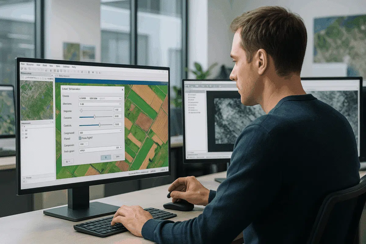
Agisoft Metashape is one of the most widely used photogrammetry software tools for creating orthomosaics, 3D models, and geospatial data products from aerial imagery. While most users focus on camera alignment, dense cloud generation, and orthomosaic stitching, one crucial yet often overlooked step can significantly impact the quality of your final deliverable: adjusting brightness and […]
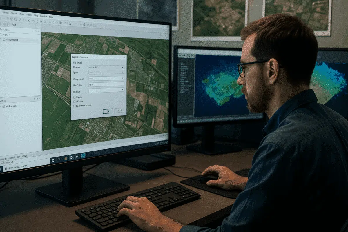
Agisoft Metashape is one of the most powerful photogrammetry tools available today, used by professionals worldwide for drone mapping, 3D modeling, and geospatial analysis. However, even experienced users sometimes face a frustrating obstacle during the final stage of their workflow: orthomosaic export failures. If you’ve encountered errors while trying to export your orthomosaic, you’re not […]
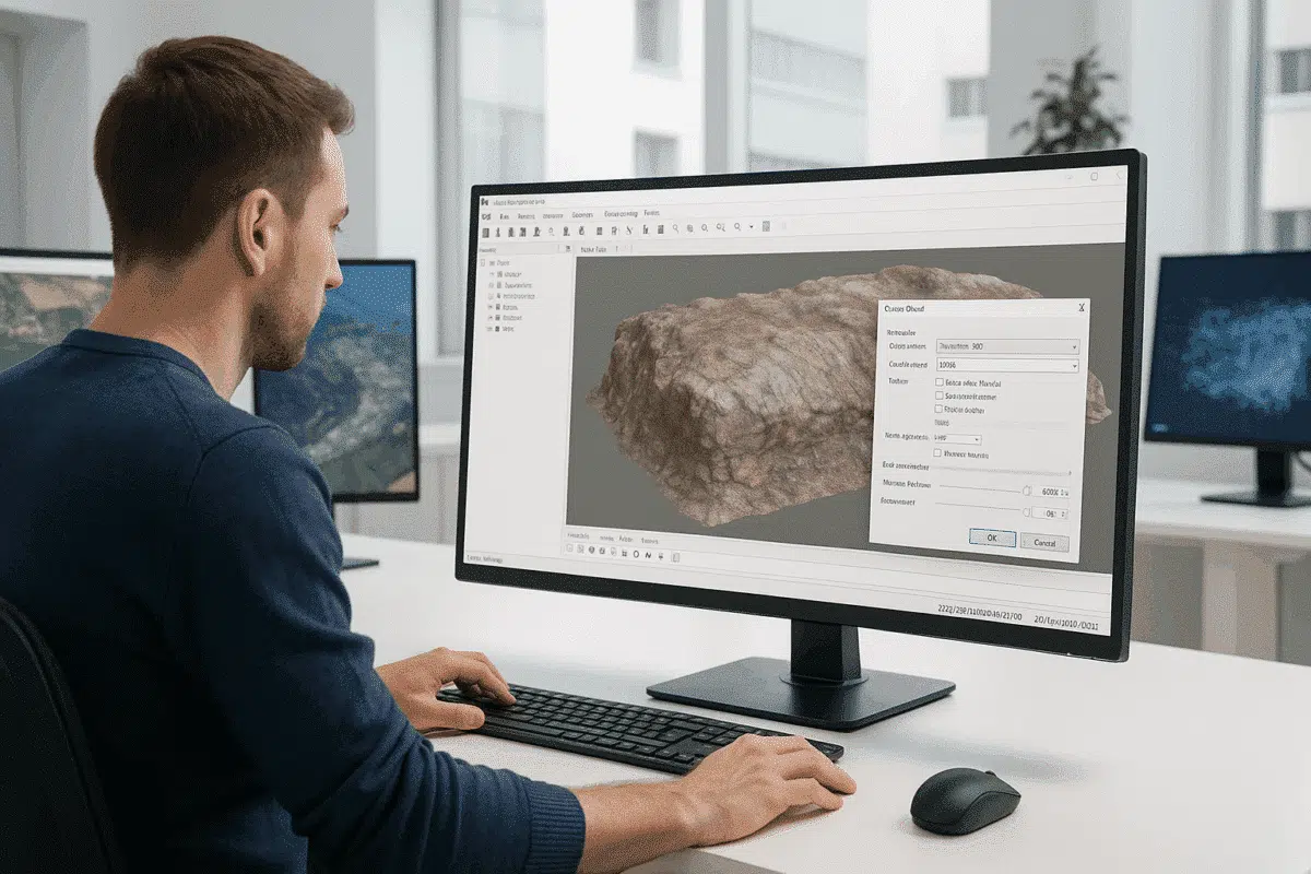
Agisoft Metashape is a powerful photogrammetry software used by professionals in surveying, archaeology, film production, and 3D modeling. One of its most advanced and effective tools for enhancing model quality is volumetric masking. When applied during the depth map generation stage, volumetric masks can dramatically improve the quality and accuracy of mesh models by excluding […]
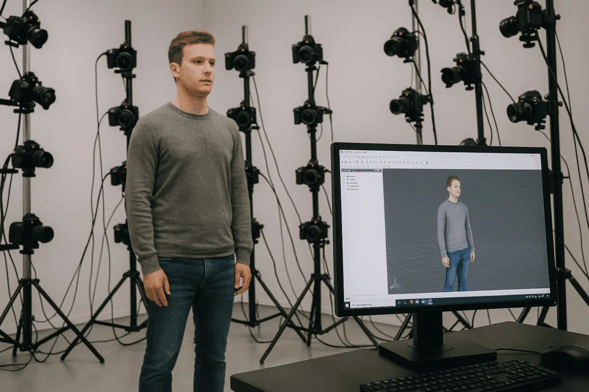
Agisoft Metashape is one of the most powerful photogrammetry tools available for generating highly detailed 3D models from photographs. While it’s widely used in fields like surveying, archaeology, and mapping, Metashape also excels in full-body and head scanning for applications such as 3D character creation, digital avatars, virtual production, medical modeling, and fashion. However, achieving […]
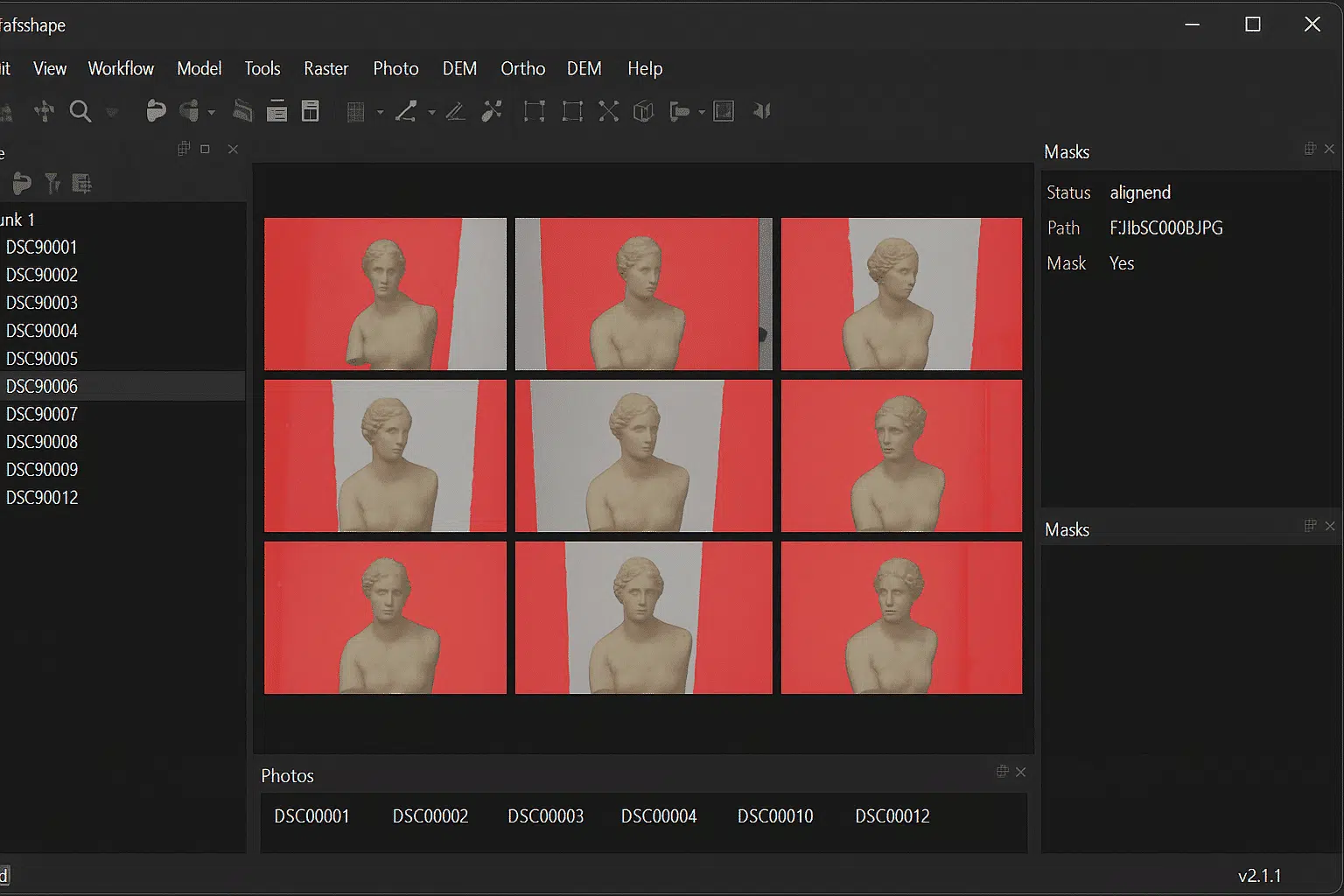
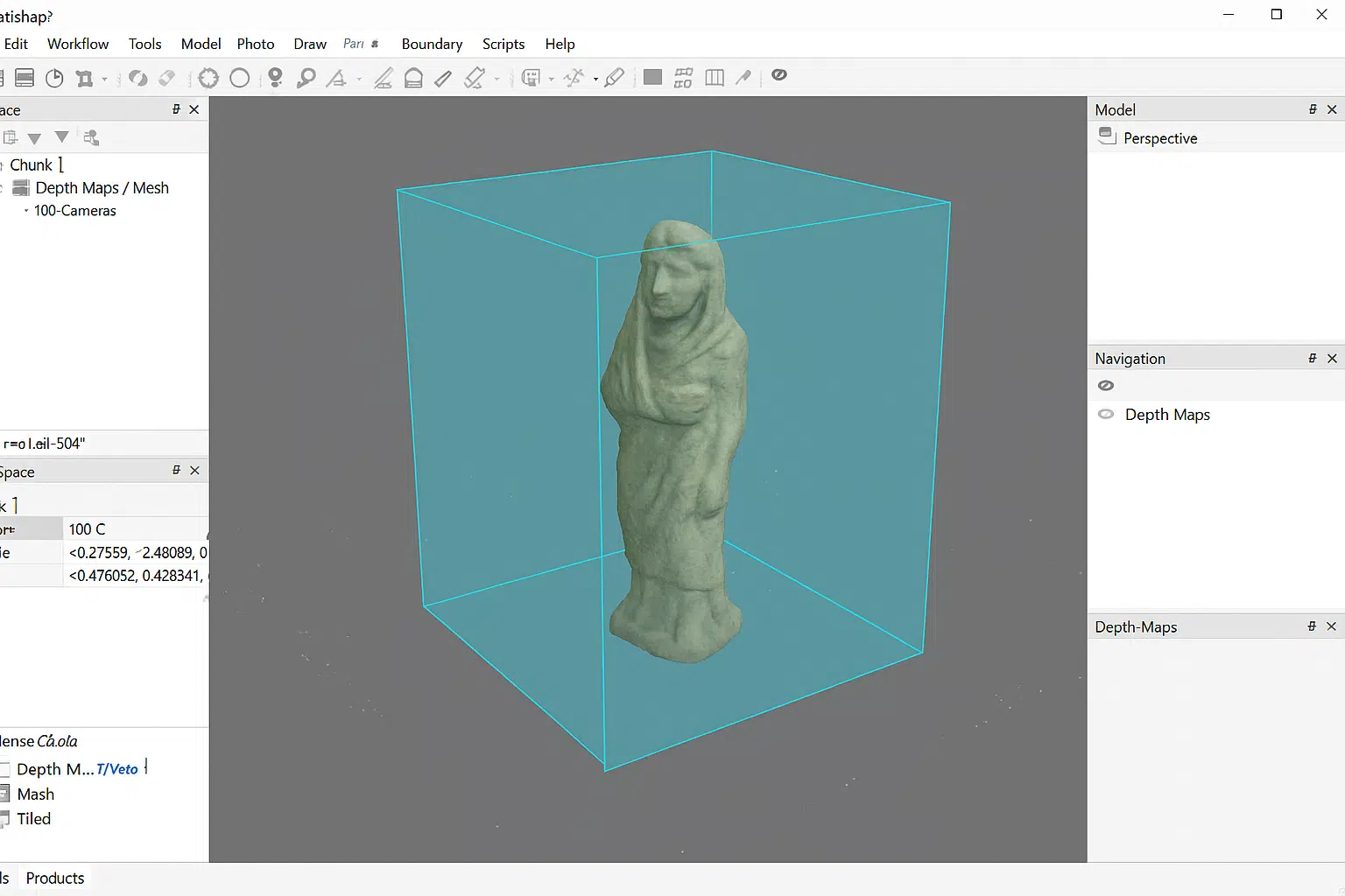
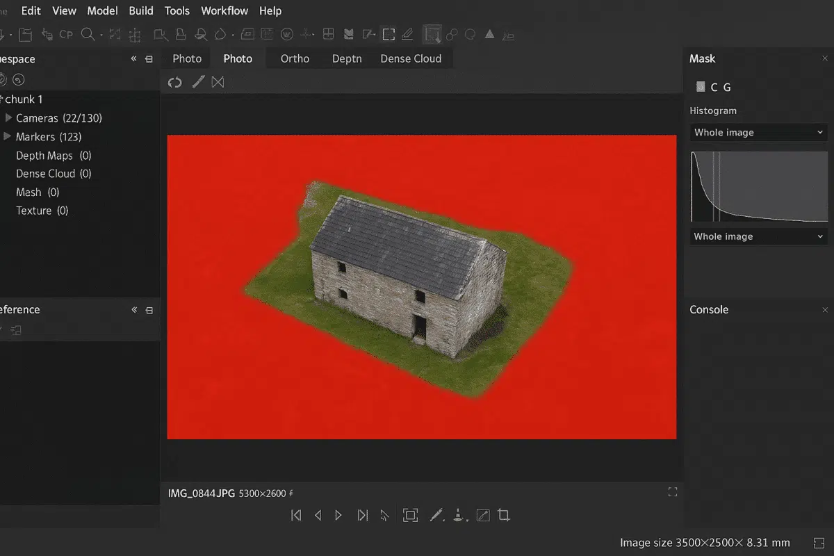
Agisoft Metashape is one of the most advanced photogrammetry software platforms available, enabling users to create accurate 3D models from ordinary photos. One of its most powerful yet underused capabilities is the ability to align photos with background suppression using a single mask. This technique streamlines the alignment process, reduces noise, and ensures higher-quality reconstructions […]
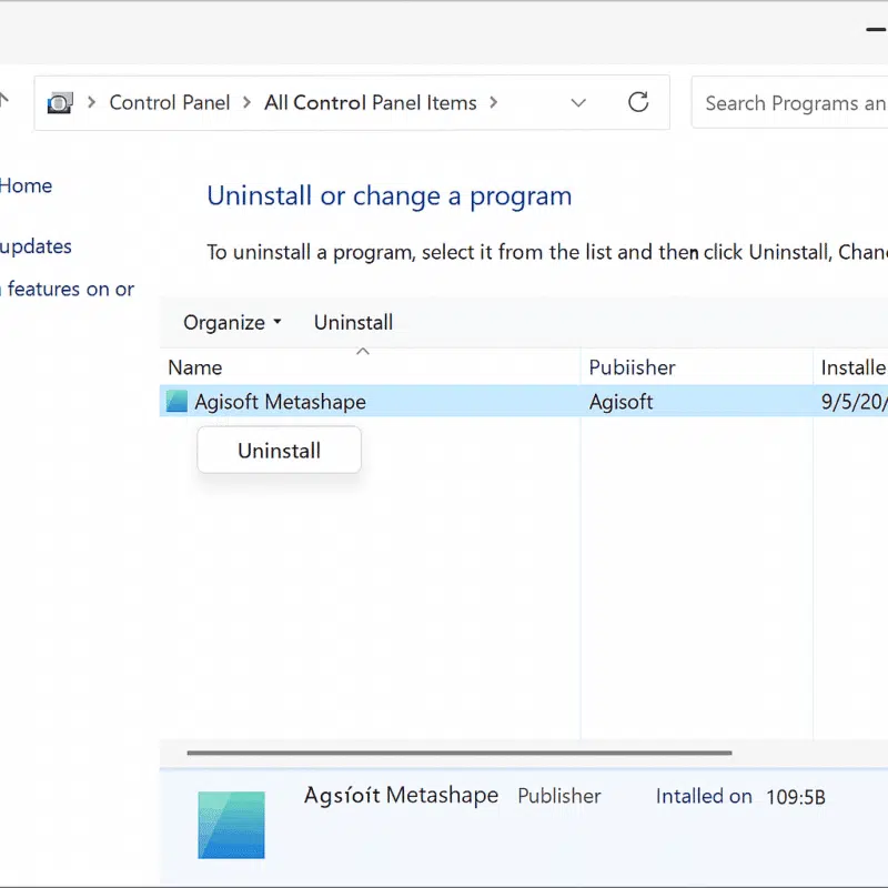
Agisoft Metashape is one of the most powerful photogrammetry software solutions used by professionals and researchers to create detailed 3D models from photographs. However, there are times when you might need to uninstall Metashape — whether you are troubleshooting an installation issue, switching devices, upgrading to a new version, or simply freeing up system resources. […]
Agisoft Metashape is one of the leading photogrammetry software tools used worldwide for creating highly detailed 3D models from photographs. One of its most powerful yet often underutilized features is the ability to create masks from background photos. This feature can dramatically improve the quality of your models, reduce processing time, and simplify your workflow […]

Agisoft Metashape is one of the most advanced photogrammetry software solutions available today, used by professionals worldwide to generate highly accurate 3D models from photographs. One of the most critical steps in the photogrammetry workflow is camera calibration. Whether performed automatically during photo alignment or manually using calibration data, this process determines how Metashape interprets […]
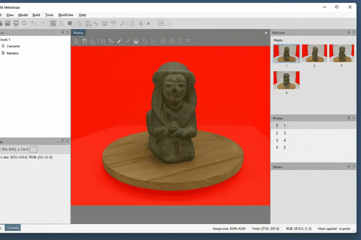
Agisoft Metashape is one of the most powerful photogrammetry software solutions available today, widely used for 3D modeling, mapping, cultural heritage documentation, and industrial applications. Among its advanced features, working with masks is a crucial technique that significantly enhances project accuracy and efficiency. Masks allow users to define which parts of an image should be […]