

 Italiano
 Français
 Deutsch
 Español
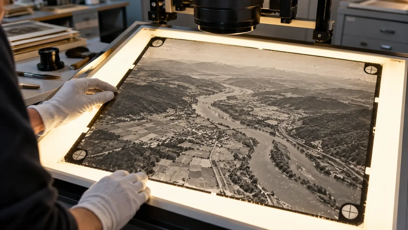
Historic aerial photographs can reveal a landscape before a dam, road or urban expansion. Scanning the film gives you digital images, but a scan is not equivalent to a modern camera image with clean EXIF metadata. Agisoft Metashape Professional can process scanned analog photographs using their fiducial marks to recover the interior image geometry needed for photogrammetry.
What makes film imagery a special case?
Each aerial frame contains a photographic image plus marks tied to the original camera’s coordinate system. Scanning can rotate, scale or slightly deform individual copies. Fiducial marks allow the digital image to be related to the film camera geometry. The workflow is especially relevant to surveys assembled from multiple years, cameras or scan resolutions. Keep those sources distinct until you understand how they were produced.
Agisoft’s scanned image tutorial explains that images from different analog cameras should occupy different calibration groups. The Professional user manual documents film camera settings and fiducial calibration in detail.
Collect the right archive material first
- Original scans at consistent, documented resolution, with the film frame and fiducial marks intact.
- Camera identification and calibration certificate if available, including fiducial coordinates and units.
- Flight index, approximate capture dates, nominal scale and any available ground survey or identifiable stable features.
- A record of scan orientation, cropping, retouching and any prior geometric corrections. Preserve untouched master scans.
Do not remove border marks from the archival master. Marginal annotations can be masked during processing if they interfere with image matching. Processing a small representative stereo block before digitizing an entire archive can reveal whether the scan quality and control are adequate.
Fiducial workflow in Metashape
- Add the scanned images and inspect the calibration groups for camera model and scan-resolution consistency.
- In Tools > Camera Calibration, enable Film camera with fiducial marks for the relevant group.
- Use Tools > Markers > Detect Fiducials when the marks match a supported type. Agisoft lists Generic, Right angle, 45 degrees cut and Frame as detection options. Inspect every detected location.
- Enter the fiducial coordinates from the camera certificate in the specified image-coordinate convention, or follow Agisoft’s calibration procedure when that certificate is unavailable. Place nonstandard marks manually as required.
- Mask auxiliary frame margins where appropriate, align a test subset, then inspect calibration, image connectivity and control residuals before building a complete orthomosaic or elevation product.
Historical change analysis needs extra restraint
Difference maps can be compelling, but a comparison of two eras also contains uncertainty from scanning, camera calibration, changing ground control, vegetation and the choice of a common coordinate system. Use stable features for validation and reserve independent checks wherever possible. Report the area and epoch for which the evidence is strong; do not infer fine-scale change from an attractive image alone. Our coordinate-system guide and report interpretation guide cover two parts of that assessment.
Scan quality determines what can be recovered
A high nominal dots-per-inch value does not rescue a blurred original negative or inconsistent scanner focus. Inspect whether all fiducials and the entire useful image area are present, whether dust or scratches obscure tie points, and whether different batches have been resized or rotated. If you must choose between a visually cleaned derivative and a faithful archival scan, retain both and process from the version with traceable geometry.
Do not merge imagery from different analog cameras solely because the photographs have the same digital pixel dimensions. The original camera certificate, film frame and scanner settings can differ independently. A short pilot block lets you assess image connection and fiducial residuals before spending time on thousands of frames.
A two-epoch validation example
For a historic shoreline, reconstruct the older survey and the newer survey independently. Use a common, documented reference system and identify stable hard features that survived both dates. Check each epoch against independent reference where available; only then compare the shoreline or elevation products. Water level, vegetation and seasonal exposure can create apparent “change” unrelated to ground movement. Label such areas as unverified rather than filling them to make a continuous change map.
The USGS methods report on historical aerial imagery offers additional context on scanned photographs, camera reports and modern structure-from-motion processing. It is a methods reference, not a guarantee that every archive can meet a modern accuracy class.
Choose the fiducial workflow from the actual film
If the camera certificate supplies fiducial coordinates, transcribe them with their units and coordinate convention rather than estimating them from a screen display. Agisoft’s instructions specify millimeter coordinates relative to the sensor center, with the image axes oriented as documented in its tutorial. A transposed coordinate or incorrect sign can undermine the interior geometry across an entire block. Record the certificate identifier and keep a copy with the project.
When the marks are nonstandard, Agisoft describes manual placement and a calibration option for archives without certificate coordinates. Inspect a sample of frames from every scan batch; automatic detection on the first roll does not prove the same marks are visible on later, cropped or damaged frames. Preserve the detected-mark review as part of QA, especially if the output will be used for measured change.
Frequently asked questions
Can Metashape detect all film fiducial designs automatically?
No. Supported designs can be detected automatically; other designs may require manual placement and camera information. Verify detections against the actual scan.
Can I mix scans from several decades in one project?
It may be possible, but first separate camera states and survey epochs, establish overlap and common reference, then evaluate each epoch independently before claiming change.
Technical basis: Agisoft film-image tutorial and Agisoft Professional manual.
