SURVEYING & MAPPING WITH AGISOFT METASHAPE

Agisoft Metashape for Surveying and Mapping

Transform overlapping drone or terrestrial imagery into georeferenced orthomosaics, elevation models, point clouds and measurable 3D data—with workflows built around RTK, PPK, Ground Control Points and independent checkpoints.

Explore Survey Workflow

Buy Professional

05
SURVEY PRIORITIES

GROUND RESOLUTION

Detail appropriate to the deliverable

REFERENCE FRAME

Coordinates, datums and heights

VALIDATION

Independent quality evidence

DELIVERABLES

GIS, CAD and measurable outputs
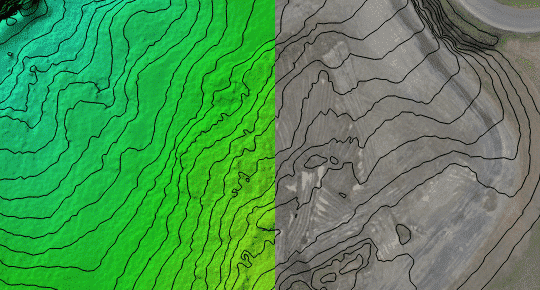
CAPTURE. REFERENCE. VALIDATE. DELIVER.

Drone Emotions Srl combines official Agisoft Metashape licensing with practical guidance for surveying, mapping, civil engineering, construction, mining and geospatial teams.

FROM IMAGES TO GEOSPATIAL INFORMATION

Build the workflow around the required result—not around a processing preset

A defensible mapping project begins before the images are imported. Required accuracy, coordinate reference system, vertical datum, ground resolution, terrain, image geometry, survey control and final file formats should be defined before acquisition and processing choices are made.

Agisoft Metashape Professional provides the tools to align imagery, use camera coordinates and control points, optimize the photogrammetric block, generate georeferenced products and report residual errors. The reliability of the result still depends on the complete survey design and on independent validation.

✓ Define the required GSD and deliverable tolerance

✓ Plan image overlap, coverage and camera geometry

✓ Select RTK, PPK, GCP or combined referencing

✓ Reserve independent checkpoints for validation

✓ Export products suitable for the downstream GIS or CAD workflow

WHO THIS PAGE SUPPORTS

Geospatial professionals and project teams

Land surveyors and mapping companies
Producing controlled orthomosaics, terrain models, contours and spatial measurements.

UAV service providers
Connecting flight planning and camera positioning with repeatable processing.

Engineering and construction teams
Documenting sites, earthworks, progress and measurable surface change.

Mining and quarry operators
Creating terrain products and evaluating stockpile or excavation volumes.

GIS and public-sector organizations
Integrating georeferenced raster, elevation and point-cloud outputs into established spatial systems.

PROFESSIONAL SURVEY OUTPUTS

Create the product the next decision actually requires

Metashape Professional can produce multiple geospatial deliverables from the same referenced image block. Each output should be generated, checked and exported for a defined downstream purpose.

01

Orthomosaics

Generate georeferenced image mosaics for mapping, inspection, digitization and GIS use, with the projection and pixel size selected for the project.

02

DSM and DTM

Build elevation surfaces and distinguish a surface model from a terrain model created after appropriate ground-point classification and review.

03

Point clouds and 3D data

Create, classify, edit and export spatial point data, meshes and textured models for visualization, measurement or integration with other software.

04

Measurements and volumes

Measure distance, area, elevation and volume from a correctly scaled or georeferenced project using a documented reference surface.

END-TO-END WORKFLOW

Six decisions connect field capture to final delivery

Processing quality cannot recover information that was never captured or replace a weak reference framework. Treat acquisition, control, reconstruction and validation as one connected workflow.

01 — SPECIFICATION

Define accuracy and outputs

Record the required coverage, GSD, horizontal and vertical reference, deliverable format, tolerance and applicable survey standard before planning the mission.

02 — ACQUISITION

Capture usable geometry

Plan overlap, flight height, camera angle, speed, lighting and terrain clearance so the dataset provides complete coverage and sufficient parallax.

03 — REFERENCING

Establish the coordinate framework

Import verified RTK or PPK camera coordinates, surveyed control and the correct coordinate system, geoid or vertical-datum information.

04 — ALIGNMENT

Inspect and optimize the block

Review camera alignment, coverage, tie-point geometry, calibration groups and residual patterns before applying justified camera or marker accuracy values.

05 — RECONSTRUCTION

Build the required products

Generate point clouds, surfaces, DEMs, orthomosaics or 3D models with settings appropriate to the available hardware and intended spatial product.

06 — VALIDATION

Test, document and export

Evaluate independent checkpoints, residuals, completeness and surface artifacts, then export in the required CRS and preserve the processing report.

REFERENCE AND CONTROL

Use RTK, PPK, GCPs and checkpoints for different jobs

Camera coordinates can position the image block, control points can constrain it and checkpoints can test it independently. A robust design assigns each observation a clear role.

01 — CAMERA POSITIONS

RTK and PPK workflows

Use per-image position information and realistic uncertainty values. Check solution status, antenna offsets, time synchronization, datums and height systems before trusting centimetre-level coordinates.

02 — SURVEY CONTROL

Ground Control Points

Use accurately surveyed and clearly identifiable markers to constrain the project. Distribution and measurement quality matter more than simply increasing the number of points.

03 — INDEPENDENT TESTING

Checkpoints

Exclude dedicated checkpoints from optimization and use them to measure performance at independent surveyed locations. Report their errors separately from GCP residuals.

ACCURACY AND QUALITY CONTROL

Processing software does not guarantee survey accuracy by itself

Accuracy is influenced by GSD, image sharpness, overlap, flight geometry, camera calibration, terrain, GNSS quality, control distribution, coordinate-system configuration and the method used to test the result. Small residuals alone do not prove that a deliverable is correct.

Review camera and marker errors together, inspect systematic patterns and compare independent checkpoints with the project specification. Surveying, engineering, legal or regulated deliverables should be reviewed and approved by appropriately qualified professionals.

Read the Processing Report Guide

QUALITY GATES

Evidence to review before delivery

✓ Image coverage and effective GSD

✓ Alignment completeness and camera geometry

✓ Calibration stability and reprojection patterns

✓ Camera, GCP and checkpoint RMSE

✓ Correct CRS, geoid and vertical datum

✓ Surface artifacts, gaps and edge effects

✓ Export resolution, extent and file format

LICENSING FOR GEOSPATIAL WORK

Choose Professional first, then choose the access model

Surveying and mapping workflows normally require Agisoft Metashape Professional for georeferencing, control points, coordinate systems, DEMs, orthomosaics, measurements and geospatial exports. Node-Locked and Floating licensing determine how the software is accessed.

DEDICATED WORKSTATION

Professional Node-Locked

A perpetual commercial license used on one activated computer at a time. Suitable for an individual surveyor, a dedicated processing workstation or a small team with one primary operator.

✓ Professional geospatial toolset

✓ One active workstation at a time

✓ Rehostable activation

SHARED ORGANIZATIONAL ACCESS

Professional Floating

A centrally managed license pool for organizations that install Metashape Professional on multiple computers and require a defined number of simultaneous users.

✓ Concurrent-seat model

✓ Central license server

✓ Quotation-based configuration

WORKFLOW EVALUATION

Professional Free Trial

Use the 30-day trial to evaluate installation, representative datasets, processing stages and required outputs before purchasing a commercial license.

✓ No payment required

✓ Test with representative data

✓ Confirm hardware and workflow fit

Need to compare capabilities and access models first? Review the Professional vs Standard and Node-Locked vs Floating guide.

PRACTICAL SURVEYING GUIDES

Go deeper into planning, control and verification

Use these focused resources to examine the decisions behind a reliable Metashape surveying workflow.

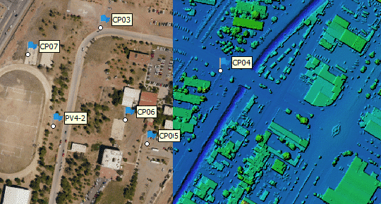
Ground sampling distance and terrain detail in an Agisoft Metashape surveying project

MISSION PLANNING

Ground Sampling Distance explained

Understand how sensor resolution, focal length, flight height and terrain affect image detail, coverage and processing requirements.

Read GSD Guide

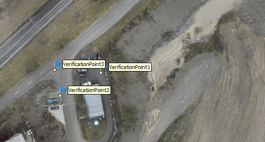
Ground Control Points in an Agisoft Metashape aerial mapping workflow

CONTROL AND VALIDATION

GCPs versus checkpoints

Separate points used to constrain the adjustment from points reserved to test the result, then distribute both groups around meaningful project geometry.

GCP & Checkpoints

Aerial imagery prepared for RTK and PPK processing in Agisoft Metashape

REFERENCE WEIGHTING

Camera accuracy for GPS, RTK, PPK and GCPs

Assign uncertainty values that reflect the actual observations instead of applying one optimistic setting to every camera and marker.

Accuracy Settings

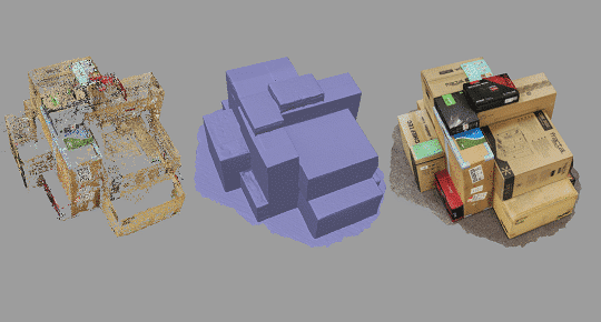
Three-dimensional reconstruction results created with Agisoft Metashape Professional

REPORTING

RMSE and processing-report interpretation

Read camera, marker and checkpoint errors in context and distinguish internal fit from independently demonstrated positional performance.

Processing Report

RESEARCH AND PROJECT READINESS

Document the assumptions behind the result

Use structured research and readiness resources to identify missing evidence before a workflow becomes a deliverable.

VALIDATION FRAMEWORK

RTK, GCP and checkpoint accuracy validation

Review how independent evidence, coordinate consistency and acceptance thresholds affect the interpretation of an apparently precise result.

TECHNICAL TOOL

Metashape project-readiness checklist

Confirm the objective, imagery, reference data, hardware, validation plan, deliverables and responsibility framework before processing begins.

OFFICIAL AGISOFT RESOURCES

Continue with current product documentation

These external links open material published and maintained by Agisoft LLC. Confirm that instructions correspond to the Metashape version used for the project.

Professional features

Review the official Professional toolset for photogrammetric triangulation, point clouds, DSM/DTM, orthomosaics, measurements and geospatial exports.

Control and checkpoints

Follow Agisoft’s official procedure for importing markers, assigning point roles, placing observations and optimizing the referenced image block.

Professional user manual

Consult the official Agisoft Metashape Professional 2.3 manual for complete parameter definitions, commands, supported formats and processing procedures.

FREQUENTLY ASKED QUESTIONS

Agisoft Metashape surveying and mapping questions

Use these answers for initial planning, then confirm project-specific requirements against current official documentation and the applicable survey specification.

Professional is the appropriate edition when the workflow requires georeferencing, Ground Control Points, coordinate systems, DEMs, orthomosaics, measurements or GIS-compatible spatial exports. Standard is designed primarily for core image-based 3D reconstruction without the complete geospatial toolset. Review the edition comparison before purchasing.

Yes, a project can use accurately positioned RTK or PPK images without GCPs when the camera coordinates, uncertainties, antenna offsets, timing and reference systems are correctly handled. Independent surveyed checkpoints remain strongly recommended because they test the result without participating in optimization.

There is no universal number. The required quantity and distribution depend on project geometry, area, terrain, camera-position quality, required accuracy and the reliability of the surveyed coordinates. Points should cover the site, edges and meaningful elevation changes. Reserve enough independent checkpoints to evaluate performance separately.

A Ground Control Point contributes to georeferencing and optimization. A checkpoint is measured in the images but excluded from optimization so its surveyed coordinate can be compared with the photogrammetric result. Reporting only GCP residuals does not provide the same independent evidence as checkpoint testing.

Metashape Professional can generate elevation models. A DSM represents visible surfaces such as terrain, vegetation and structures. A DTM attempts to represent bare terrain and normally requires appropriate point-cloud classification, manual review and project-specific decisions around objects, slopes and breaklines.

Metashape Professional can calculate volume from a referenced elevation model and a defined base surface or comparison surface. The validity of the number depends on complete coverage, surface quality, boundary placement, reference choice and the accuracy of the underlying project.

No single accuracy value applies to every project. Performance depends on GSD, optics, image quality, geometry, control, GNSS, calibration, terrain and processing choices. Establish a tolerance before capture and verify the completed project with independent checkpoints and other checks required by the applicable standard.

Choose Node-Locked when one dedicated workstation or operator needs the license at a time. Choose Floating when the organization wants Metashape installed on multiple computers and needs a centrally managed number of simultaneous sessions. The edition remains Professional in both cases.

LICENSING, TRAINING AND WORKFLOW GUIDANCE

Describe the survey before selecting the configuration

Tell us the image count and resolution, sensor, RTK or PPK context, GCP availability, required outputs, coordinate system, accuracy objective, hardware and number of users. We can help identify the appropriate license and next technical resource.

Request Project Guidance

Drone Emotions Srl
Agisoft Authorized Reseller & Training Center
[email protected]
800 984 535 · +39 347 433 3302