Agisoft Metashape is a powerful tool for generating high-resolution Digital Elevation Models (DEMs) and orthomosaics from drone or terrestrial imagery. A common question users face is: Can I generate accurate results without Ground Control Points (GCPs)? In this article, we explore the differences in workflows, accuracy, and use cases when working with or without GCPs in Metashape.
What Are DEMs and Orthomosaics?
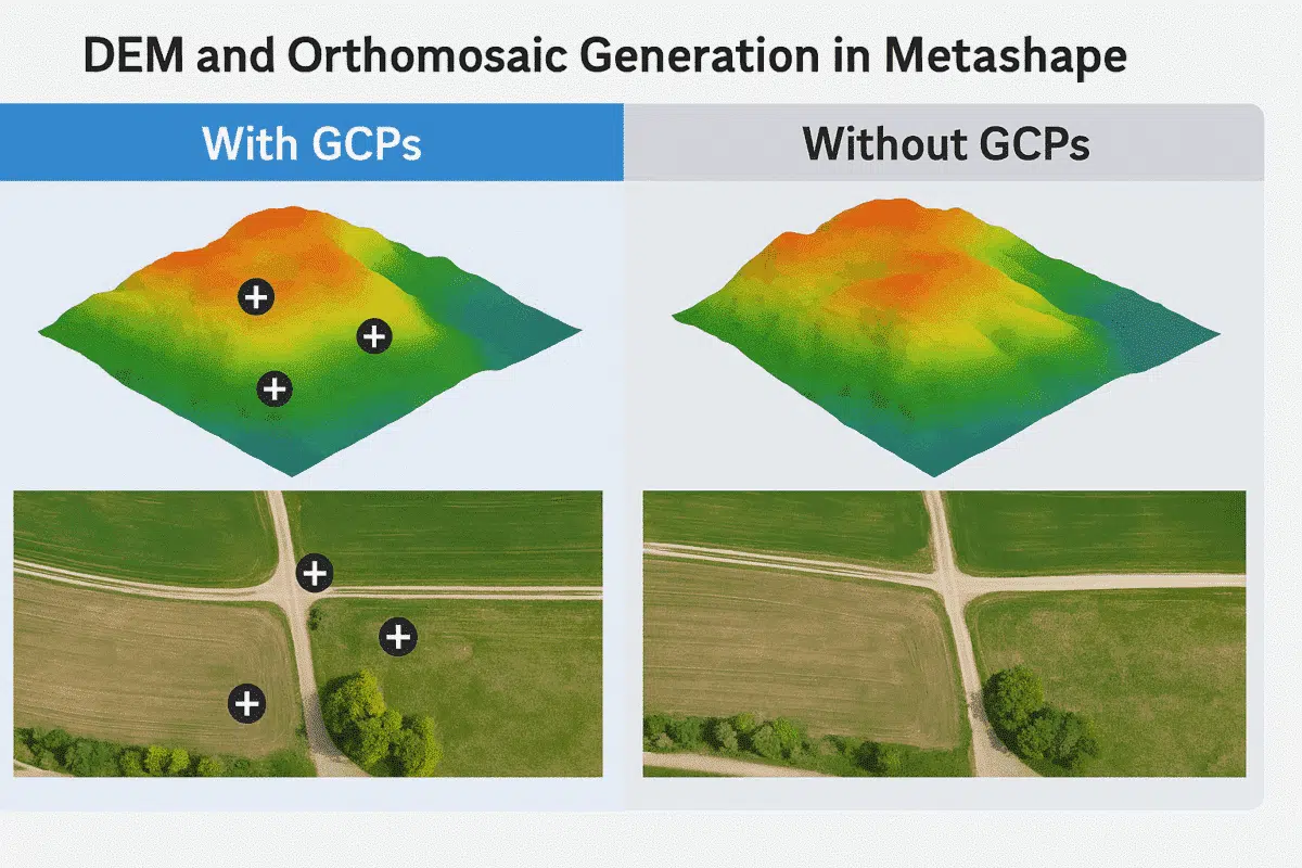
A Digital Elevation Model (DEM) represents the elevation of terrain, generated by interpolating a point cloud. An orthomosaic is a georeferenced, geometrically corrected image composed of multiple overlapping photos stitched together with accurate scale and perspective.
What Are Ground Control Points (GCPs)?
GCPs are physical points with known real-world coordinates. These are visible in multiple images and are used to tie the 3D reconstruction to a specific coordinate system. GCPs greatly improve the accuracy and geospatial consistency of both DEMs and orthomosaics.
Workflow: Generating DEM & Orthomosaic Without GCPs
1. Capture Images with Overlap
Use a drone or camera to capture images with at least 70% front overlap and 60% side overlap. Even without GCPs, this is essential for tie-point matching.
2. Align Photos in Metashape
- Open Metashape and create a new project
- Import your images
- Go to Workflow → Align Photos
- Use “High” or “Medium” accuracy and enable adaptive camera model fitting
3. Build Dense Cloud
- Workflow → Build Dense Cloud
- Select quality and depth filtering level (e.g. Medium/Moderate)
4. Build DEM
- Workflow → Build DEM
- Select source: Dense Cloud
- Choose a coordinate system (WGS84 by default)
5. Build Orthomosaic
- Workflow → Build Orthomosaic
- Choose source: DEM
- Projection plane: Current view or based on coordinate system
Even without GCPs, Metashape will generate a DEM and orthomosaic using only image alignment and EXIF GPS data (if available).
Limitations of Not Using GCPs
- Lower positional accuracy (up to ±10 m or worse)
- Inconsistent elevation data if EXIF altitudes are unreliable
- Possible tilting or skewing of the entire model
- Problems aligning with existing GIS or CAD data
Workflow: Generating DEM & Orthomosaic With GCPs
1. Capture GCPs in the Field
Use a GNSS receiver or total station to collect GCPs at known points on the ground. These points should be visible in at least 3–4 images each.
2. Import and Mark GCPs in Metashape
- Prepare a CSV file with GCP names and coordinates
- In Metashape, go to Reference pane → Import Markers
- Mark each GCP manually in the images
3. Optimize Camera Alignment
- Right-click the chunk → Optimize Cameras
- Enable all calibration parameters (f, cx, cy, k1, k2, etc.)
4. Generate DEM and Orthomosaic (Same Steps)
The rest of the workflow is identical: generate the dense cloud, build the DEM, and finally the orthomosaic. However, the results will be tightly tied to your GCPs—significantly improving geolocation precision and consistency.
Comparison: With vs Without GCPs
| Aspect | With GCPs | Without GCPs |
|---|---|---|
| Horizontal Accuracy | < 5 cm | ±5–10 m |
| Vertical Accuracy | < 10 cm | ±10–20 m or worse |
| Model Stability | Very high | Moderate |
| Georeferencing | Precise | Approximate |
| Compliance | Survey-grade | Not acceptable for legal or engineering use |
When Can You Skip GCPs?
- For hobby or visualization projects
- When using drones with RTK/PPK GPS
- In remote areas with no accessible reference points
If your drone has a high-precision GPS system, and you’re not working on regulatory or infrastructure projects, you may be able to achieve acceptable results without GCPs.
Conclusion
Generating DEMs and orthomosaics in Metashape is possible with or without GCPs—but the difference in accuracy and reliability is substantial. If your goal is scientific, engineering, or GIS-grade results, use GCPs whenever possible. For informal or exploratory work, the GCP-free workflow is a fast and accessible option. Always assess your project goals, available hardware, and required precision before choosing the best path forward.