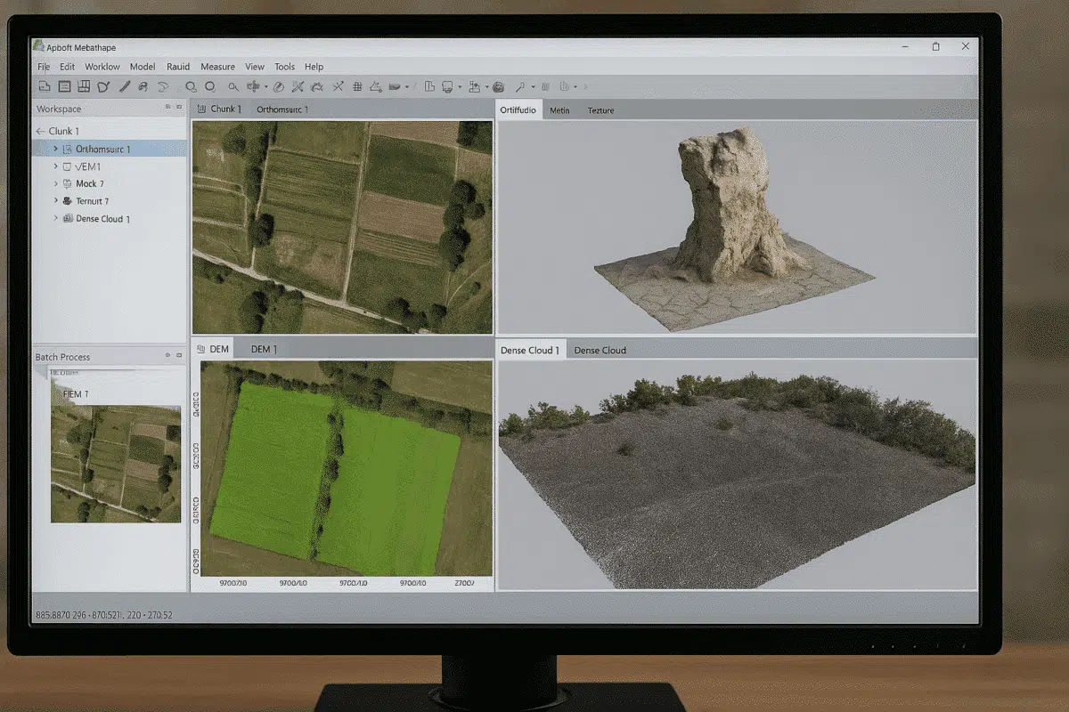
Agisoft Metashape is one of the most powerful photogrammetry tools available today, widely used for 3D modeling, mapping, and surveying. A frequent question among new users is: what file formats does Agisoft Metashape support? Understanding supported formats is essential for a smooth workflow, whether you are importing drone images, laser scans, or exporting 3D models for CAD software. This article provides a complete overview of the formats compatible with Metashape and explains how to use them effectively.
Image File Formats Supported in Agisoft Metashape
The first step in any photogrammetry project is importing images. Agisoft Metashape supports a wide range of image file formats, ensuring compatibility with most cameras and drones on the market. Supported image formats include:
- JPEG (.jpg, .jpeg) – The most common format, widely used for drone and DSLR photography. It is lightweight but uses lossy compression.
- TIFF (.tif, .tiff) – A preferred choice in professional workflows, as it supports high-quality, lossless data and multiple bands (useful in multispectral imaging).
- PNG (.png) – Less common in aerial mapping but supported for high-quality images with transparency.
- RAW formats – While Metashape does not process proprietary RAW files directly (like .CR2 or .NEF), you can convert them into TIFF or JPEG for use.
In addition to standard image formats, Metashape can also handle multispectral and thermal images from specialized drone sensors, provided they are converted into TIFF or JPEG before processing.
Point Cloud Formats: Import and Export
Point clouds are essential in surveying and 3D reconstruction. Agisoft Metashape allows both import and export of different point cloud formats, making it compatible with GIS and CAD software:
- LAS / LAZ (.las, .laz) – Industry-standard formats for lidar and dense point clouds. LAZ provides compressed storage.
- PLY (.ply) – Widely used in 3D workflows for storing point data with color attributes.
- XYZ (.xyz) – Simple ASCII text-based format containing X, Y, Z coordinates.
- PTS (.pts) – Used for exporting structured point clouds, often for laser scan data.
- E57 (.e57) – A vendor-neutral format compatible with many lidar scanners and CAD applications.
When exporting point clouds, Metashape also allows users to define coordinate systems, scaling, and classifications, ensuring interoperability with surveying software such as AutoCAD Civil 3D, ArcGIS, and QGIS.
3D Model Formats: From Mesh to Visualization
After generating a mesh, users often need to export their 3D models for visualization, analysis, or 3D printing. Agisoft Metashape supports the most common 3D model file formats:
- OBJ (.obj) – A standard and versatile format for 3D modeling, compatible with Blender, MeshLab, and most 3D software.
- FBX (.fbx) – Popular in animation and game development pipelines.
- 3DS (.3ds) – Used in older 3D modeling workflows, still supported by many CAD tools.
- COLLADA (.dae) – An exchange format for 3D models, supported by Google Earth and many visualization tools.
- STL (.stl) – Essential for 3D printing, containing only geometry data without textures.
Textures can be exported alongside these formats, ensuring photorealistic rendering in external software.
DEM, Orthophoto, and Raster Formats
One of the most valuable outputs from Agisoft Metashape is its ability to generate Digital Elevation Models (DEM) and orthophotos. These can be exported in several GIS-compatible formats:
- GeoTIFF (.tif) – The standard raster format for DEMs, orthomosaics, and DSMs. It preserves spatial reference information.
- JPEG (.jpg) – Lighter and faster to share but with compression.
- PNG (.png) – Supported for high-quality images where lossless compression is needed.
- KML/KMZ (.kml, .kmz) – For quick visualization of orthophotos in Google Earth.
These formats are crucial for integration with GIS tools such as QGIS, ArcGIS, or MapInfo, making Metashape a bridge between drone photogrammetry and spatial analysis workflows.
Camera and Project Data Formats
In addition to visual outputs, Agisoft Metashape works with camera calibration and project files that ensure accuracy and repeatability. Key supported formats include:
- XML – For storing project metadata, camera calibration, and processing settings.
- CSV (.csv) – Used for importing and exporting Ground Control Points (GCPs) and camera reference coordinates.
- TXT (.txt) – Simple text-based export of coordinates and alignment data.
- PRJ (.prj) – Contains coordinate reference system information for integration with GIS platforms.
This ensures smooth interoperability with surveying workflows, allowing teams to align photogrammetric data with official map projections and coordinate systems.
Practical Tips for File Handling in Metashape
While Agisoft Metashape is flexible in handling multiple formats, a few best practices can improve results:
- Use TIFF when possible – For input images, TIFF provides better accuracy and avoids compression artifacts compared to JPEG.
- Keep coordinate systems consistent – Always ensure exported DEMs, orthophotos, and point clouds share the same projection to avoid misalignment in GIS software.
- Use LAZ for large datasets – LAZ compression is ideal when exporting massive point clouds, saving disk space without losing quality.
- Check scaling before exporting STL – For 3D printing, ensure your model is correctly scaled to avoid errors during production.
Following these guidelines will help streamline your projects and ensure compatibility across platforms.
Conclusion: Choosing the Right Format in Metashape
Agisoft Metashape supports a wide variety of file formats, from simple JPEG images to complex E57 lidar scans and STL 3D models. The right format depends on your workflow—whether you are building orthophotos for GIS, exporting meshes for visualization, or preparing models for 3D printing. By understanding supported file types and best practices, users can maximize both efficiency and accuracy in their photogrammetry projects.
Ready to take your Metashape projects to the next level? Explore advanced export options and ensure your workflow matches the needs of your industry, whether it’s surveying, archaeology, or film production.