PROFESSIONAL APPLICATIONS OF AGISOFT METASHAPE

Agisoft Metashape Industries and Applications

Choose a photogrammetry workflow by the decision, data and deliverable—not by a generic software recipe. Explore sector-specific guidance for surveying and mapping, cultural heritage, agriculture and forestry.

Explore Industries

Compare Editions

03
SECTOR PATHS

SURVEY & MAP

Orthomosaics, terrain and control

DOCUMENT & PRESERVE

3D heritage records and archives

MONITOR & INTERPRET

RGB, multispectral and canopy data
CHOOSE THE WORKFLOW. DEFINE THE EVIDENCE. DELIVER WITH CONFIDENCE.

Drone Emotions Srl connects official Agisoft Metashape licensing with sector-specific technical guidance, professional training and transparent workflow planning.

THREE PROFESSIONAL WORKFLOW PATHS

Start from the sector, then define the deliverable

Each sector page translates common photogrammetric principles into a specific decision framework. Select the closest application, then adapt capture, processing and validation to the real project.

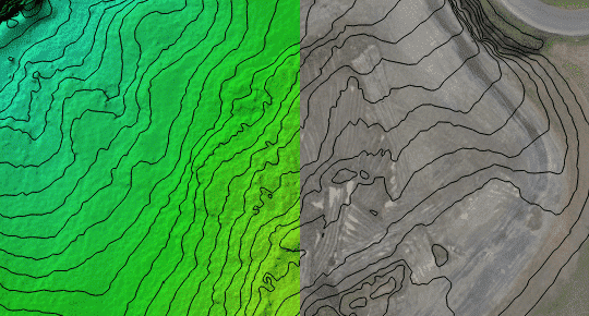
Contour mapping and terrain products for Agisoft Metashape surveying workflows

SURVEYING & MAPPING

Georeferenced mapping and measurable terrain products

Plan aerial mapping around ground sampling distance, image geometry, coordinate reference, GCPs or checkpoints, camera accuracy and the acceptance criteria for each deliverable.

✓ Orthomosaics and elevation models

✓ RTK, PPK, GCP and checkpoint strategy

✓ Point clouds, contours and measurements

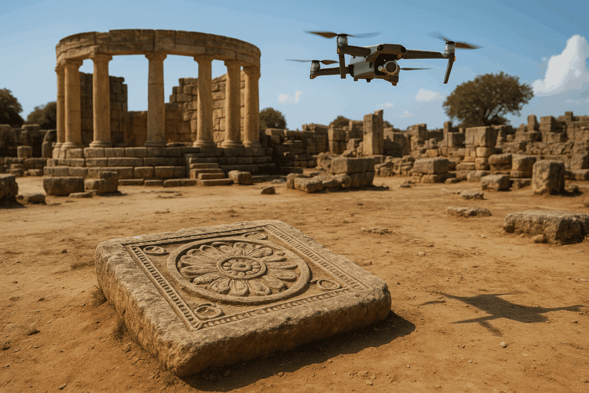
Archaeological and cultural heritage documentation with Agisoft Metashape

CULTURAL HERITAGE

Traceable 3D documentation for sites, buildings and collections

Connect subject safety, complete image coverage, scale, spatial reference, metadata and preservation outputs for archaeology, built heritage and museum digitization.

✓ Archaeological sites and excavations

✓ Historic buildings and monuments

✓ Artefacts, archives and virtual access

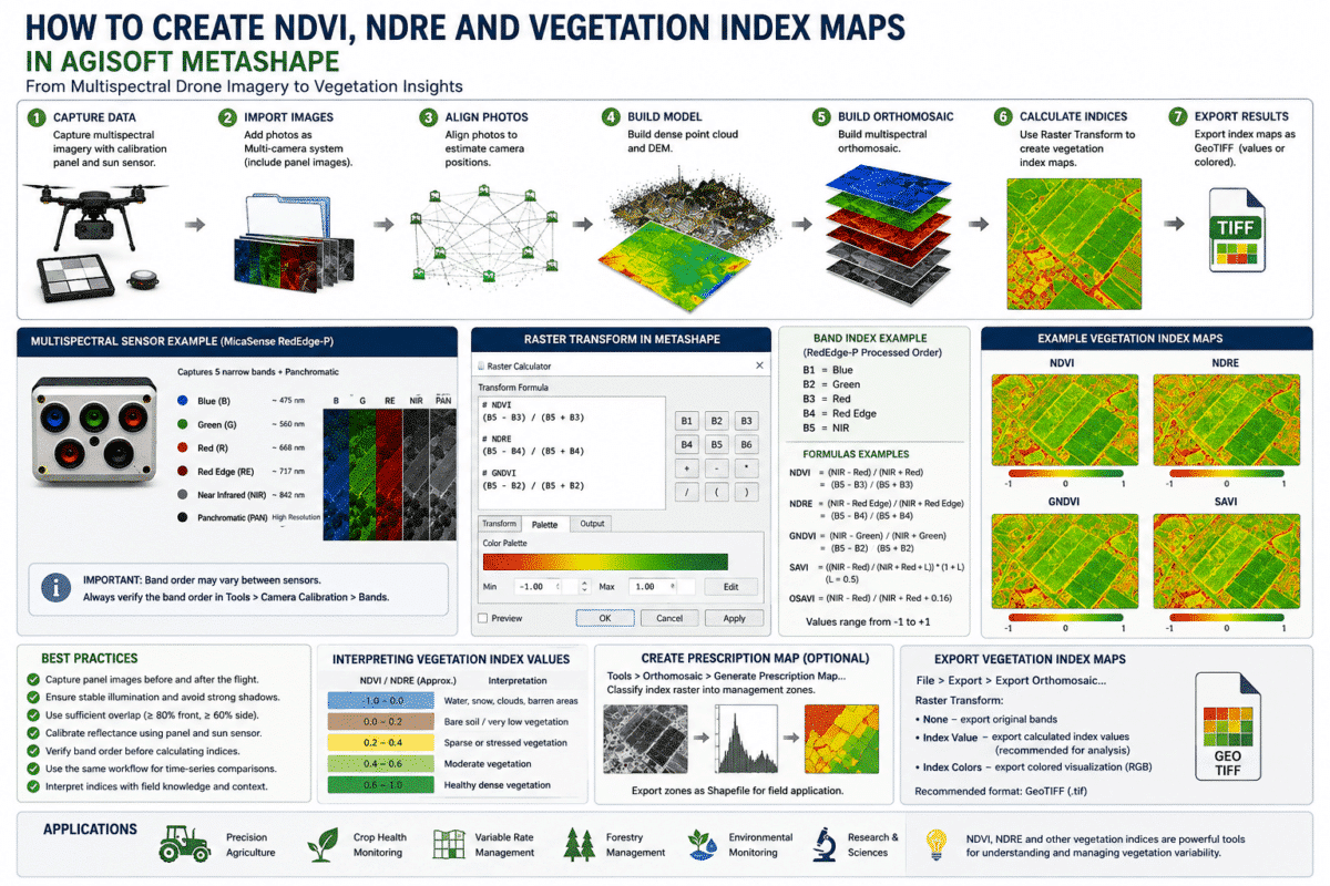
Agriculture and forestry vegetation mapping with Agisoft Metashape Professional

AGRICULTURE & FORESTRY

Calibrated mapping for vegetation, terrain and visible canopy

Build RGB and multispectral products around sensor choice, reflectance calibration, spatial reference, repeatability and field validation.

✓ RGB and reflectance orthomosaics

✓ NDVI, NDRE and custom indices

✓ Terrain and canopy products

CHOOSE BY REQUIRED OUTPUT

The deliverable determines the workflow

A sector label is only the starting point. The required measurement, coordinate system, sensor, validation evidence and final format determine the capture and processing method.

01

Georeferenced maps

Orthomosaics, DSMs, DTMs, contours, volumes and GIS-ready exports require defined coordinates, control and independent quality checks.

02

Measured 3D records

Textured models, orthographic records and condition baselines need complete coverage, verified scale and preserved acquisition metadata.

03

Vegetation and canopy layers

Reflectance mosaics, vegetation indices and canopy products require suitable sensors, calibration and field-based interpretation.

04

Research and teaching

Reproducible methods, shared laboratories and educational deployments connect technical outputs with eligibility, access and curriculum needs.

A COMMON DECISION FRAMEWORK

Six stages connect every industry workflow

The settings change by project, but the underlying method remains consistent: define the question, acquire appropriate evidence, validate the result and deliver only what the data can support.

01 — PURPOSE

Define the decision

Identify the question, responsible user, required evidence, acceptance criteria and limitations before selecting equipment or settings.

02 — DATA

Select the evidence

Choose the camera, sensor bands, reference data, scale, resolution and supplementary measurements required by the deliverable.

03 — ACQUISITION

Plan complete capture

Control overlap, viewpoint, focus, exposure, lighting, ground sampling distance, calibration and access constraints in the field.

04 — PROCESSING

Build the required product

Align, reconstruct, reference and export with settings appropriate to the real dataset rather than copying a universal maximum-quality recipe.

05 — VALIDATION

Test the result

Use independent checks, field observations, completeness review and documented thresholds suited to the intended professional decision.

06 — DELIVERY

Document and preserve

Deliver the product with units, reference, method, validation evidence, known limitations and the files required for reuse or audit.

EDITION AND LICENSE MODEL

The required deliverable—not the industry name—selects the edition

Standard supports core image-based 3D reconstruction. Professional adds the geospatial, measurement, multisensor, automation and deployment capabilities required by most surveying, mapping, agriculture and advanced documentation projects.

CORE 3D RECONSTRUCTION

Metashape Standard

Suitable for image alignment, point-cloud generation, mesh reconstruction, photorealistic texturing and common 3D exports when advanced spatial tools are not required.

✓ Objects, interiors and visual models

✓ Detailed mesh and texture production

✓ Node-Locked license

GEOSPATIAL AND MULTISENSOR WORKFLOWS

Metashape Professional

The appropriate edition for georeferencing, GCPs, measurements, orthomosaics, elevation models, multispectral imagery, vegetation indices, laser scans and automation.

✓ Surveying and mapping deliverables

✓ Metric heritage documentation

✓ Agriculture and forestry workflows

ASSIGNMENT AND ACCESS

Choose the license model

Select Node-Locked for one assigned workstation at a time, Professional Floating for shared concurrent access, or Educational licensing only when eligibility and non-commercial-use conditions are satisfied.

✓ Node-Locked or Professional Floating

✓ Commercial or eligible Educational use

✓ Configuration based on users and concurrency

FROM ORIENTATION TO IMPLEMENTATION

Continue through the Drone Emotions knowledge ecosystem

Move from software capabilities to realistic project decisions, published methods, live training and project-specific support without treating a generic article as a substitute for validation.

SOFTWARE CAPABILITIES

Features

Review the main tools available in Standard and Professional before matching them to a sector workflow.

PROJECT DECISIONS

Technical Scenarios

Examine representative projects that state assumptions, risks, validation gates, deliverables and limitations.

METHODS AND EVIDENCE

Research Hub

Use technical methods, readiness tools and scientific references to strengthen project design and interpretation.

LIVE LEARNING

Professional Training

Apply the workflow to your team, equipment, datasets, processing environment and required outputs.

AUTHORIZED LICENSING AND PRACTICAL GUIDANCE

Connect the application to the correct configuration

Drone Emotions Srl is an Agisoft Authorized Reseller and Training Center. We can help distinguish the software edition from the license model, review user and workstation requirements, and identify the technical resource most relevant to the proposed workflow.

A recommendation should begin with the real data and deliverable. Accuracy, processing time, feasibility and biological or structural interpretation cannot be guaranteed from an industry label alone.

Verify Reseller Status

PROJECT BRIEF CHECKLIST

Information that improves the recommendation

✓ Application and decision to be supported

✓ Sensor, image count and image resolution

✓ Scale, coordinate and accuracy requirements

✓ Required products and export formats

✓ Workstation and expected dataset size

✓ Users, computers and simultaneous sessions

✓ Commercial or Educational eligibility

✓ Training or project-review objectives

FREQUENTLY ASKED QUESTIONS

Choosing an Agisoft Metashape industry workflow

Use these answers to select a starting path. The final method and license configuration should still be based on the actual data, users and required evidence.

Choose Surveying and Mapping when the primary outputs are georeferenced orthomosaics, elevation products, contours, volumes or coordinate-based measurements. Choose Cultural Heritage for archaeological sites, historic buildings, monuments, artefacts or digital collections. Choose Agriculture and Forestry for RGB or multispectral vegetation mapping, repeat surveys, terrain and visible-canopy products. A project may legitimately use more than one path.

No. The required tools and deliverables determine the edition. Standard supports core image alignment, point-cloud generation, mesh reconstruction, texturing and common 3D exports. Professional is required for georeferencing, control points, measurements, orthomosaics, elevation models, multispectral processing, vegetation indices, laser-scan workflows and advanced automation.

Yes, provided the acquisition and reference strategy satisfies every intended output. For example, aerial images of a historic landscape may support both heritage documentation and a georeferenced orthomosaic. The most demanding deliverable should influence capture planning, and each output should be validated for its own purpose.

No. A workflow page explains decisions, dependencies and quality checks, but actual performance depends on the sensor, image quality, capture geometry, scene, reference data, computer hardware, settings and acceptance criteria. Accuracy and feasibility must be tested with representative project evidence.

Accurate RTK or PPK positions can reduce the amount of ground control needed, but independent checkpoints remain important for testing the complete workflow. Camera calibration, synchronization, coordinate transformations, lever-arm offsets, image geometry and processing choices can still affect the final result.

Yes. The workflows described here rely on Metashape Professional capabilities such as georeferencing, multiband orthomosaics, reflectance calibration, raster transformations, custom vegetation indices and geospatial export. Field observations and specialist interpretation remain necessary after processing.

Not automatically. Educational pricing is limited to qualifying accredited institutions and eligible students or staff for permitted non-commercial education and research. A company, museum, charity, public authority or independent research organization is not eligible solely because its activity includes research or training.

Yes. Provide the application, sensor, image volume, required outputs, coordinate or measurement needs, workstation, users and expected simultaneous sessions. Drone Emotions can help distinguish Standard from Professional, Node-Locked from Floating, commercial from eligible Educational licensing, and self-guided resources from professional training or consultation.

FROM INDUSTRY PATH TO PROJECT PLAN

Describe the deliverable before selecting the software configuration

Tell us what must be measured, mapped, documented or interpreted; which data and hardware are available; and how many people need access. We can help identify the appropriate edition, license model, technical guide and training route.

Request Project Guidance

Drone Emotions Srl
Agisoft Authorized Reseller & Training Center
[email protected]
800 984 535 · +39 347 433 3302