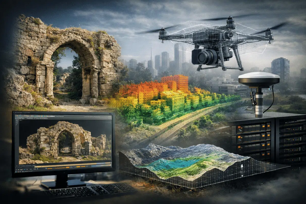
When a new version of Agisoft Metashape is released, most discussions focus on the list of new features. While this is useful, professional users are usually more interested in a different question: how does this update change daily work in real projects? Agisoft Metashape 2.3 is not just an incremental update, but a version that […]
Author Archives: admin

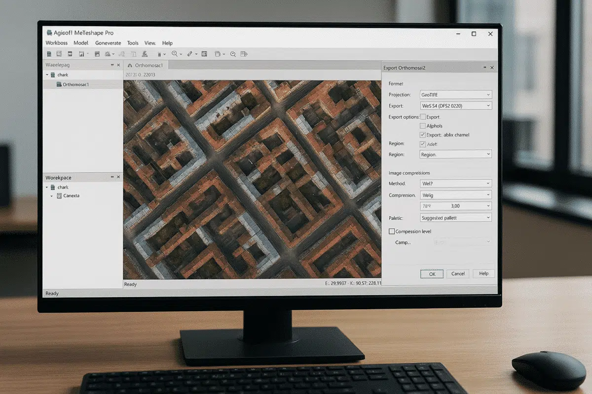
Satellite imagery has become an essential data source for large-scale mapping, environmental monitoring, urban planning, and geospatial analysis. While photogrammetry is traditionally associated with drone or aerial photography, modern photogrammetric software is increasingly capable of handling satellite images with impressive results. includes dedicated tools and workflows that allow users to process satellite imagery and generate orthomosaics, […]
Agisoft Metashape 2.3 introduces a powerful new utility for texture refinement: the Texture Editing Tool, also known as Assign Image. This addition expands the flexibility of texture workflows by allowing users to manually select specific images to influence defined portions of a texture map. Whether you’re fixing problem areas or improving visual consistency, this tool […]
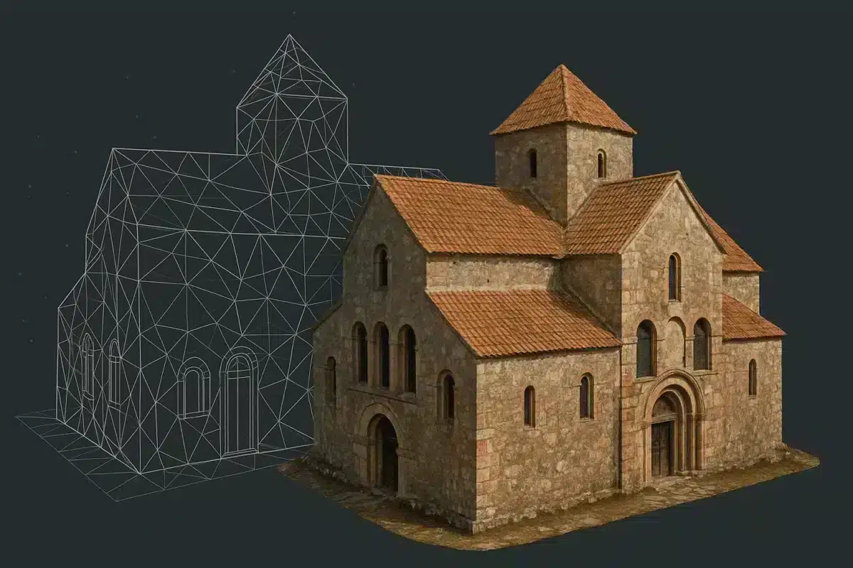
Agisoft Metashape 2.3 is a meaningful update for anyone building maps, orthomosaics, or high-detail 3D models from photos and laser scans. While earlier versions already delivered robust photogrammetry, this release focuses on three practical themes: higher-quality surface appearance (texturing), more flexible camera and lens modeling, and stronger tools for LiDAR and large-scale production workflows. The […]
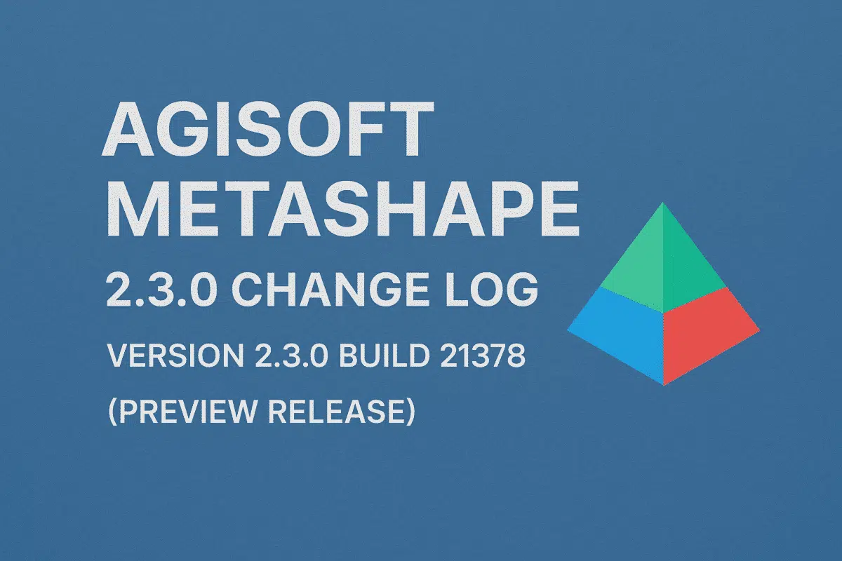
Agisoft Metashape 2.3.0 build 21378 (preview release, 4 October 2025) introduces a focused set of improvements that target three main areas: more natural and detailed textures, better support for complex camera and fisheye setups, and advanced tools for LiDAR and laser scan workflows. While many changes are available in both the Standard and Professional editions, […]
Agisoft Metashape 2.2.3 is the newest stable release of the well-known photogrammetry software, available in both Standard and Professional editions and downloadable directly from the official Agisoft website. This version represents the most recent update in the 2.2.x series and introduces a set of bug fixes along with several targeted enhancements for users working with […]
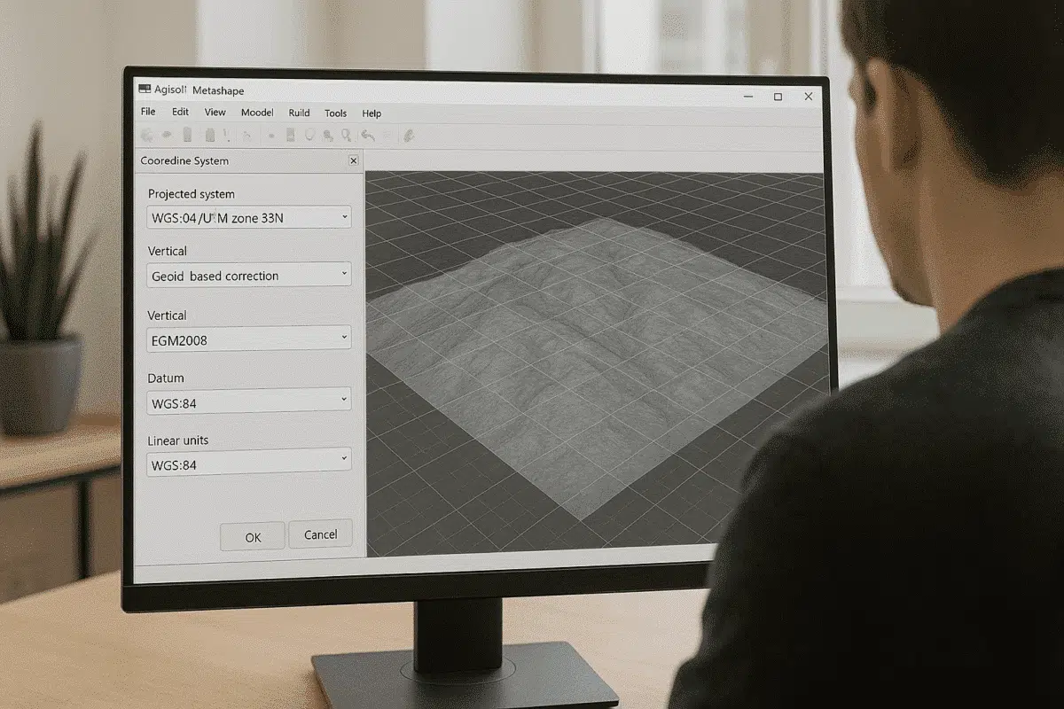
Agisoft Metashape Professional is widely used for photogrammetry, 3D modeling, topographic mapping, and geospatial analysis. One of the most important steps in processing georeferenced data is choosing and correctly converting between coordinate systems. Whether you work with drone RTK/PPK data, ground control points (GCPs), or GIS datasets, understanding how to manage coordinate systems in Metashape […]
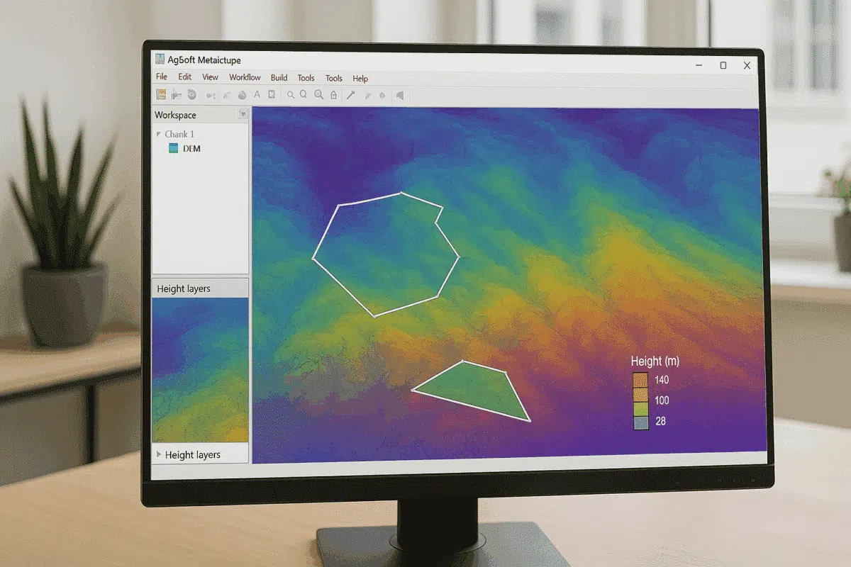
Agisoft Metashape Professional is a leading photogrammetry software used by surveyors, GIS specialists, and drone mapping professionals worldwide. One of its most powerful analytical features is the ability to perform DEM-based measurements — enabling users to calculate areas, volumes, elevation differences, and terrain profiles directly from Digital Elevation Models (DEMs) generated within the software. This […]
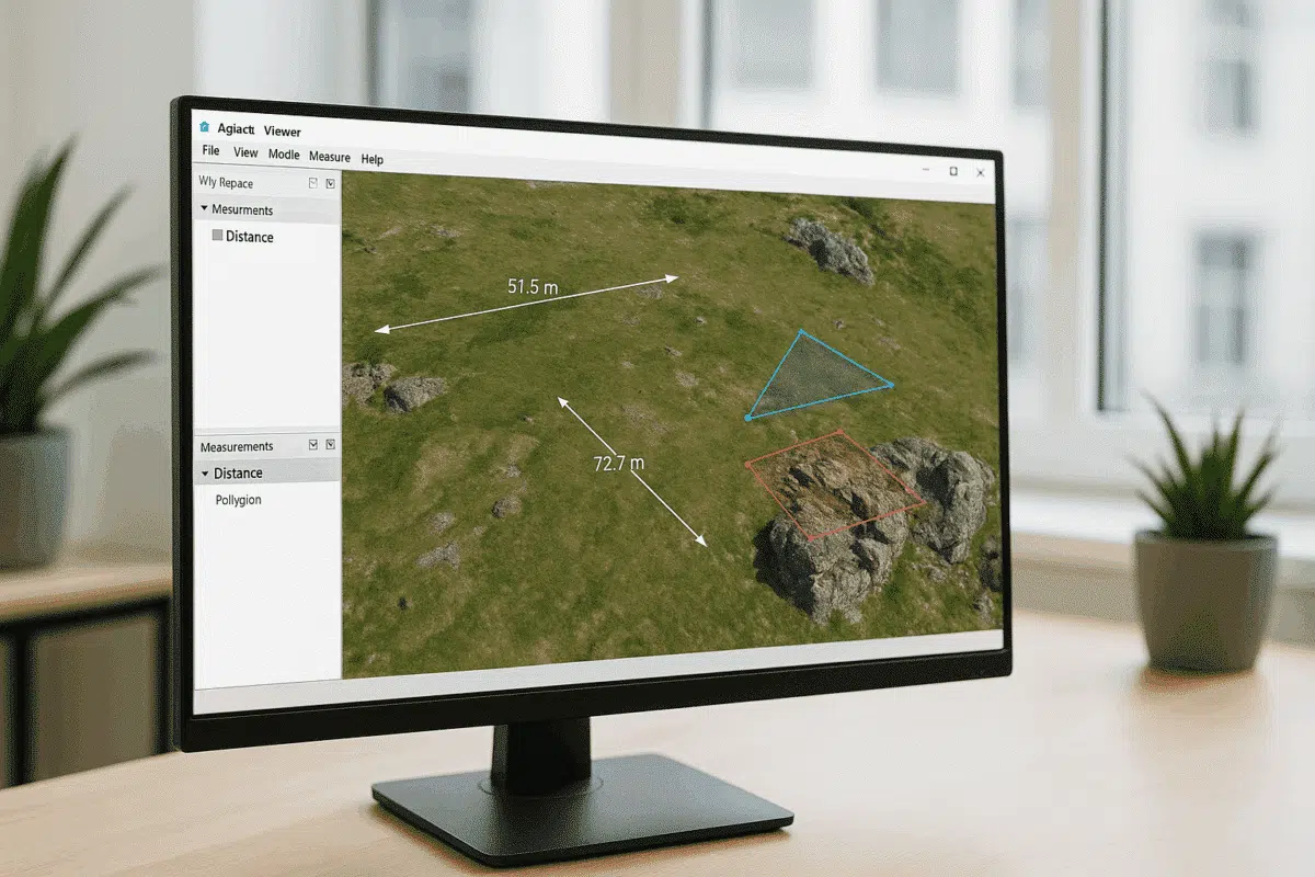
Agisoft Viewer is a lightweight, free application developed by Agisoft that allows users to view, explore, and analyze 3D models, orthomosaics, and digital elevation data created in Agisoft Metashape Professional. Among its most valuable features are the Measure and Drawing tools, which enable users to interact with spatial data, perform basic analysis, and make annotations […]
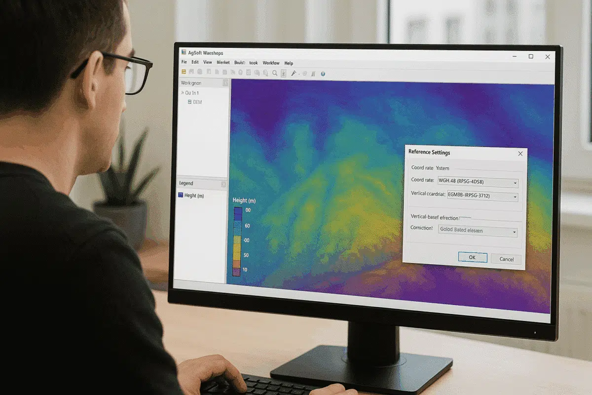
Agisoft Metashape Professional is one of the most advanced photogrammetry software solutions for processing aerial and terrestrial imagery into georeferenced 3D models, orthomosaics, and elevation maps. A key step in achieving accurate elevation results is understanding how to handle height above geoid within the project’s coordinate system. Without proper geoid configuration, elevation values may be […]