In the world of photogrammetry and 3D modeling, professionals often need not only to process data but also to present and share it in an accessible way. That’s where Agisoft Viewer comes in. This lightweight and free application developed by Agisoft allows users to open, navigate, and inspect 3D models, orthophotos, DEMs, and point clouds generated in Agisoft Metashape, without requiring a full software license. For surveyors, engineers, archaeologists, and GIS specialists, it is an invaluable tool to bridge the gap between complex data and real-world collaboration.
In this article, we will explore what Agisoft Viewer is, its key features, practical applications, and why it remains an essential component of modern photogrammetry workflows.
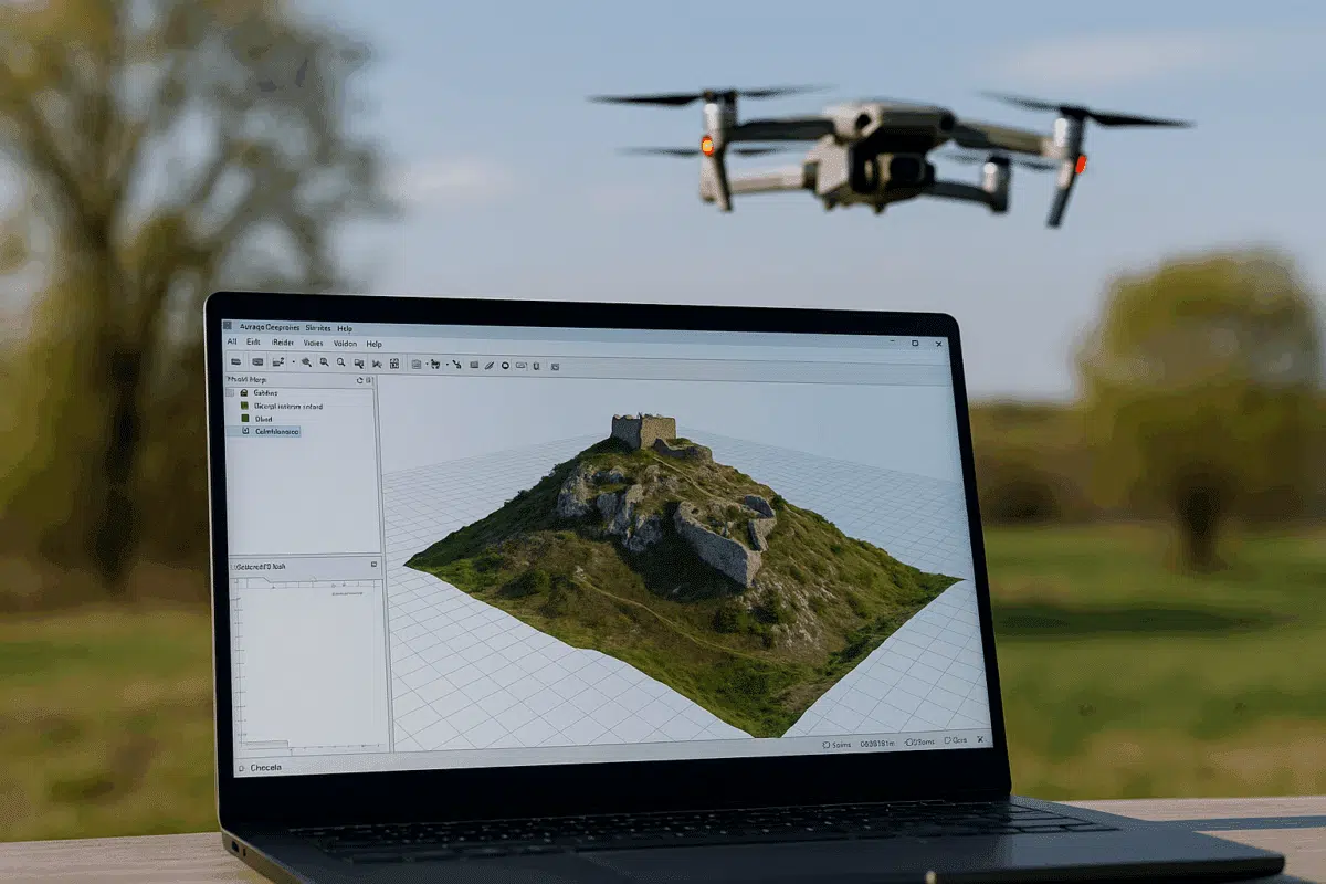
What is Agisoft Viewer?
Agisoft Viewer is a free stand-alone application designed to handle the visualization of large geospatial datasets. It can open files produced in Agisoft Metashape Professional and Standard, giving users the ability to navigate point clouds, textured models, DEMs (Digital Elevation Models), and orthophotos interactively.
Unlike full photogrammetry software, Viewer does not generate 3D data but focuses on display, measurement, and exploration. This makes it particularly useful for clients, stakeholders, and field teams who need to review data without modifying the original projects.
Key Features of Agisoft Viewer
One of the reasons Agisoft Viewer is widely used is its combination of simplicity and powerful visualization capabilities. Some of its most relevant features include:
- Open and inspect 3D models: navigate textured meshes and point clouds in real time.
- Orthophoto and DEM support: open large georeferenced raster files for analysis and visualization.
- Lightweight and free: no license cost, easy to install even on mid-range laptops.
- Basic measurement tools: users can take linear measurements directly on the model.
- Coordinate system support: preserves georeferencing data for GIS-related projects.
- Sharing capabilities: allows professionals to hand over 3D deliverables to clients without requiring them to buy expensive software.
This makes Agisoft Viewer a practical companion tool to Metashape, especially for professionals working in fields that require data sharing and stakeholder engagement.
Why Professionals Use Agisoft Viewer
In many projects, the ability to process data is only part of the workflow. Visualization and communication of results are equally important. Agisoft Viewer addresses this need by offering:
- Client-friendly solutions: stakeholders can explore results without technical barriers.
- Cost-effective collaboration: since the tool is free, organizations can distribute models widely.
- Compatibility: supports standard formats like .psz, .las, .ply, and orthophotos in GeoTIFF format.
- Field utility: works on laptops and field devices, enabling quick checks after UAV missions.
For example, an urban planning department can use Metashape to create a digital 3D model of a district, then distribute it to architects and officials via Agisoft Viewer for feedback and planning purposes.
Practical Applications of Agisoft Viewer
Agisoft Viewer is not just a visualization tool but an enabler of collaboration. Here are some real-world scenarios where it is used:
- Archaeology: sharing 3D scans of excavation sites with research teams and museums worldwide.
- Construction and engineering: reviewing site progress in 3D without the need for heavy software.
- Agriculture: visualizing orthophotos and elevation models to assess crop health and irrigation planning.
- Environmental monitoring: tracking coastline erosion or forest changes with georeferenced models.
- Disaster management: distributing UAV-based surveys of affected areas to emergency responders.
In all these cases, the free accessibility and ease of use of Agisoft Viewer allow data to travel from specialists to decision-makers in an efficient way.
Advantages and Limitations
Like any tool, Agisoft Viewer has both strengths and limitations. Let’s summarize them:
| Advantages | Limitations |
|---|---|
|
|
For professional data processing, Metashape remains essential. However, for presentation, inspection, and collaboration, Agisoft Viewer is one of the most efficient free tools available today.
Agisoft Viewer vs. Other Free 3D Tools
When compared to other free 3D viewers such as MeshLab or CloudCompare, Agisoft Viewer stands out for its direct compatibility with Metashape projects and its geospatial support. While MeshLab is excellent for mesh editing and CloudCompare for point cloud analysis, Agisoft Viewer remains the most straightforward choice for users focused on photogrammetry deliverables.
This direct link to Metashape ensures no data loss or format conversion issues, which is a key advantage in professional workflows.
Conclusion
Agisoft Viewer is much more than a simple add-on: it is a bridge between photogrammetry specialists and clients, allowing 3D models, orthophotos, and DEMs to be shared and explored without technical barriers. By providing a free, lightweight, and intuitive platform, Agisoft ensures that photogrammetry results reach a broader audience, maximizing the value of UAV and 3D survey projects.