Agisoft Metashape is a powerful photogrammetry software that transforms ordinary images into precise 3D models and geospatial data. But what is it really used for, and who uses it? In this article, we explore the most common applications of Metashape in professional fields like drone mapping, surveying, archaeology, and beyond.
What Is Agisoft Metashape?
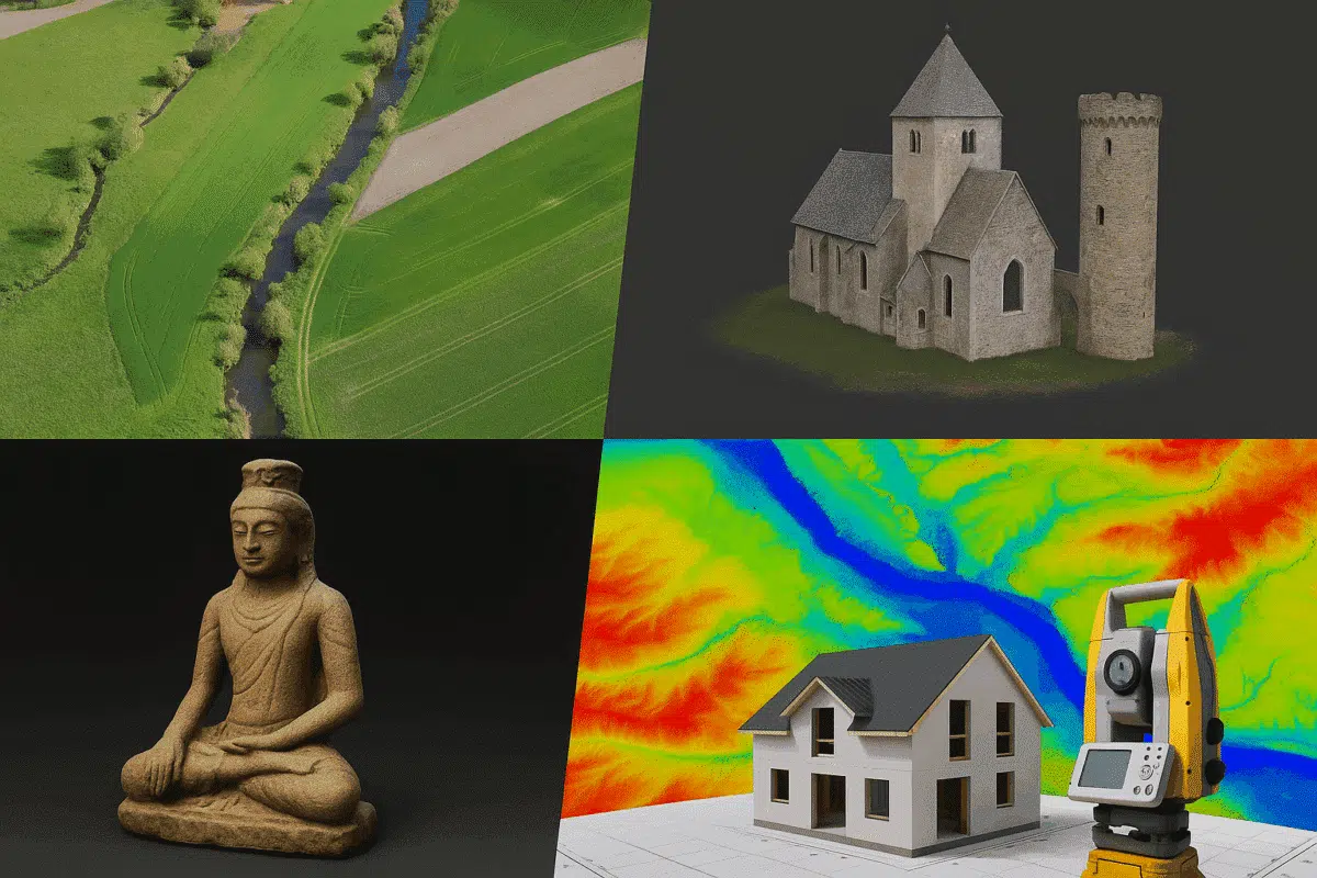
Agisoft Metashape is a desktop software tool that processes photographs taken from drones, smartphones, or DSLRs to create 3D spatial data. It uses photogrammetric algorithms to generate:
- 3D point clouds
- Textured 3D meshes
- Orthomosaics
- Digital Elevation Models (DEMs)
- Georeferenced maps and measurements
The software supports both standard photography and multispectral imaging, making it incredibly versatile for scientific and commercial use.
Top 8 Use Cases of Agisoft Metashape
1. Drone Mapping and Aerial Surveying
One of the most popular applications of Metashape is drone-based mapping. Surveyors use drones to capture overlapping aerial photos, which Metashape turns into:
- High-resolution orthophotos
- 3D terrain models (DTMs and DSMs)
- Contour lines and elevation data
This data is used in land planning, agriculture, civil engineering, and mining projects to evaluate terrain, calculate volumes, and monitor changes over time.
2. Archaeology and Cultural Heritage
Archaeologists use Metashape to create 3D models of excavation sites, ancient structures, and artifacts. It helps preserve fragile heritage in digital form and enables remote analysis without disturbing the site. Researchers also use 3D reconstructions for publications and museum exhibitions.
3. Architecture and Construction
In the AEC (Architecture, Engineering, and Construction) industry, Metashape is used for creating as-built models and documenting building progress. It allows professionals to:
- Measure distances and volumes from 3D models
- Generate 3D scans for renovation planning
- Integrate with CAD/BIM workflows
It’s particularly helpful for generating accurate visual records without the need for expensive LiDAR equipment.
4. Environmental Monitoring
Researchers and environmental engineers use Metashape to monitor ecosystems, forests, coastlines, and glaciers. With drone imagery or time-lapse datasets, the software can track erosion, deforestation, flood risk, and habitat changes with centimeter-level accuracy.
5. Precision Agriculture
In agriculture, Metashape is paired with drones and multispectral cameras to create vegetation indices like NDVI. These outputs help farmers:
- Detect crop health issues early
- Optimize irrigation and fertilization
- Measure plant height and canopy coverage
This data leads to higher yields and more sustainable farming practices.
6. Forensics and Accident Reconstruction
Law enforcement and forensic experts use Metashape to create accurate 3D reconstructions of accident scenes and crime scenes. These digital models can be presented in court or used for further analysis, helping to preserve evidence and support legal arguments.
7. Film, Gaming, and 3D Art
Artists and developers in the gaming and film industry use Metashape to scan real-world objects and environments. The photorealistic 3D meshes created can be exported for use in tools like Blender, Unreal Engine, or Unity, allowing for fast, high-quality asset creation.
8. Education and Research
Metashape is also a favorite among universities and research institutions. It is used in geology, paleontology, marine biology, and many other fields. Students and researchers use it to document fieldwork, conduct spatial analysis, and generate publishable datasets.
Why Choose Metashape Over Other Software?
Agisoft Metashape stands out for several reasons:
- One-time purchase license: No subscriptions required
- Cross-platform support: Runs on Windows, Mac, and Linux
- Python API: Automate workflows and integrate with GIS software
- High accuracy: Compatible with GCPs, RTK/PPK data, and GPS metadata
It’s also incredibly stable and regularly updated, with an active user base and strong documentation.
Conclusion: A Tool for Professionals and Innovators
Agisoft Metashape is used across industries and disciplines to convert images into powerful 3D data. Whether you’re flying a drone over a vineyard, documenting an ancient temple, or mapping a construction site, Metashape provides the precision and flexibility needed to succeed.
Its combination of accuracy, affordability, and advanced features makes it one of the most versatile photogrammetry tools available in 2025.
Want to try it out? Agisoft offers a full-featured 30-day trial of Metashape Professional. No credit card required.