Photogrammetry and LiDAR are two leading technologies for 3D mapping, modeling, and spatial analysis. While both have their strengths, they are suited for different applications. In this article, we compare photogrammetry with laser scanning and explain when using Agisoft Metashape is the better choice.
What Is Photogrammetry?
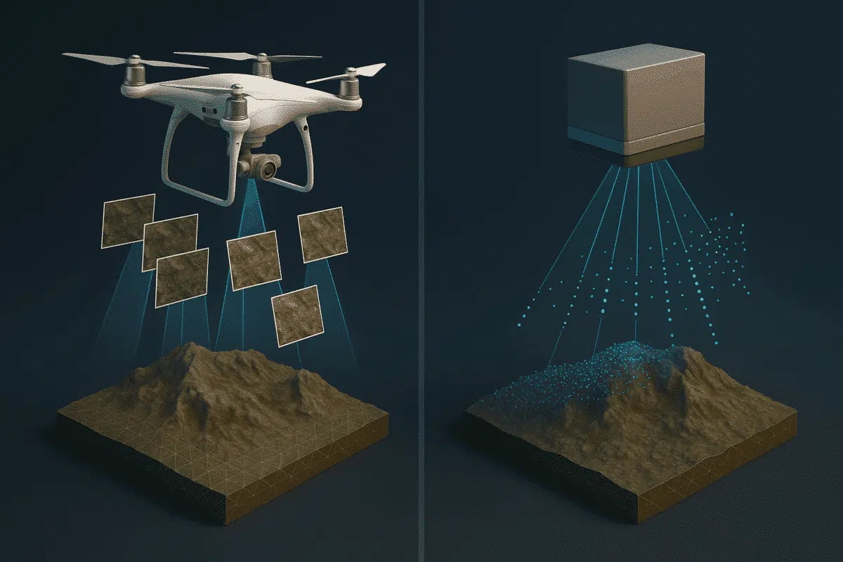
Photogrammetry is the science of extracting 3D information from 2D images. In tools like Metashape, it uses multiple overlapping photos to generate dense point clouds, orthophotos, and textured 3D models. It relies heavily on visual texture and image quality.
What Is LiDAR?
LiDAR (Light Detection and Ranging) uses laser pulses to measure distances and generate point clouds with precise XYZ coordinates. LiDAR sensors can be airborne, vehicle-mounted, or handheld. Unlike photogrammetry, it doesn’t rely on lighting or texture, making it ideal for forested or low-light environments.
Comparison: Photogrammetry vs LiDAR
| Feature | Photogrammetry (Metashape) | LiDAR |
|---|---|---|
| Cost | Low (uses cameras/drones) | High (specialized equipment) |
| Visual Detail | High-resolution, photo-textured | Only point cloud (no images) |
| Vegetation Penetration | No | Yes |
| Light Dependency | Yes | No |
| Accuracy | 2–5 cm with RTK/GCPs | 1–3 cm natively |
| Software Cost | Low (Metashape license) | High (LiDAR processing tools) |
When to Use Metashape Instead of LiDAR
- Budget Constraints: Cameras and drones are far cheaper than LiDAR hardware.
- Visual Inspection: Need for photorealistic models (e.g., architecture, cultural heritage).
- Urban Mapping: Buildings and flat surfaces are ideal for photo-based reconstruction.
- Small Sites: Processing fewer images is manageable without high-end computing.
- Multispectral Integration: Metashape supports custom bands and imagery beyond RGB.
When LiDAR May Be the Better Option
- Forested Areas: LiDAR can penetrate vegetation and map ground beneath trees.
- Night Mapping: LiDAR operates independently of ambient light.
- Infrastructure Inspection: Precise scanning of powerlines, pipelines, or rail tracks.
- Large-Scale Surveys: Faster acquisition over large areas with fewer data gaps.
Hybrid Workflows: Using Both LiDAR and Photogrammetry
Some projects benefit from combining both methods. For example, LiDAR may be used to acquire accurate ground elevation, while Metashape provides high-resolution textures for surface visualization. You can merge LiDAR data with photogrammetric meshes using Metashape Pro or external tools like CloudCompare or Blender.
Case Study: Mapping a Historical Building
An architectural team used a DJI Mavic 3 Enterprise with RTK to document a historic church. The mission produced 400+ overlapping images, processed in Agisoft Metashape to create an ultra-realistic 3D textured model. The same team also used terrestrial LiDAR to scan interior elements. The combination ensured both visual richness and structural accuracy.
Cost Analysis
Choosing photogrammetry over LiDAR can reduce costs dramatically:
- Drone + Metashape License: $2,000–$5,000 total
- LiDAR Sensor + Software: $15,000–$100,000+
This makes Metashape ideal for startups, universities, and small firms.
Conclusion
Both photogrammetry and LiDAR are essential tools in modern 3D mapping. However, if your focus is visual modeling, low-cost operation, or small to medium-scale mapping, Agisoft Metashape is a smart choice. Its combination of affordability, precision, and flexibility makes it the go-to solution for thousands of professionals worldwide. Consider your project needs, environment, and deliverables before choosing the right technology.