Creating high-quality 3D models of buildings using Agisoft Metashape depends heavily on your data collection method. Whether you’re modeling for architecture, cultural heritage, construction, or real estate, the way you capture your images determines the accuracy, detail, and usability of your final model. In this guide, we’ll explore the best collection methods for building reconstruction, including aerial photogrammetry, terrestrial imaging, and hybrid approaches. Let’s dive into what works best—and when.
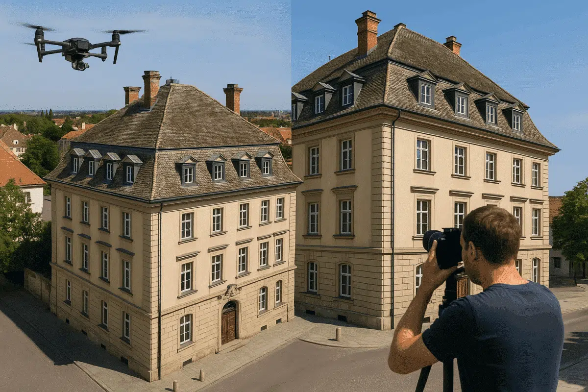
Aerial Photogrammetry: Ideal for Roofs and Urban Context
One of the most common methods for building reconstruction in Metashape is aerial photogrammetry, typically done with drones. This method excels at capturing roofs, facades, and the building’s surroundings from a top-down and oblique perspective.
- Equipment: Multirotor drones with a high-resolution RGB camera (e.g., DJI Matrice 4 or DJI Matrice 400).
- Flight Parameters: Side overlap: 75–85%, Forward overlap: 80–90%, Altitude: 30–60 meters depending on structure height.
- Advantages: Efficient coverage of large areas, access to rooftops, RTK/GNSS accuracy.
- Limitations: Less detailed facade data, limited in narrow urban canyons.
In Metashape, aerial images can be aligned and processed into dense point clouds, mesh models, and textured outputs. However, facades may lack vertical detail without additional data.
Terrestrial Photogrammetry: Detailed Facade and Interior Capture
Terrestrial imaging involves capturing photos from ground level using DSLR or mirrorless cameras. This method offers high detail for vertical surfaces, ornaments, entrances, and interiors.
- Equipment: Full-frame cameras with wide-angle or standard lenses (e.g., Sony A7 series, Canon EOS R).
- Shooting Tips: Ensure consistent lighting, avoid motion blur, maintain overlap (60–80%), use GCPs when possible.
- Advantages: High-resolution texture for facades, interior coverage, better control of exposure and focus.
- Limitations: Limited access to roofs or higher elevations, more time-consuming in the field.
In Metashape, ground images can be aligned together or with aerial images. Use scale bars or targets to improve accuracy, especially for architectural documentation and restoration projects.
Hybrid Workflow: The Best of Both Worlds
The most reliable method for building reconstruction is often a hybrid workflow, combining aerial and terrestrial imagery. This approach maximizes coverage and detail across all building elements.
- Workflow Tips: First align aerial images, then add terrestrial photos. Enable camera groups in Metashape to separate calibration.
- Optimize Accuracy: Use GCPs visible from both air and ground, or tie points between datasets.
- Use Case: Ideal for historical buildings, complex structures, construction monitoring, or detailed BIM modeling.
With Metashape’s camera calibration and optimization tools, combining datasets can yield a high-fidelity 3D model with complete roof, wall, and ground detail. Always run gradual selection to clean sparse point clouds before dense reconstruction.
Recommended Settings and Best Practices in Metashape
Regardless of the collection method, follow these core best practices when working in Agisoft Metashape:
- Image Quality: Use the Image Quality tool to discard blurry photos (below 0.5 score).
- Masking: Mask moving objects or sky when mixing ground and drone imagery.
- Chunk Management: Use separate chunks for different data sources if alignment fails.
- Ground Control: Include GCPs or use RTK-tagged images for geo-referenced outputs.
High-quality reconstruction depends not just on quantity of images, but consistency, overlap, lighting, and perspective variation. Always preview alignment and adjust camera parameters if needed before running dense cloud generation.
Choosing the Best Method for Your Project Goals
The ideal collection method for 3D building modeling with Metashape depends on your project goals:
| Project Type | Best Method |
|---|---|
| Urban mapping | Aerial photogrammetry |
| Architectural restoration | Hybrid (aerial + terrestrial) |
| Interior modeling | Terrestrial photogrammetry |
| BIM integration | Hybrid workflow with high accuracy |
Always assess the accessibility of the site, the level of detail required, and your available tools. Then choose the method—or combination—that ensures optimal results with minimal field effort.
Conclusion: Combine Methods for Best Results
For most 3D building modeling projects, combining drone-based aerial imagery with detailed ground photos provides the best reconstruction results in Agisoft Metashape. While drone imagery covers large areas quickly, ground images offer critical facade and interior details. By optimizing camera settings, ensuring proper overlap, and using control points, you can generate precise, photo-realistic 3D models suitable for any application—from heritage documentation to smart city planning.