Agisoft Metashape is not just a photogrammetry tool for drones and surveys—it’s a game-changer in archaeology and cultural heritage preservation. With its ability to turn photographs into highly detailed 3D models, researchers are using it to document, study, and protect historical sites and artifacts in ways never before possible. This article explores how Metashape is transforming the field, with real-world applications and workflows.
Why Use Photogrammetry in Archaeology?
In archaeology, precision is everything. Every layer of soil, stone fragment, and structure tells a story. Traditional documentation methods—photos, sketches, or 2D plans—can be limited. Photogrammetry offers a way to capture spatial data in full 3D, preserving a digital twin of the excavation site or object.
Metashape enables:
- Accurate 3D reconstructions of sites, tombs, and ruins
- Digital preservation of artifacts too fragile to move
- Monitoring erosion or damage over time
- Creating virtual exhibits and public engagement tools
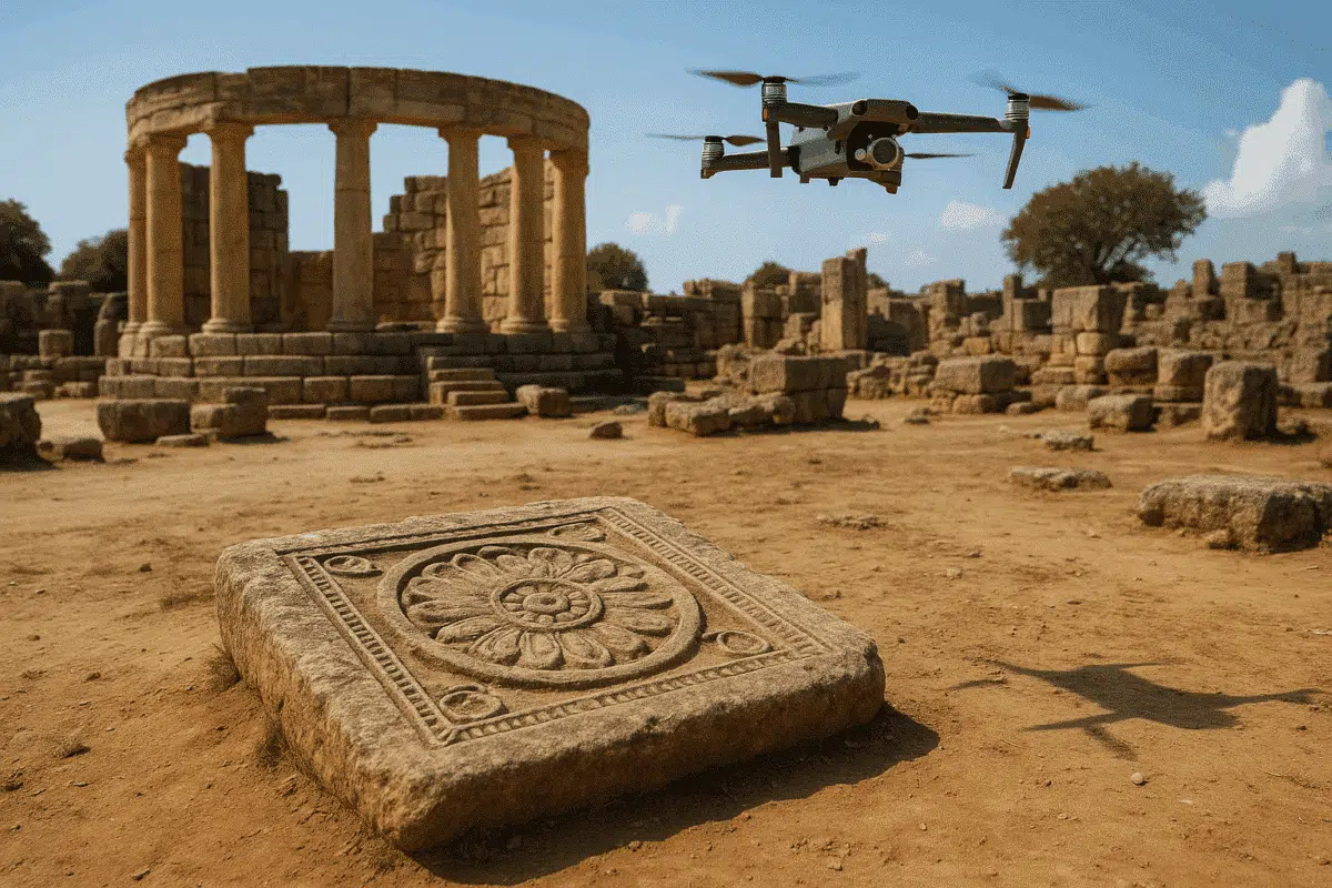
Case Study 1: Documenting Ancient Temples in Greece
In 2024, a research team used Metashape to document a collapsed Doric temple in southern Greece. Using drone imagery and ground-based photos, they processed over 2,000 images to produce a complete textured model of the ruin.
This 3D model helped:
- Map and classify every visible stone block
- Plan potential restoration steps virtually
- Share the site in immersive 3D with museum visitors
Case Study 2: Pottery and Artifact Preservation
Metashape is frequently used for small object scanning, such as pottery, coins, and statues. Unlike 3D scanning devices, photogrammetry is non-invasive and low-cost. Museums and labs use DSLR cameras or even smartphones to capture multiple angles of an artifact, then use Metashape to reconstruct it.
Benefits include:
- Generating scaled 3D models for cataloging and replication
- Allowing remote study by scholars and researchers
- 3D printing replicas for education and exhibition
How It Works: Metashape Workflow for Heritage Projects
Whether you’re scanning a fresco or modeling an entire archaeological trench, the workflow is similar:
- Capture images with consistent lighting, sharp focus, and high overlap
- Align photos in Metashape to generate a sparse point cloud
- Build a dense cloud and 3D mesh using depth maps
- Apply textures for realistic color representation
- Export the model in OBJ, PLY, or GLB for analysis or sharing
Accuracy and Scale
For scientific applications, accurate scaling is essential. Teams use:
- Scale bars in each scene for proper referencing
- Ground Control Points (GCPs) in larger surveys
- Built-in Metashape tools for manual scale adjustment and unit conversion
Sharing and Visualization
One of the biggest advantages of using Metashape in archaeology is the ability to share models publicly. Platforms like Sketchfab, ArcGIS Scene Viewer, and even social media allow researchers to publish interactive models, bringing history to life online.
This has proven especially useful for public outreach, virtual museums, and educational use in schools and universities.
Final Thoughts
From tomb documentation in Egypt to virtual reconstructions in Rome, Agisoft Metashape is revolutionizing archaeology and cultural heritage. It offers affordable, high-quality 3D digitization that preserves history in a way both scholars and the public can access.
As technology and accessibility grow, Metashape is likely to become even more central to how we study and protect our global past.