The integration of aerial laser scans with advanced photogrammetry software has transformed the way we capture and analyze our world. Among the leading tools for this purpose, Agisoft Metashape stands out for its ability to process both aerial imagery and LiDAR data efficiently. This article explores how to manage aerial laser scan datasets within Metashape, providing an accessible guide for surveyors, researchers, and professionals across industries.
What Are Aerial Laser Scans and Why Use Them?
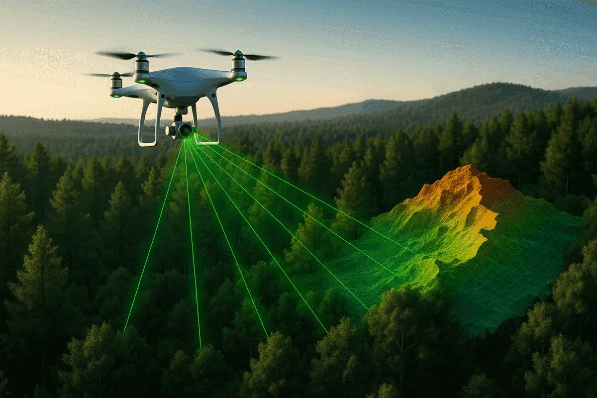
Aerial laser scanning, commonly referred to as LiDAR (Light Detection and Ranging), is a technique that uses laser pulses from drones or aircraft to measure distances between the sensor and the ground. The resulting point clouds represent highly accurate three-dimensional models of the terrain, vegetation, or infrastructure below.
When combined with Agisoft Metashape, aerial laser scans offer several benefits:
- High accuracy: LiDAR captures fine details in elevation models, even through vegetation cover.
- Speed: Large areas can be scanned in relatively short flight times.
- Integration with imagery: Combining LiDAR and RGB data produces visually rich and precise outputs.
This makes the technology invaluable for mapping, forestry, archaeology, mining, and urban planning projects.
Importing Aerial Laser Data into Agisoft Metashape
The first step in processing aerial laser scans is to import the raw point cloud data into Metashape. Supported formats typically include LAS, LAZ, and other industry-standard point cloud files. The import process is straightforward:
- Launch Agisoft Metashape and create a new project.
- Select File > Import > Import Point Cloud and choose your LAS/LAZ dataset.
- Assign the correct coordinate reference system (CRS) to ensure spatial accuracy.
Once imported, Metashape displays the point cloud in the workspace. Users can zoom, pan, and rotate the dataset to assess coverage and density. At this stage, it is crucial to verify metadata such as flight parameters, coordinate systems, and sensor calibration.
Optimizing and Cleaning the Point Cloud
Aerial laser scans often contain noise or redundant points. Before further processing, the dataset must be optimized. Agisoft Metashape provides several tools to refine point clouds:
- Filtering: Remove low-confidence or misclassified points, such as reflections from water surfaces or moving objects.
- Classification: Automatically categorize points into ground, vegetation, and buildings for improved analysis.
- Manual Editing: Users can select and delete unwanted data points or adjust classifications as needed.
By cleaning and optimizing the point cloud, you ensure that subsequent models—such as digital terrain models (DTM) or digital surface models (DSM)—achieve maximum accuracy and clarity.
Generating 3D Models from Laser Scans
One of the most powerful features of Agisoft Metashape is its ability to convert laser scan data into detailed 3D surfaces. Once the point cloud is ready, you can generate various products:
- Digital Terrain Models (DTM): Representing bare-earth surfaces, ideal for topographic surveys.
- Digital Surface Models (DSM): Including vegetation and man-made structures for urban or forestry applications.
- Textured 3D Models: By combining LiDAR with aerial imagery, you can produce highly realistic 3D reconstructions.
These outputs are compatible with GIS software and CAD platforms, enabling seamless integration into workflows for analysis, planning, or presentation.
Applications of Aerial Laser Scans in Metashape
The combination of aerial laser scans and Agisoft Metashape supports diverse industries. Some key applications include:
- Environmental monitoring: Assessing forest canopy structures, biomass, and terrain erosion.
- Archaeology: Revealing hidden structures beneath vegetation cover with high precision.
- Mining and quarrying: Monitoring excavation progress, calculating volumes, and ensuring safety compliance.
- Urban development: Creating accurate 3D city models for planning, construction, and infrastructure management.
Because Metashape integrates both LiDAR and imagery, it is particularly effective for producing outputs that are both visually engaging and analytically precise.
Tips for Efficient Data Processing
Processing large aerial laser scan datasets can be demanding. To optimize efficiency, consider the following recommendations:
- Use high-performance hardware: A strong GPU, fast SSD storage, and sufficient RAM improve processing speed.
- Split large projects: Break down massive point clouds into manageable sections before merging results.
- Leverage classification tools: Automating classification reduces manual editing time significantly.
- Combine with aerial imagery: Adding photographic data enriches the final outputs, making them suitable for both technical and public-facing purposes.
By following these strategies, users can handle even complex projects efficiently and produce high-quality deliverables.
Conclusion: Unlocking the Potential of Aerial Laser Scans with Metashape
Processing aerial laser scan data with Agisoft Metashape empowers professionals to create precise, detailed, and versatile 3D models. From environmental monitoring to city planning, the integration of LiDAR with photogrammetry delivers unmatched accuracy and visual clarity. By mastering the import, cleaning, and modeling workflows within Metashape, you can transform raw point clouds into actionable insights for your projects.
Whether you are a surveyor, researcher, or industry specialist, Metashape offers the tools you need to make the most of aerial laser scanning technology. Start experimenting with your own datasets and unlock the full potential of LiDAR combined with photogrammetry.